
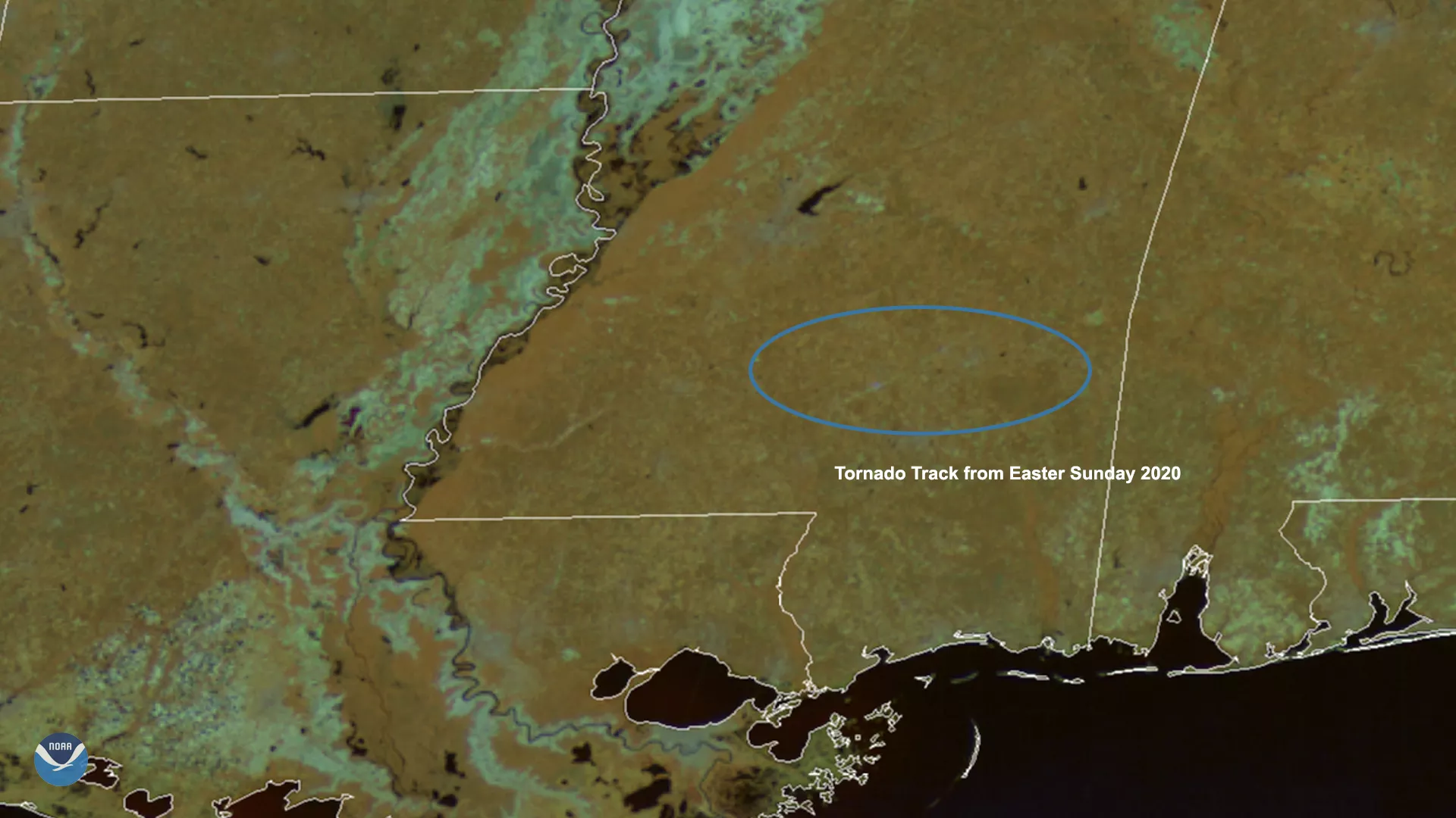
On April 16, 2020, GOES-East viewed the aftermath of an EF- 4 tornado in Mississippi, which caused a 68-mile-long scar across Jefferson Davis and Clarke counties. For the majority of Easter Sunday, the state suffered through a series of tornadoes that tore through homes, businesses, and roads; cleanup efforts are still underway. The United States sees about 1,200 tornadoes a year on average, most of which happen during the spring and summer months.
Scarring after Easter Sunday Tornado in Mississippi.
Several other tornadoes in the past few years have yielded similar effects on the ground. On May 30, 2011, an EF-5 tornado rampaged through the town of Joplin, Mo., destroying upwards of 30% of the city. By 2014, 90% of the damage had been replaced or fixed. Five years after the tornado, its land scar was still visible on high-resolution MODIS satellite imagery.
A few weeks earlier, a series of 199 tornadoes tore across the American landscape on April 27, 2011, with two causing extensive damage to parts of the South. An EF-5 and EF-4 tornado generated 160+ mph winds that scarred the ground in Tuscaloosa, Hackleburg, and Phil Campbell, Ala., for years afterward., This page features GOES and MODIS imagery of the tornadoes and their impacts: “Three distinct tornado scars remain in Alabama: One runs from Tuscaloosa to Birmingham, a second is south of Tuscaloosa, and a third is north of Tuscaloosa.”
The GOES-East geostationary satellite, also known as GOES-16, keeps watch over most of North America, including the continental United States and Mexico, as well as Central and South America, the Caribbean, and the Atlantic Ocean to the west coast of Africa. The satellite's high-resolution imagery provides optimal viewing of severe weather events, including thunderstorms, tropical storms, and hurricanes.