As Earth Day celebrates its golden anniversary in 2020, NOAA too is celebrating 50 years of monitoring the Earth’s weather, climate, and environment—and taking steps to preserve them.
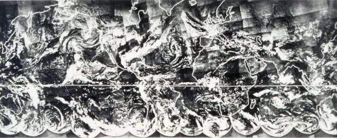
The first complete view of the world's weather, photographed by TIROS-IX, was in 1965.This image was assembled from 450 individual photos from the satellite.
Ten years before the first Earth Day sparkedthe birth of the modern environmental movement, the first weather satellite launched into orbit on April 1, 1960, and it revolutionized our ability to observe the Earth, its atmosphere, and its oceans. That satellite, TIROS-1, was the first of a series of 10 polar-orbiting TIROS satellites, the ninth of which took the first complete view of the world's weather in 1965.
NOAA operates satellites in two complementary orbits' geostationary operational environmental satellites ( GOES ), and polar-orbiting environmental satellites, or POES. The geostationary satellites orbit the Earth above a fixed location over the equator, allowing the satellites to travel at the same rate as the Earth's spin.
The POES satellites, on the other hand, orbit the planet's poles 14 times a day, at approximately 520 miles above the surface of the Earth, allowing the advantage of daily global coverage.The Earth's rotation allows the satellite to see a different view with each orbit, and each satellite provides two complete overlapping views of weather around the world every day.
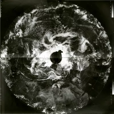
Credit: Schwerdtfeger Library
On April 22, 1970, the world celebrated its first Earth Day. The above polar image was taken on that day by the Environmental Science Services Administration (ESSA)-9 satellite. ESSA was NOAA’s predecessor, and its satellite program provided complementary imagery to the legacy TIROS established in the 1960s.
Later that year, in December 1970, NOAA-1 blasted off, the first of a series of NOAA polar-orbiting satellites. Fifty years later, the NOAA-20 satellite is our most recent addition to our fleet of next-generation Joint Polar Satellite System (JPSS) satellites.
For Earth Day 2020, let’s look at how NOAA’s polar-orbiting satellites have shown us the world from their unique perspective over the last half-century.
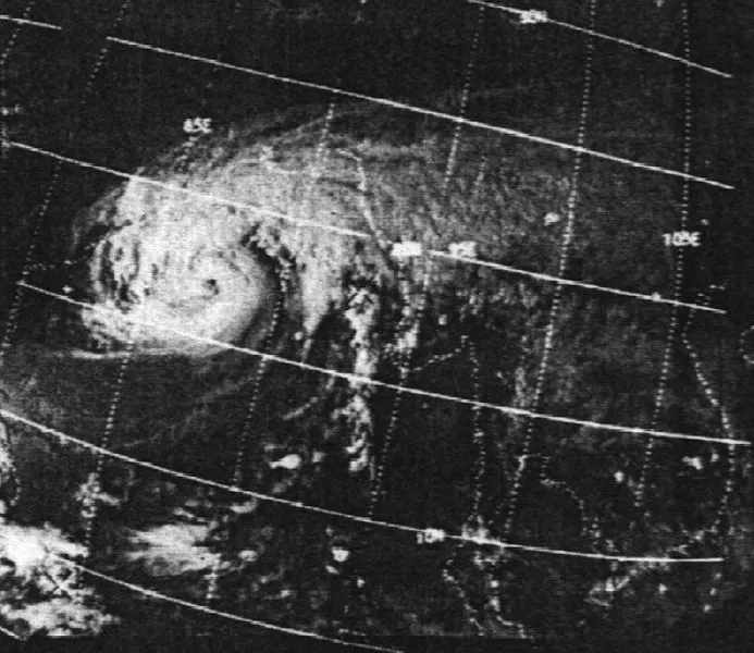
A few months after the first Earth Day, ESSA-9 snapped this image of the Bhola Cyclone on November 11, 1970. The cyclone devastated East Pakistan and India’s West Bengal and remains one of the world’s worst natural disasters in recorded history.
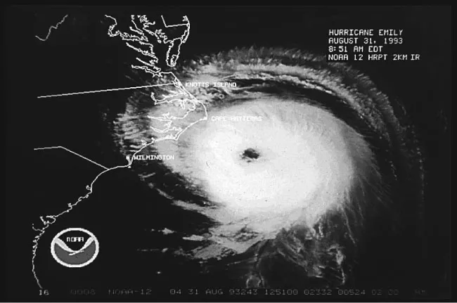
As Hurricane Emily was threatening the United States, the NOAA-12 satellite captured it lashing the Outer Banks of North Carolina on August 31, 1993. Emily became a major hurricane that day when its sustained winds hit 115 mph, and was the strongest hurricane of the 1993 season.
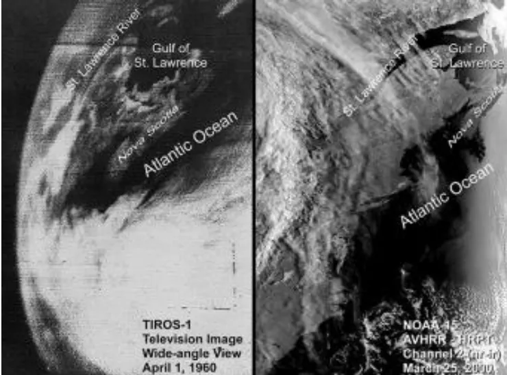
The image on the left shows the first image of the Earth, taken by the TIROS-1 satellite in 1960. The image on the right shows the same region of the Earth, taken by the Advanced Very High Resolution Radiometer (AVHRR) on the NOAA-15 satellite in 2000.
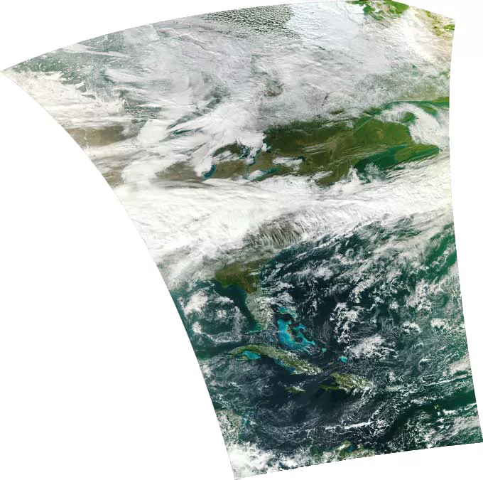
On November 21, 2011, the Visible Infrared Imager Radiometer Suite (VIIRS) on the NOAA/NASA Suomi National Polar-orbiting Partnership (NPP) satellite took this first-light image of eastern North America.
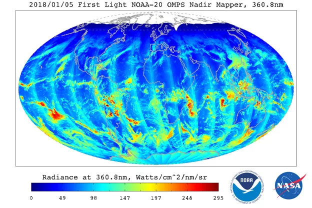
On January 5, 2018, NOAA’s next-generation JPSS satellite, NOAA-20, took its first-light OMPS image of the globe. OMPS, which stands for the Ozone Mapping and Profiler Suite , tracks the health of the ozone layer and measures the concentration of ozone in the Earth's atmosphere.
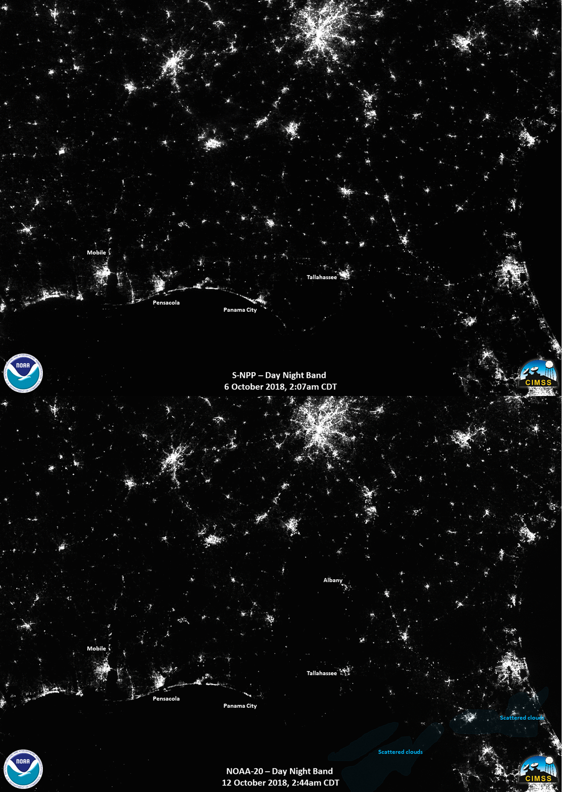
NOAA-20’s VIIRS instrument uses its Day/Night Band to assess power outages after devastating storms, such as Hurricane Michael in October 2018. The before and after image above shows Day/Night Band imagery from October 6 (before Michael) and October 12 (after Michael). The change in illumination from city lights over the Florida Panhandle northeastward into east-central Georgia is stark.
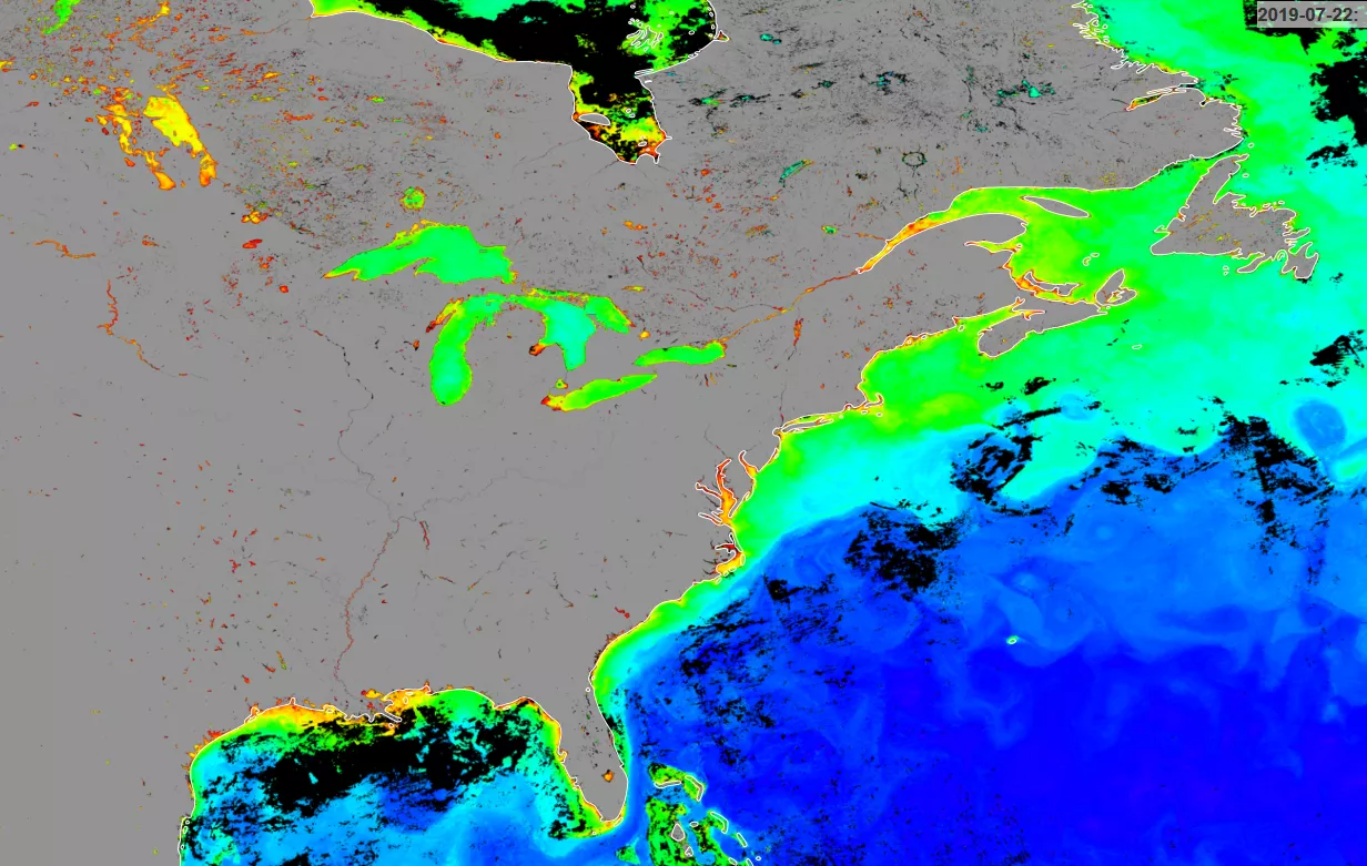
This NOAA-20 image from July 2019 is also via its VIIRS instrument, which can detect ocean color from orbit. Ocean color can tell scientists a lot about the health and composition of Earth’s oceans, including the amount and location of chlorophyll, sediments, and colored dissolved organic material around the world.
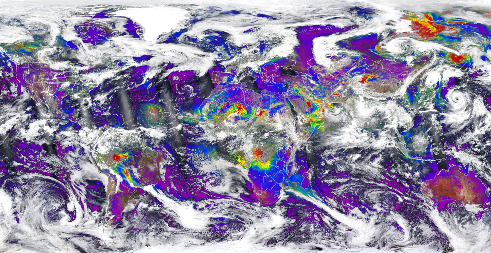
The Aerosol Optical Depth (AOD) product provided by the VIIRS instrument on Suomi-NPP and NOAA-20 gives a measurement of the liquid or solid particles suspended in the atmosphere. The AOD data and imagery, such as this image from August 13, 2019, help monitor smog and air quality around the globe, which affects human health and the environment.
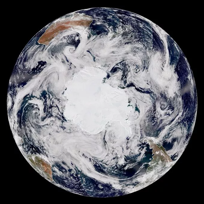
This JPSS satellite mosaic from January 2020 is pieced together from various JPSS images from the Southern Hemisphere. From this perspective, Antarctica is the bright white continent in the center, South America is located at the bottom right, southern Africa is bottom left, and Australia is toward the top.
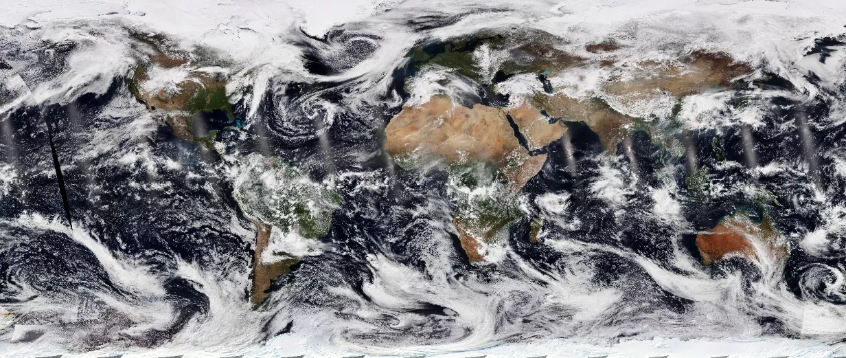
And how could we not wrap this up without a global JPSS view of our Blue Planet from last year’s Earth Day, April 22, 2019?
Here’s to many more Earth Days with NOAA’s satellites keeping watch from above—Happy 50th!
