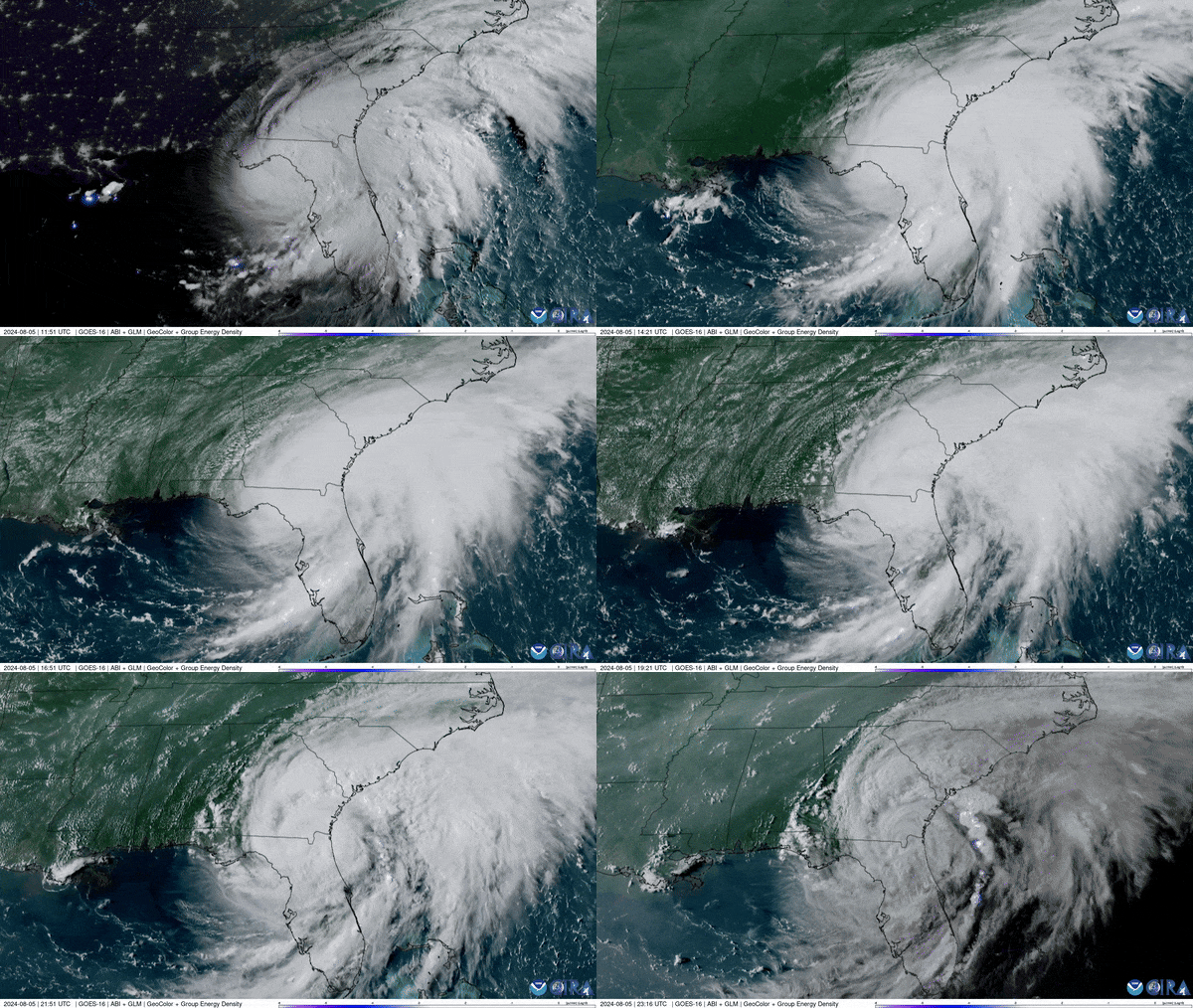


Phenomena: Tropical Cyclones, Hurricanes
Satellite: GOES-16
Product: GeoColor GLM Group Energy Density
Instrument: ABI, GLM
Date: August 5, 2024 11:46 - 23:16 UTC
NOAA’s GOES East (GOES-16) satellite has been carefully monitoring Hurricane Debby as it travels across the U.S. state of Florida. Yesterday, this day-long satellite imagery of Debby shows the storm as it made landfall and moved across the northern part of the sunshine state.
Debby formed as a tropical storm in the southeast Gulf of Mexico, just north of Cuba, on August 3rd, 2024. During the evening of August 4th, 2024, the storm was upgraded to a hurricane as it neared the state of Florida. Debby made landfall in the Big Bend region of Florida's panhandle, as a category 1 hurricane on the morning of August 5th, 2024, then crossing Florida and Georgia, hugging the southeast coast as a tropical storm. It is forecasted to bring heavy rainfall and flooding from Florida through the Carolinas and up into New England.
The GOES East geostationary satellite, also known as GOES-16, keeps watch over most of North America, including the contiguous United States and Mexico, as well as Central and South America, the Caribbean, and the Atlantic Ocean to the west coast of Africa. The satellite's high-resolution imagery provides optimal viewing of severe weather events, including thunderstorms, tropical storms, and hurricanes
