
As winter approaches and snow covers parts of the globe, the ability to distinguish between snow and cloud cover becomes increasingly important.
As winter approaches and snow begins to cover parts of the United States, the ability to distinguish between snow and cloud cover becomes increasingly important. That's why scientists with the Cooperative Institute for Research in the Atmosphere (CIRA) in Fort Collins, Colorado, in cooperation with the Naval Research Laboratory in Monterey, California, are developing image products to help scientists do just that.
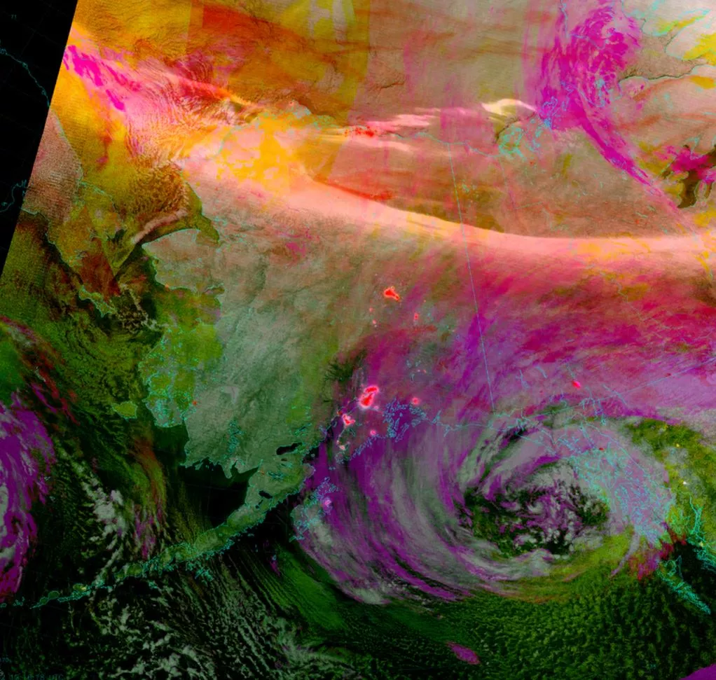
Known as "Snow-Cloud Discriminator" products, this kind of imagery is created with data from 11 bands of the Visible Infrared Imaging Radiometer Suite (VIIRS) instrument aboard the NOAA/NASA Suomi NPP satellite. In it snow appears white, low clouds appear yellow, mid-level clouds appear orange, high clouds appear magenta, bare ground appears green, and water appears black.
But that's not all! The snow-cloud discriminator image shown here incorporates VIIRS's Day/Night Band so it can be used at night (most snow detection algorithms use visible imagery, which only works int he daytime). To keep city lights from looking like snow, they've been colored red. (The aurora, however, could not be masked.)
Satellite images of snow cover are used in several ways, including search and rescue (e.g., assisting pilots over mountainous terrain), water supply resource monitoring and management, short-term forecasting (e.g., of radiation fog or monitoring the progress of a major winter storm), and recreation.
