

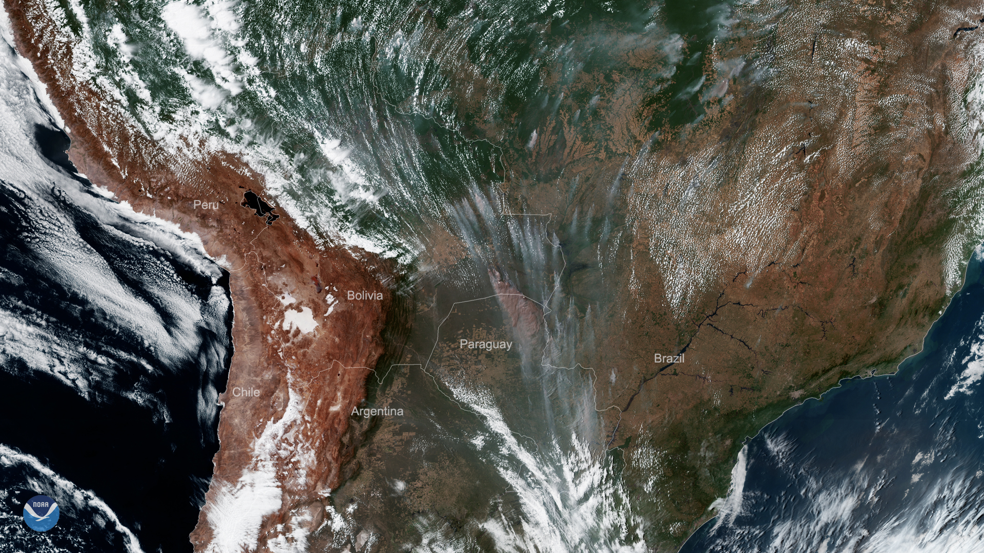
As this year’s unusually severe fires across South America continue to burn, GOES East viewed more smoke plumes on Sept. 9, 2019 across Brazil, Bolivia, and Paraguay. One particularly massive plume can be seen billowing across the border between Bolivia and Paraguay.
The fires, which have been a literal and figurative hot topic in the media as of late, have generated major concern around the world, especially those burning the Amazon rainforest.
The Amazon rainforest is the world’s largest, covering 2.1 million square miles and producing between 6 and 20 percent of the oxygen in the Earth’s atmosphere. A vital ecosystem, it provides habitat for countless species of flora and fauna while helping to keep the planet’s carbon dioxide levels in check. When trees burn, they release carbon dioxide as well as black and brown carbon, and ozone precursors back into the atmosphere, which can contribute to global warming as well as other atmospheric conditions that can affect radiation, clouds, and the climate in general.
This GeoColor-enhanced imagery was created by NOAA's partners at the Cooperative Institute for Research in the Atmosphere. The GOES East geostationary satellite, also known as GOES-16, provides coverage of the Western Hemisphere, including the United States, the Atlantic Ocean and the eastern Pacific. The satellite's high-resolution imagery provides optimal viewing of severe weather events, including thunderstorms, tropical storms, and hurricanes.