
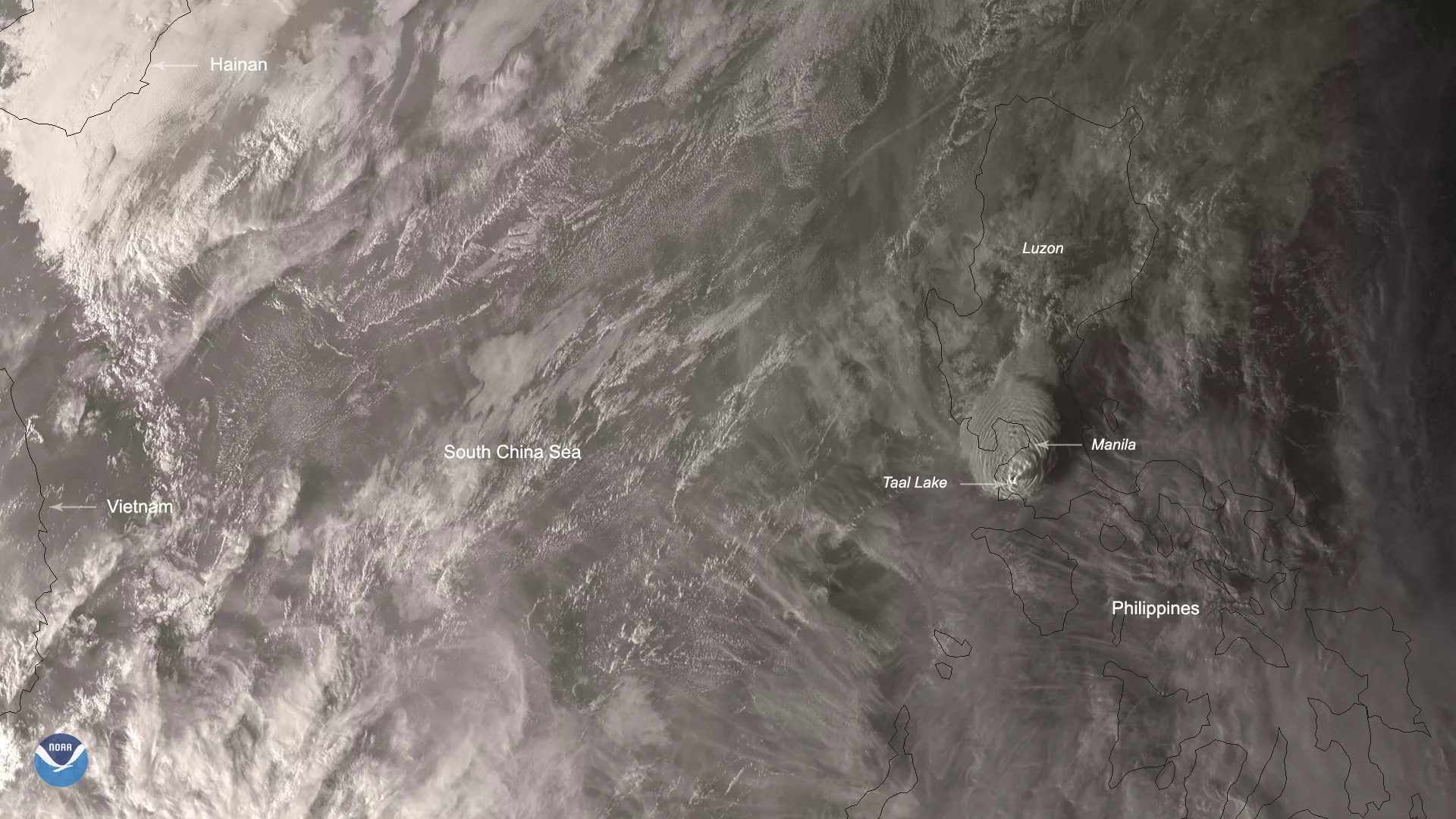
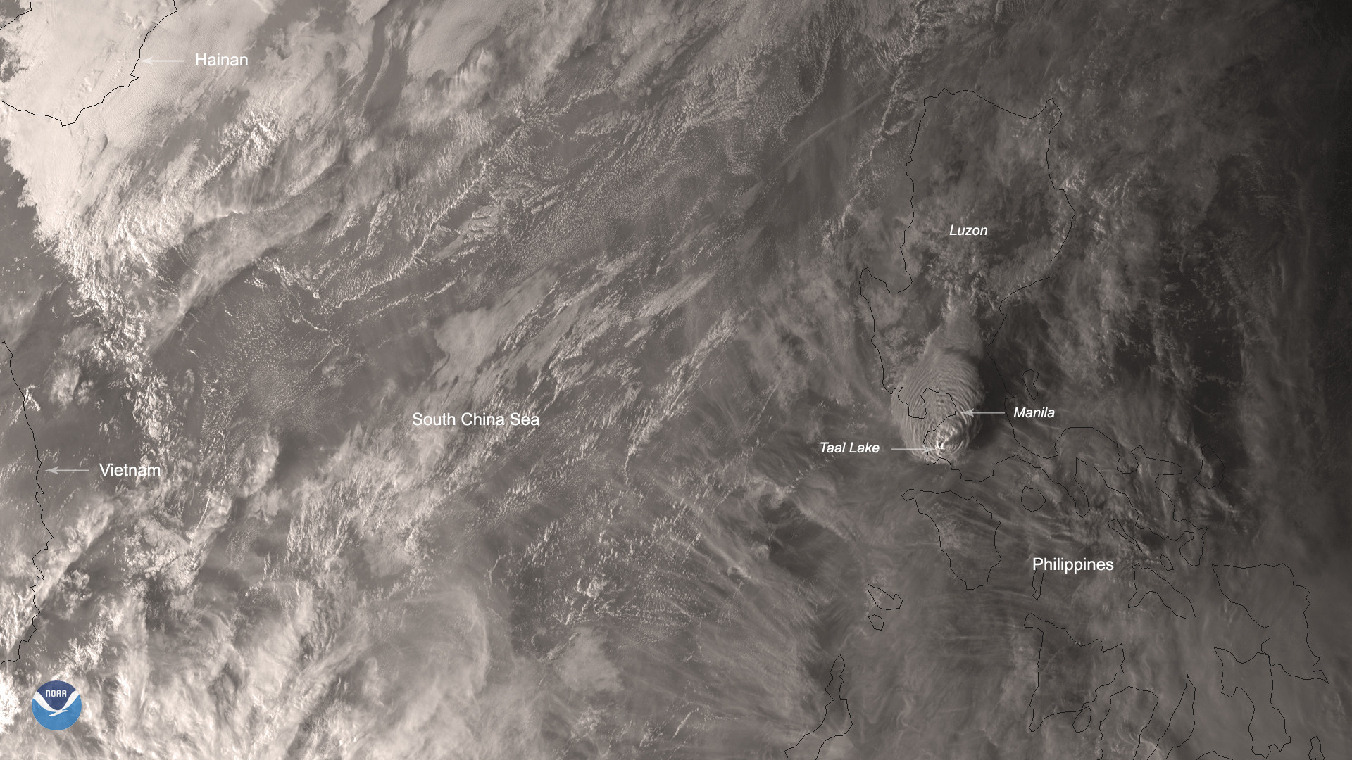
On Jan. 12, 2020, the Himawari-8 satellite captured an image of the Philippines during the aftermath of Taal Volcano’s first volcanic eruption in over forty years. Eruptive activity, which has been occurring since 5:30 p.m. local time on Jan. 12, has generated steam-laden plumes up to nine miles tall, causing travel disruptions and extreme weather events in and around the vicinity of its location in Volcano Island, south of the archipelago’s capital city of Manila.
According to the Philippine Institute of Volcanology and Seismology (PHIVOLCS), “heavy ashfall from the ongoing eruptions...has reportedly fallen southwest of the volcano island in Cuenca, Lemery, and Taal...which can cause irritation and breathing problems” for island residents. The ashfall will also reduce visibility in the area and trigger mudflows due to existing rain. Additionally, PHIVOLCS has raised the threat alert status from Level 3 (magmatic unrest) to Level 4 (hazardous eruption imminent); the final level, which denotes a hazardous eruption in progress, has yet to be called into effect. In the meantime, all residents within a nine-mile radius are considered at high risk for subsequent eruptions and have been ordered by governmental authorities to evacuate the area.
The low pressure trough that caused flash floods and landslides in Caraga City has been exacerbated by the eight earthquakes over magnitude 4 that have occurred in the last 48 hours. For the Cagayan Valley, Cordillera Administrative Region, and Aurora, a cold front will cause intermittent rainfall that will possibly trigger flash flooding conditions and landslides. Finally, Manila and its environs will likely experience flash flooding and landslides in low-lying areas due to localized thunderstorms for the rest of the week.
This True Color image was captured by the Advanced Himawari Imager (AHI) on Japan’s Himawari-8 satellite. This satellite, the first unit of the Japan Meteorological Agency's (JMA) third-generation of geostationary satellites, provides visible light and infrared images of the Asia-Pacific region. Himawari's data are vital for global geostationary coverage, which is why NOAA and JMA have agreed to mutual back-up arrangements for their geostationary systems.