

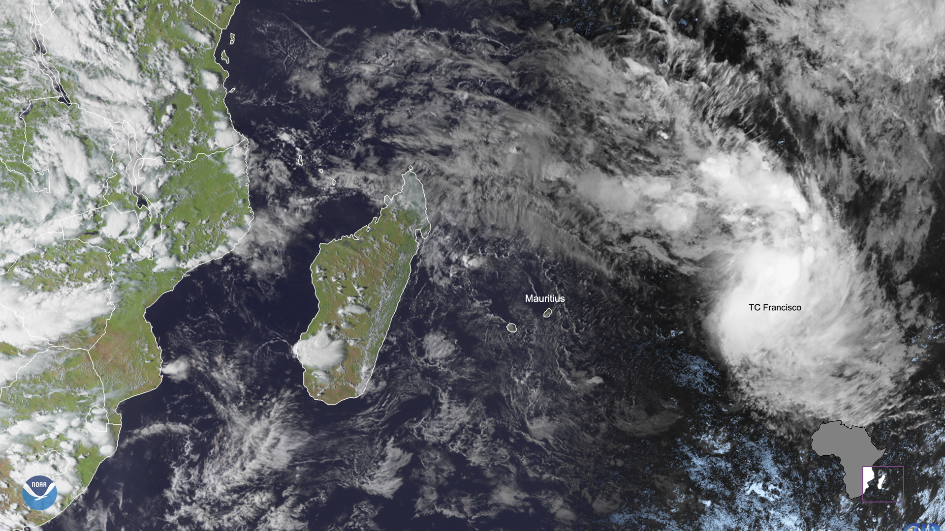
On Feb. 5, 2020, the Meteosat-8 satellite saw Tropical Cyclone Francisco make its way towards the island of Mauritius in the south Indian Ocean. The storm, which was tracked moving southeastward at a speed of up to 35 miles per hour, is expected to intensify over the next couple of days. Forecast models at the Joint Typhoon Warning Center (JTWC) predict that the storm will start moving southwestward and possibly weaken, despite significant wave heights of 15 feet affecting local industry and tourism for nearby Mauritius.
According to Mauritius Meteorological Services , there is currently “a moderate airstream... flowing over [the] region,” with cloudy conditions and rain on the eastern coast of the island. Temperatures for the nation will hover around 68° degrees Fahrenheit, somewhat below its February average temperature of 89° degrees Fahrenheit.
Mauritius’ summer, which lasts from approximately November to April, usually delivers 67% of the total annual rainfall totals for the island. At this time, no cyclone alerts have been issued by the government, and the only fallout expected from the storm is an elevated chance of rain for parts of the island.
In geostationary orbit at approximately 22,300 miles above the equator, the Meteosat-8 satellite operates over Europe, Africa, and the Indian Ocean. Meteosat-8 (launched from the Guiana Space Centre in Kourou in 2002) is positioned at 41.5 degrees and provides full disc imagery every 15 minutes. Meteosat-8 is equipped with the Spinning Enhanced Visible and InfraRed Imager (SEVIRI), which observes the Earth in 12 spectral channels and the Geostationary Earth Radiation Budget (GERB) instrument, a visible-infrared radiometer for monitoring the amount of radiation on Earth. Meteosat-8 is one of the four geostationary satellites operated by EUMETSAT (European Organisation for the Exploitation of Meteorological Satellites).