

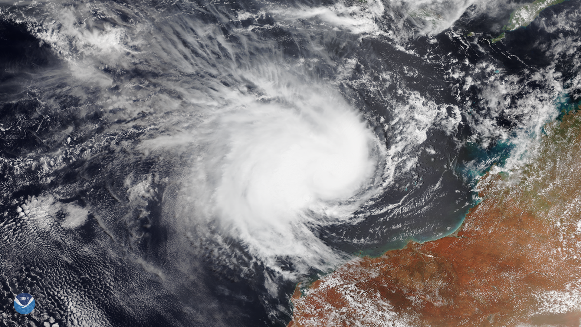
The NOAA-20 satellite captured this image of Tropical Cyclone Claudia off the northwestern coast of Australia on Jan. 13, 2020. The storm is currently located approximately 416 miles northwest of Learmonth, and is tracking west-southwestward into the Southern Indian Ocean at roughly 12 mph.
Imagery from both NOAA and NASA indicates the system is under strong vertical wind shear due to its elongated shape from west to east. The Joint Typhoon Warning Center also confirms the storm’s “central convection [warmer rising air] remains sheared from the low-level circulation as it continues to decay.”
Wind shear is a change of wind velocity and/or direction which may be vertical, horizontal, or a mixture of both. In this case, vertical wind shear is occurring, since the horizontal wind direction and speed are changing with altitude.
With current maximum sustained wind speeds at roughly 80 mph and gusts around 98 mph, it is the equivalent of a Category One hurricane on the Saffir-Simpson Hurricane Scale. However, the Australian Government Bureau of Meteorology states the storm will slowly weaken, as it moves over open waters to the northwest of the Pilbara and that gales and heavy rainfall are not expected over the mainland of Western Australia.
This image was captured by the NOAA-20 satellite's VIIRS instrument , which scans the entire Earth twice per day at a 750-meter resolution. Multiple visible and infrared channels allow it to detect atmospheric aerosols, such as dust, smoke and haze associated with industrial pollution and fires. The polar-orbiting satellite circles the globe 14 times daily and captures a complete daytime view of our planet once every 24 hours.