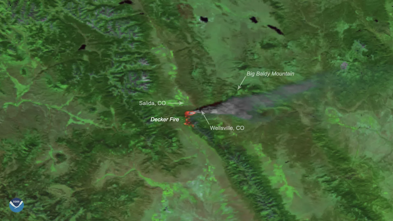
On Oct. 2, 2019, the Suomi National Polar-Orbiting Partnership (Suomi NPP) satellite zoomed in on the Decker Fire, which began burning nine miles south of Salida, Colo. on Sept. 8, 2019. Caused by a lightning strike and fueled by dry conditions and gusty winds, the fire has grown significantly, charring more than 3,700 acres thus far. It has also prompted evacuation orders for parts of Chaffee County.
Large amounts of smoke have been drifting eastward, but shifting winds are starting to blow plumes northward as of today, Oct. 3, which may affect areas of southern Chaffee County including Poncha Springs and Salida. The air quality index is currently rated as unhealthy around Salida to the north, which means sensitive individuals should avoid all physical outdoor activity. It is rated as moderate around Howard toward the east, meaning sensitive individuals should consider limiting prolonged or heavy exertion.
More than 240 personnel are working to fight the blaze, along with five helicopters dropping water on the flames, multiple dozers, and engines. It is currently 5 percent contained, but portions of the fire are now in terrain where fire managers and crews can safely engage in greater suppression efforts.
This image was created by combining three of the high resolution thermal and visible channels from the VIIRS sensor onboard Suomi NPP. These channels (known as SVI 4,2,1 RGB) allow us to distinguish different land types and features based on their visual and thermal differences. Areas of land that are hotter in temperature due to an active fire or burn scar appear dark red in the imagery. Smoke appears in shades of gray and white.
