

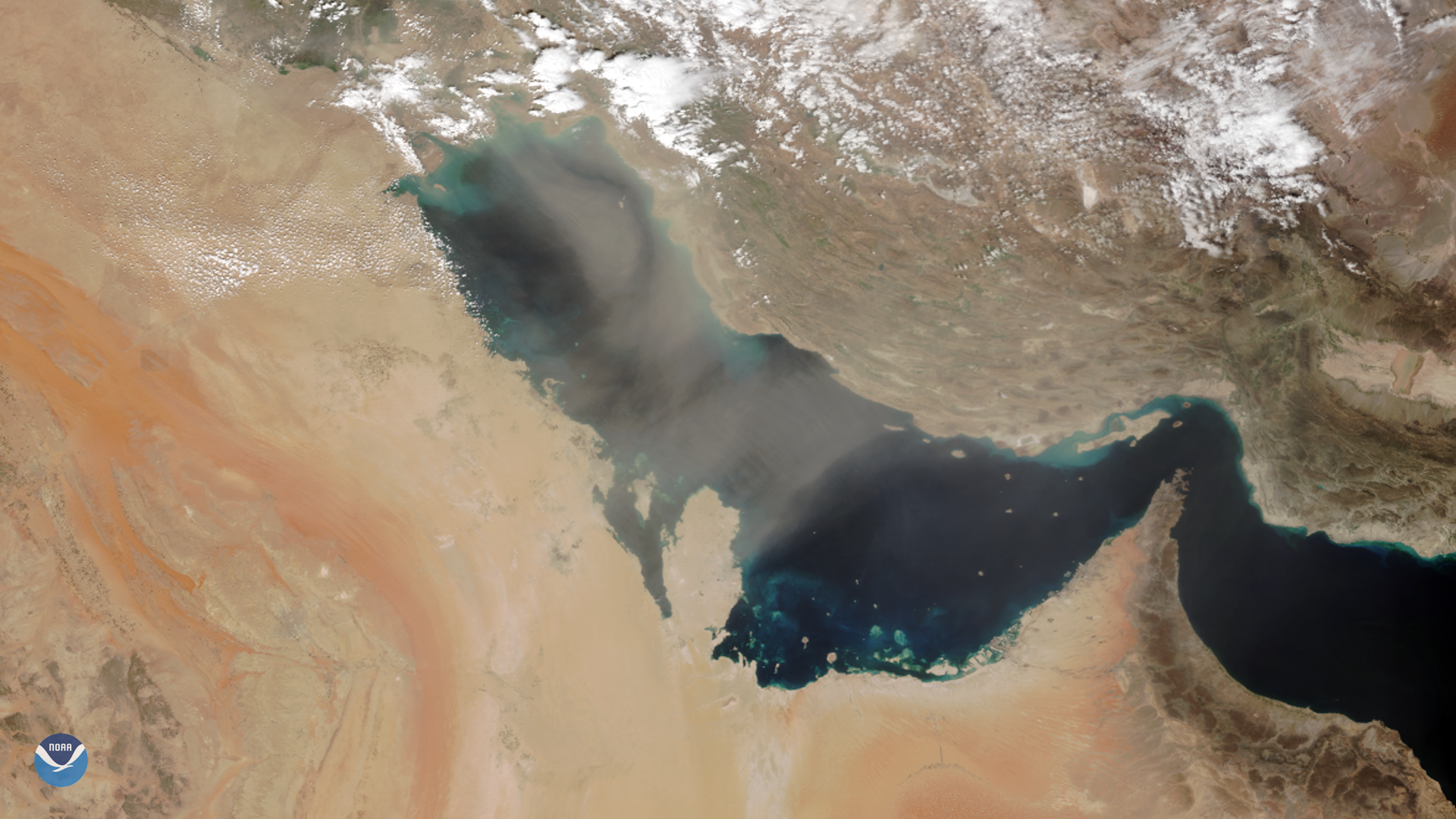
As NOAA-20 passed over the Middle East on March 8, 2020, it captured this image of dust blowing over the Persian Gulf. Dust storms are caused by strong, turbulent winds that draw up and carry fine-grained material from dry, loose soil or sand in places where vegetation cover is sparse.
The dust over the Persian Gulf appears to have originated from the Arabian Desert and is being carried northeastward by a low-pressure system spinning over Iraq. This time of year, however (Dec. through April), may often have gale-force “ kaus ” winds, that blow toward the northwest, while “ shamal ” winds tend to blow toward the southeast in June and July.
In a 2017 article from Middle East Eye, Enric Terradellas from the World Meteorology Organisation explained: “In the Middle East, there has been a significant increase in the frequency and intensity of sand and dust storms in the last 15 years or so.” Drought is a critical factor for the amount of material that makes it into the air, though the storms are highly complex phenomena that are induced by both human and natural factors.

Dust blowing over the Persian Gulf on March 8, 2020. Image via Meteosat-8.
The main image above was captured by the NOAA-20 satellite's VIIRS instrument , which scans the entire Earth twice per day at a 750-meter resolution. Multiple visible and infrared channels allow it to detect atmospheric aerosols, such as dust, smoke and haze associated with industrial pollution and fires. The polar-orbiting satellite circles the globe 14 times daily and captures a complete daytime view of our planet once every 24 hours.
In geostationary orbit at approximately 22,300 miles above the equator, the Meteosat-8 satellite / Meteosat-11 satellites operate over Europe, Africa, and the Atlantic/Indian Ocean. Meteosat-8/-11 (launched from the Guiana Space Centre in Kourou in 2002/2015) is positioned at 41.5/0.0 degrees and provides full disc imagery every 15 minutes. Meteosat-8/-11 is equipped with the Spinning Enhanced Visible and InfraRed Imager (SEVIRI), which observes the Earth in 12 spectral channels and the Geostationary Earth Radiation Budget (GERB) instrument, a visible-infrared radiometer for monitoring the amount of radiation on Earth. Meteosat-8/-11 is one of the four geostationary satellites operated by EUMETSAT (European Organisation for the Exploitation of Meteorological Satellites).