
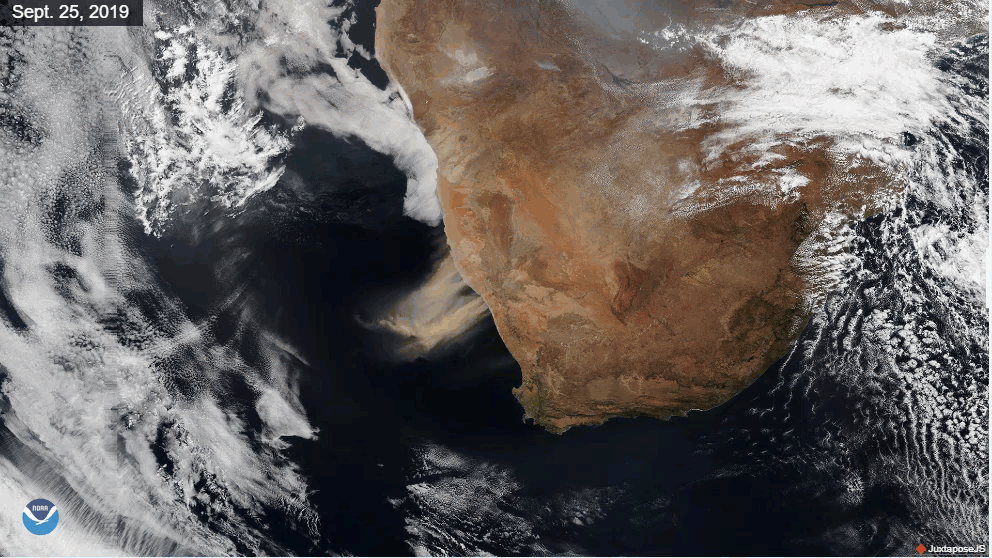
Very strong winds over southern Africa kicked up huge plumes of dust and sand, turning the skies an earthy red on Sept. 25, 2019. People living in South Africa's Northern Cape province told a local news outlet that visibility was reduced to the point that they couldn't "see the white line in the street." The same news outlet reported that planes were diverted to other airports during the intense sandstorm.
This true-color image (left) from NOAA-20's Visible Infrared Imaging Radiometer Suite (VIIRS) shows the storm over the town of Alexander Bay, which is located along the southern bank of the Orange River, which forms part of the border between South Africa and Namibia. The NOAA-20 imagery on the right shows the plume of dust blowing across the Atlantic Ocean on Sept. 26.
While all that dust helps create a stable layer of dry, sinking air, which can help prevent tropical disturbances from developing or gaining strength in the Northern Hemisphere, it’s not so great for human health. People with respiratory disorders like asthma are particularly at risk because the dust can irritate the lungs.
"Depending on weather and climate, dust can remain suspended in (the) air for days, causing allergy outbreaks far from their source," according to the World Meteorological Organization.The VIIRS sensor onboard NOAA-20 provides daily, high-resolution visible and infrared images of Earth's atmosphere across the globe.