
March 02, 2020
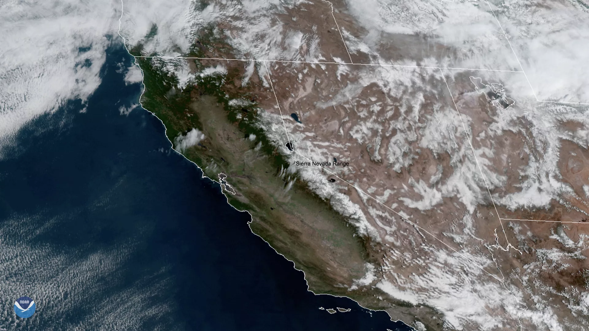
On March 2, 2020, GOES-West saw limited snow cover on the Sierra Nevada range in California, due to the dry winter season of 2019-20. What’s more, NOAA’s National Weather Service (NWS) predicts that for the next seven days, high temperatures for the area will be mild-- ranging from 41 to 67 degrees Fahrenheit--with dry conditions expected through Friday. The National Centers for Environmental Information (NCEI)’s January 2020 Climate Report mentioned that there was a “decline in the Sierra Nevada snowpack... [however,] California’s major reservoirs remained at normal to above-normal levels.”
According to the National Operational Hydrologic Remote Sensing Cente r (NOHRSC), snow cover for March 1 was at 52%, up eight percent from last month’s average cover of 44%. Hydrographs (which display area water level changes over a period of time) for the Sierra Nevada region suggest a potentially devastating shift in the mountain range’s snowmelt regime in the near future. Snowmelt from the Sierra Nevada Mountains provides roughly 75 percent of California’s agricultural water, and 60 percent of Southern California’s water resources.
Warm and dry winters can cause snow droughts in the Sierra Nevada, both by nudging precipitation in the direction of rainfall rather than snowfall and by melting snow sooner. These sorts of changes in Sierra snowpack will likely have profound—and expensive—impacts on everything from salmon runs, to ski resorts, to regional fire risk.
This GeoColor enhanced imagery was created by NOAA's partners at the Cooperative Institute for Research in the Atmosphere. The GOES-West satellite, also known as GOES-17, provides geostationary satellite coverage of the Western Hemisphere, including the United States, the Pacific Ocean, Alaska, and Hawaii. First launched in March 2018, the satellite became fully operational in February 2019.