
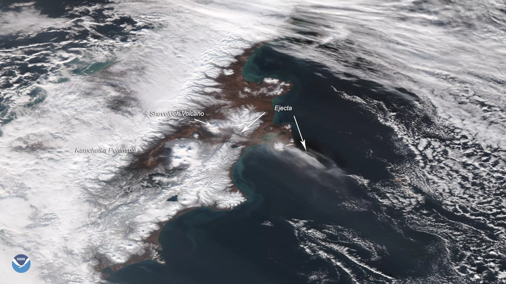
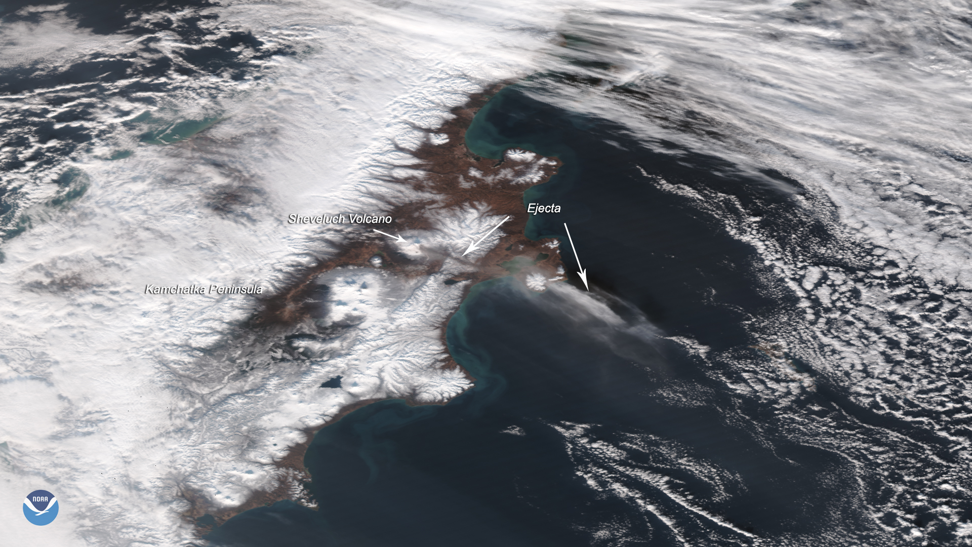
The Suomi-NPP satellite captured this image of the Sheveluch volcano erupting on Nov. 12, 2019, which affected flights over an area spanning from Alaska’s Aleutian Islands into the North Pacific, according to the NWS Oakland Center Weather Service Unit.
Ash from the plume, which was ejected as high as 33,000 feet, was pulled southeastward by winds in the Bering Sea into a strong low-pressure system in the Gulf of Alaska. In the image, the ejected ash closest to the volcano is a mix of rock, minerals, and other particles along with hot gasses, such as sulfur dioxide and water vapor. Thus, it appears darker against the snow-capped peaks of the VostoÄny Mountains beneath it. However, as ash is carried by the wind, the heavier particles tend to fall to the ground sooner, causing the plume to become lighter in color.
During the last 11,700 years (the Holocene epoch), the volcano, which belongs to the Kliuchevskaya volcano group , has had at least 60 large explosions along with long periods of dormancy. The current active period started around 900 B.C., with moderate or large eruptions occurring at roughly 50 to 400 year-long intervals. In 1854 and 1956, catastrophic eruptions took place that each caused part of the lava dome to collapse and resulted in devastating avalanches. The mountain began erupting again in 1999 and has continued on and off to this day. It is now considered one of the most active volcanoes in the region.
This image loop from EUMETSAT is shown via Ash RGB.
This True-Color image was captured by the VIIRS sensor on board Suomi-NPP, which provides daily, high-resolution visible and infrared images of Earth's atmosphere from across the globe.