
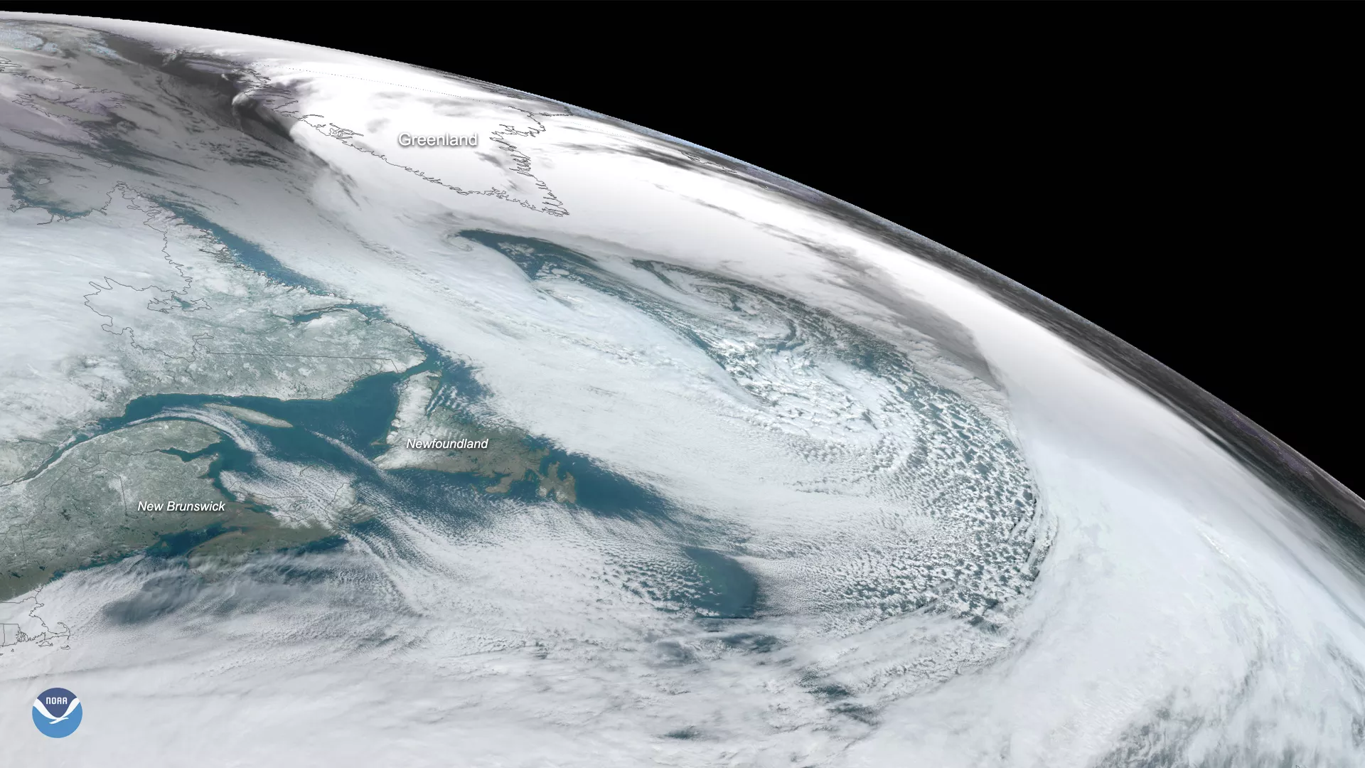
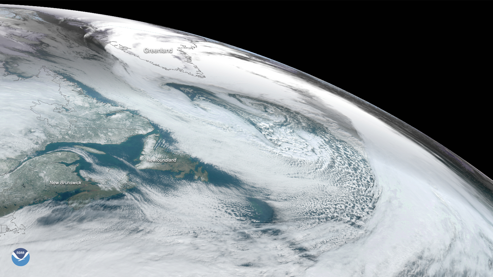
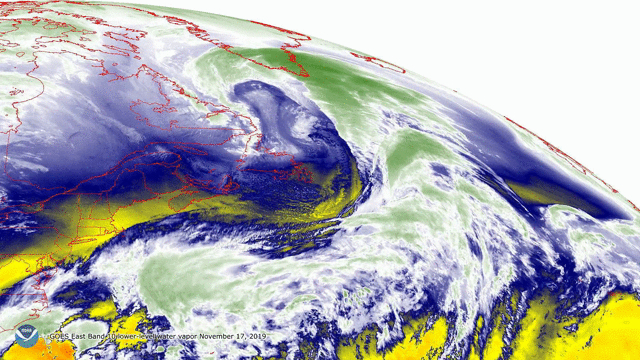
On Nov. 17, 2019, the GOES East satellite captured this image of a massive cyclone that formed over the Labrador Sea between eastern Canada’s Labrador Peninsula and Greenland. Although the storm has since begun to weaken as it moves toward western Europe , several embedded mini-cyclones could be seen swirling within it.
If that wasn’t impressive enough, the storm displayed a feature known as a sting-jet. A sting jet is a small, narrow core of very intense winds (often more than 100 mph) that sometimes form around the center of a low-pressure area when focused streams of warm and cold air feed warm air and moisture into the system. The unusually powerful winds associated with sting jets can often topple trees and damage structures as they encounter land. The “sting” in its name is due to the fact that it resembles the shape of a scorpion’s tail.
Sting jets are relatively small, averaging roughly thirty miles across, and don’t last long. They form roughly two to two-and-a-half miles above the ground, descend toward the surface, then dissipate just three to four hours later.
The GOES East geostationary satellite, also known as GOES-16, keeps watch over most of North America, including the continental United States and Mexico, as well as Central and South America, the Caribbean, and the Atlantic Ocean to the west coast of Africa. The satellite's high-resolution imagery provides optimal viewing of severe weather events, including thunderstorms, tropical storms, and hurricanes.