
This season’s Humberto isn’t the first tropical cyclone in the Atlantic Basin to be given the name. In fact, it’s the fifth Hurricane Humberto to emerge in the Atlantic, but this time, NOAA is watching through the sophisticated Advanced Baseline Imager (ABI) of GOES-16.
Humberto replaced the name Hugo on the World Meteorological Organization’s list of Atlantic hurricane names after Hurricane Hugo’s devastation in 1989 prompted its name to be retired. Since 1979, all annual lists of Atlantic tropical cyclone names are repeated after six years unless a storm is exceptional enough to warrant retirement. So far, no hurricane named Humberto has been big or bad enough.
That’s not to say we didn’t have any memorable Humbertos. In 1995, Hurricane Humberto had sustained winds of 110 mph at one point — making it a strong Category 2 hurricane — but it remained well out at sea. In 2001, another Category 2 Hurricane Humberto brought gusty winds and heavy rain, as it passed to the west of Bermuda.
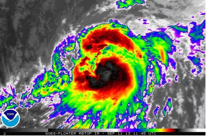
Looking back at the last two Hurricane Humbertos from the perspective of NOAA’s geostationary satellites, GOES-13 captured 2013’s Hurricane Humberto far in the eastern Atlantic Ocean (above). When it finally strengthened to a hurricane on Sept. 11, 2013, it was one of the latest-forming, first hurricanes of any Atlantic hurricane season. It stayed far away from the United States.
NOAA/NESDIS
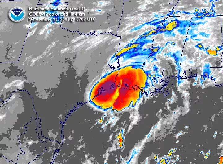
Six years earlier, a storm named Humberto made landfall along the northern Gulf Coast as a tropical storm. Unlike 2013, 2007’s Humberto hit the U.S., causing damage to structures, trees and power lines from Texas to Louisiana. NOAA’s GOES-12 was watching as that Humberto briefly intensified into a hurricane and then weakened to a tropical storm before coming ashore.
This season’s Humberto arrived during the new era of the GOES-R series of satellites. This new generation of NOAA weather satellites is equipped with advanced sensors and instruments that are providing unprecedented, real-time monitoring of weather from space.
In particular, the above image of Hurricane Humberto is courtesy of NOAA’s GOES-16’s ABI — also aboard the new GOES-17 satellite, which tracks tropical cyclones in the Pacific Ocean. The ABI’s 16 channels of weather imagery are helping revolutionize tropical cyclone monitoring and forecasting.
“The GOES-16 ABI is a significant improvement over the imager aboard the legacy GOES series,” said Dan Lindsey, GOES-R satellite scientist. “Now, forecasters are seeing more details, even smaller-scale cloud features associated with tropical cyclones.”