
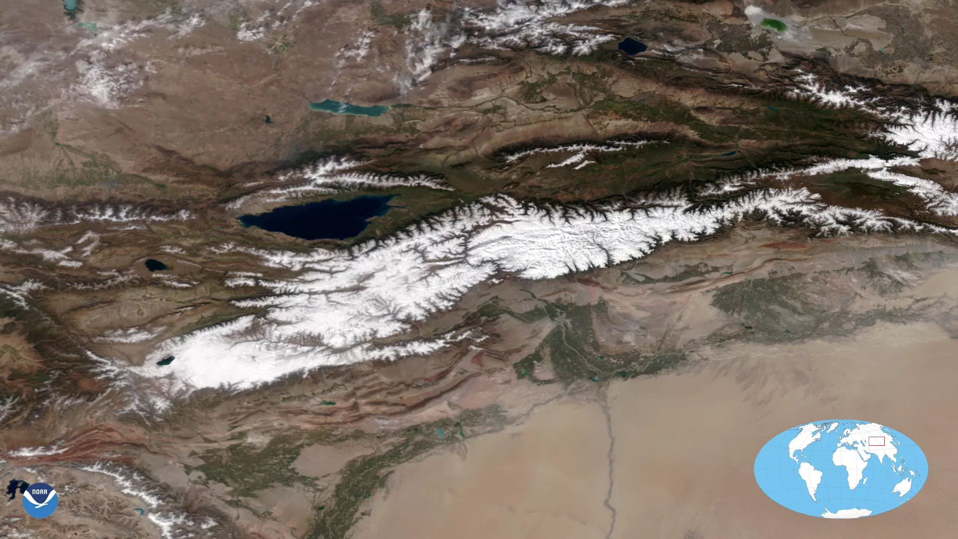
On Sept. 21, 2020, the NOAA-20 satellite was able to snap this cloudless True Color image of the snow-covered Tian Shan mountain range in northwestern China. Meaning “ Celestial Mountains ” in Chinese, the range stretches roughly 1,500 miles from west-southwest to east-northeast, mainly straddling the border between China and Kyrgyzstan.
The Tian Shan mountains are part of the Himalayan orogenic belt, formed by the collision of the Indian and Eurasian plates during the Cenozoic era, and one of the longest mountain ranges in Central Asia. The range lies just north of the Keping Shan thrust belt in northwestern Xinjiang province, made up of a colorful series of wavy ridges of sedimentary rock layers that run parallel to the mountain range. Fold and thrust belts like these are formed from pressure when land masses collide.
In this case, the oldest cream-colored layers are limestone from the Cambrian-Ordovician periods, the greenish layers are Silurian sandstones formed in an ancient ocean at the time, and the reddish layers, most easily visible in the True Color imagery above, are Devonian sandstones formed by ancient rivers. To the south and east of these features lies the sandy flat expanse of the Taklamakan Desert, which is also visible in the imagery.
This image was captured by the NOAA-20 satellite's VIIRS instrument, which scans the entire Earth twice per day at a 750-meter resolution. Multiple visible and infrared channels allow it to detect atmospheric aerosols, such as dust, smoke and haze associated with industrial pollution and fires. The polar-orbiting satellite circles the globe 14 times daily and captures a complete daytime view of our planet once every 24 hours.