
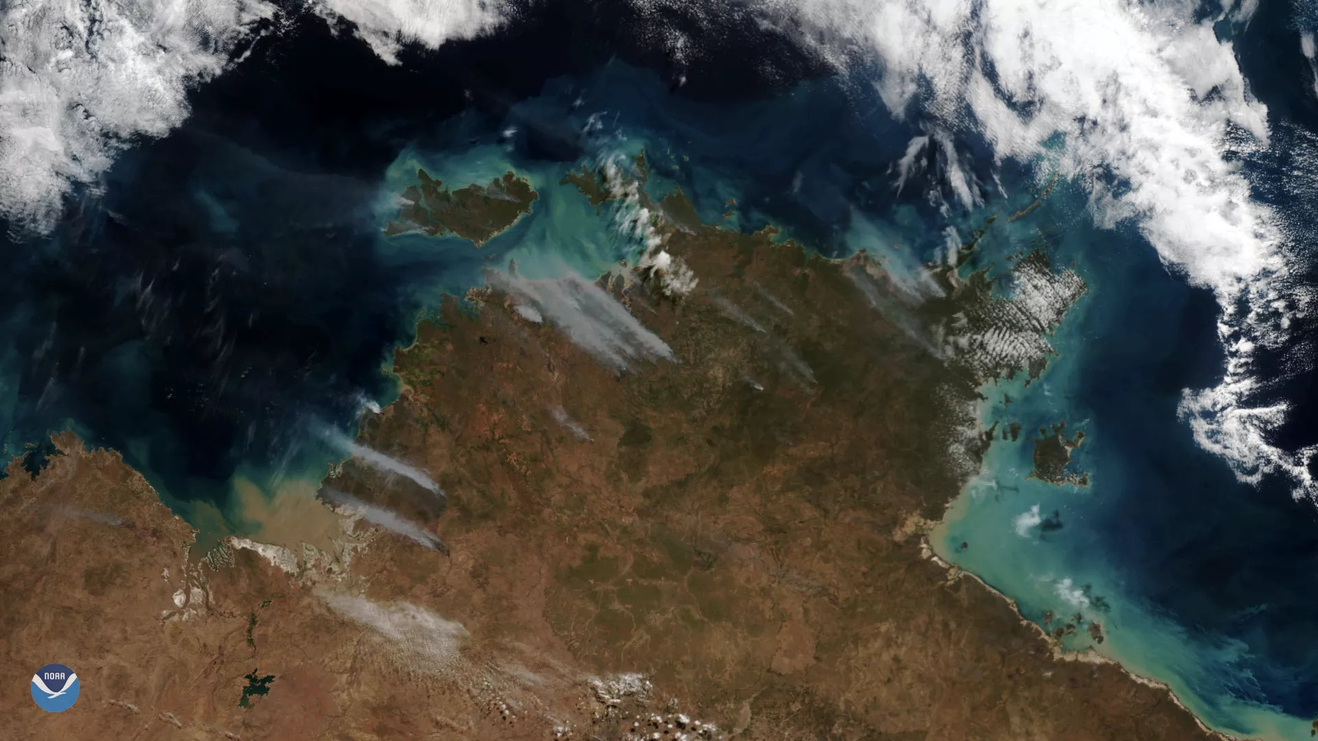
Clear skies over Australia on July 16, 2019, gave the NOAA-20 polar-orbiting satellite an unobstructed view of smoke plumes from bushfires across the Northern Territory. The bushfire season started early across parts of northern Australia, which experts with the Bushfire and Natural Hazards Cooperative Research Centre attribute to record warmth and below-average rainfall.
The Northern Australia Seasonal Bushfire Outlook noted that an above-normal bushfire potential, which depends on factors like weather, climate and vegetation is possible across parts of Queensland this year. Forested areas along the coast of south Rockhampton down to the New South Wales border, as well as “inland areas in the south, a small area west of Mackay and in the southwest of Cape York,” could see a more active bushfire season according to the outlook.
While the Top End of the Northern Territory, seen in this imagery, is reportedly “experiencing its driest wet season since 1992,” experts said the bushfire threat should remain around normal.
This true-color image was captured by the VIIRS sensor onboard NOAA-20, which provides daily, high-resolution visible and infrared images of Earth's atmosphere from across the globe.