

This past week the United Kingdom (UK) has experienced nasty weather and torrential rains, which brought flooding, power outages, and fallen trees in addition to the cancellation of various summertime events as well as numerous flights. However, the worst is yet to come.
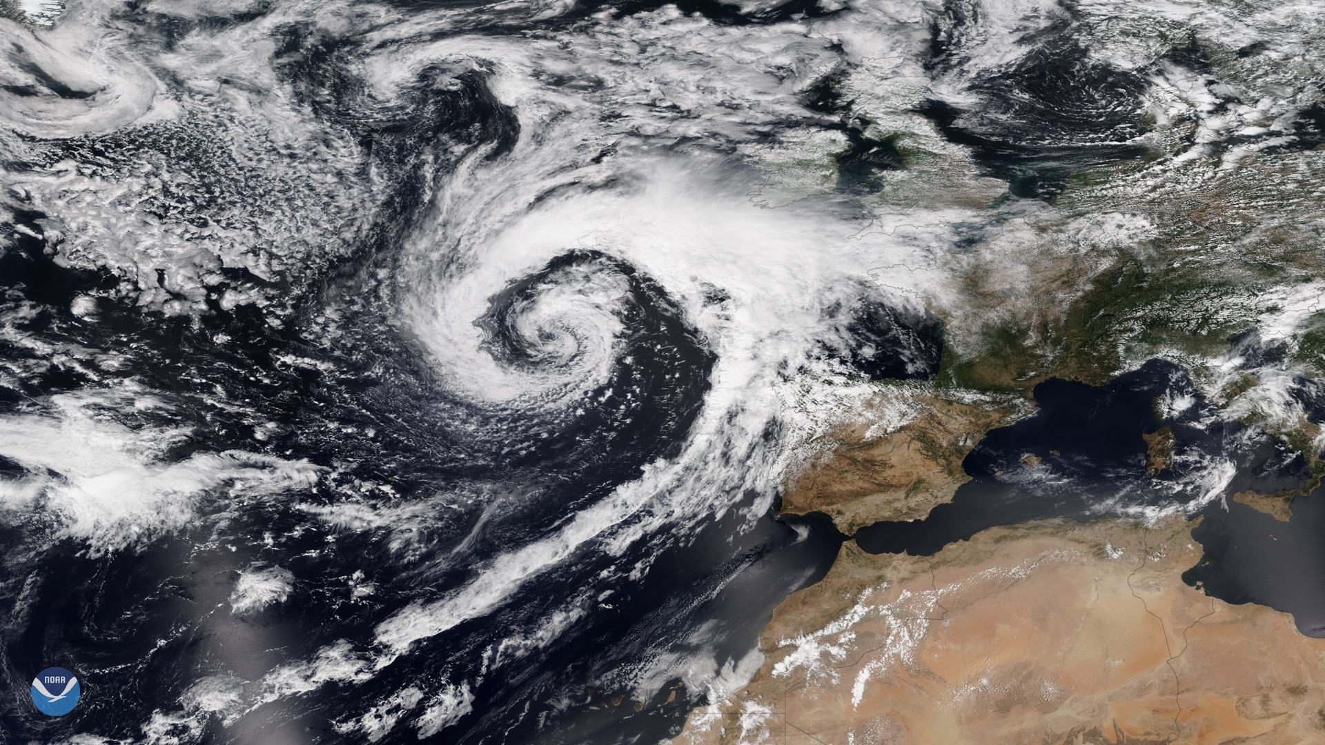
Imagery from the NOAA-20 satellite shows a powerful storm is set to wreak havoc across the region this weekend, as a low pressure system off the coast makes its way to the mainland, bringing with it unseasonably strong winds, heavy rain, and large waves along the coast.
The UK Met Office has issued yellow warnings urging residents to prepare for 54 hours of a mix of wind, rain, and thunderstorms that will affect almost all of Britain.
Although this storm-track is typical, it is stronger and earlier than usual, with similar storms more common in the fall.
This true-color image was captured by the VIIRS sensor onboard NOAA-20, which provides daily, high-resolution visible and infrared images of Earth's atmosphere from across the globe.