
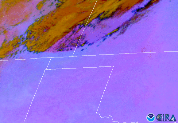
On Oct. 11, 2020, NOAA's GOES-East satellite watched a huge wall of dust blow more than 300 miles from eastern Colorado to Nebraska, Kansas, and the Texas panhandle. This particular imagery utilizes a Dust RGB product, which helps differentiate dust in the atmosphere from clouds. Dust appears pink/magenta during the day and can vary in color at night depending on height.
Events like these are called haboobs, a term derived from the Arabic word, habb, which means "to blow" or "strong wind." A haboob is an intense sand or dust storm caused by strong winds, which can carry the dust through hot and dry regions to heights as high as ~5000 feet. As a result, there is often a rapid and significant reduction in visibility during a haboob and breathing can become difficult.
Haboobs tend to form as a result of thunderstorms, in particular, the thunderstorms' downdrafts, which are relatively common in the southwestern U.S. during the North American Monsoon Season. However, Sunday's event was a result of recent drought conditions and high winds following a strong cold front. Although winds reached 60-70 mph, only minor damage was reported.
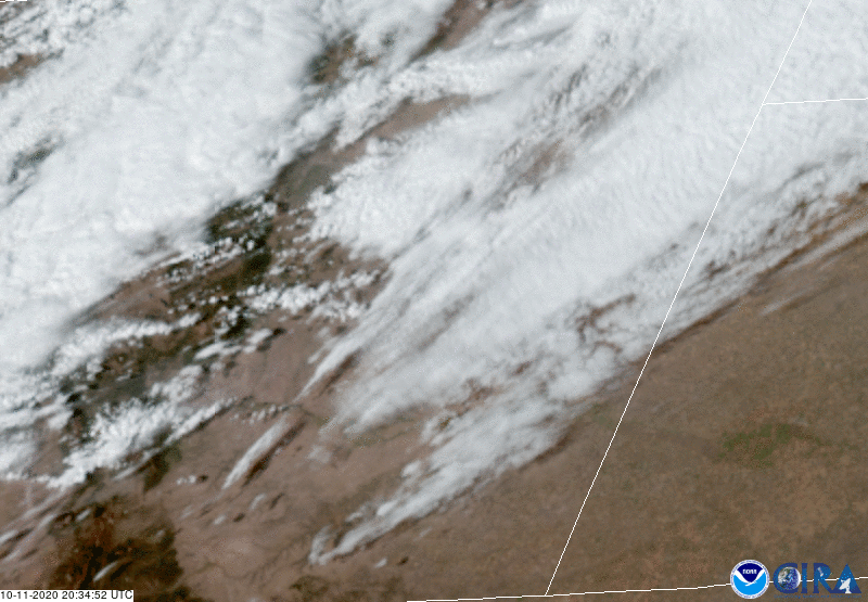
A GeoColor view of the haboob, seen by GOES-East on Oct. 11, 2020
The GOES-East geostationary satellite, also known as GOES-16, keeps watch over most of North America, including the continental United States and Mexico, as well as Central and South America, the Caribbean, and the Atlantic Ocean to the west coast of Africa. The satellite's high-resolution imagery provides optimal viewing of severe weather events, including thunderstorms, tropical storms, and hurricanes.