
Ever wonder about that special glow from the sky on a cloudy day, when the sun shines through stronger than normal? Besides being beautiful, the phenomenon may have practical applications for energy generation.
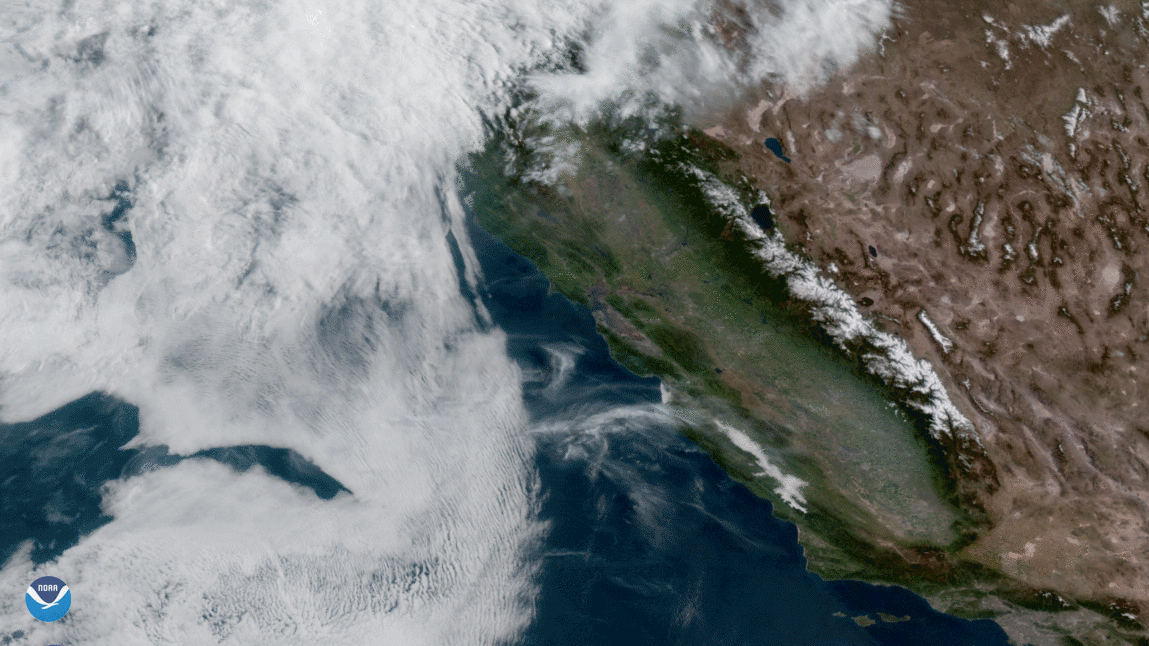
On the afternoon of April 22, 2020, the GOES-West satellite viewed a large amount of stationary cloud cover over the San Francisco area. The frozen water molecules inside of high-altitude clouds refracted the sun’s light, which in turn caused brighter-than-normal conditions on the ground. This phenomenon, which is called “cloud lensing,” is unusual, and typically lasts for a period of 5–10 minutes. However, this high power event lasted for four hours, between 12–4 p.m. PST. According to area utility providers, solar power increased by 25–60 percent, far past the maximum capacity for the inverters within the solar systems.
Engineers from Custom Power Solar , a utility provider, explained in an email that “California Independent System Operator (CAISO) states that ...the state [power] load slightly decreased... by a gigawatt, from noon to 2:10 and again dipped at 3:00. The cloud top satellite data [from GOES-West] indicates clouds at 20–30,000 feet came over at the onset of this, [and] they're likely the cause.” In other words, the ice crystals within the heavy, stationary cloud cover refracted the afternoon sunlight, adding to the existing solar power, causing an abnormal energy surge on the ground. The solar panels recorded the surge, and that's how the area recorded the excess power. Current solar panel capacity in the SF Bay area is estimated at 500 megawatts; however, the recorded power surge for that particular afternoon was measured to be one gigawatt, twice the current capacity. CO2 emissions decreased by roughly 700 metric tons due to the decreased energy load on the state's power grid.
This phenomenon, if appropriately harnessed by the ever-evolving solar power technology currently available in the U.S., couldhelp reduce the need for resources such as natural gas that would otherwise have been used to generate electricity.
This GeoColor enhanced imagery was created by NOAA's partners at the Cooperative Institute for Research in the Atmosphere. The GOES-West satellite, also known as GOES-17, provides geostationary satellite coverage of the Western Hemisphere, including the United States, the Pacific Ocean, Alaska, and Hawaii. First launched in March 2018, the satellite became fully operational in February 2019.