

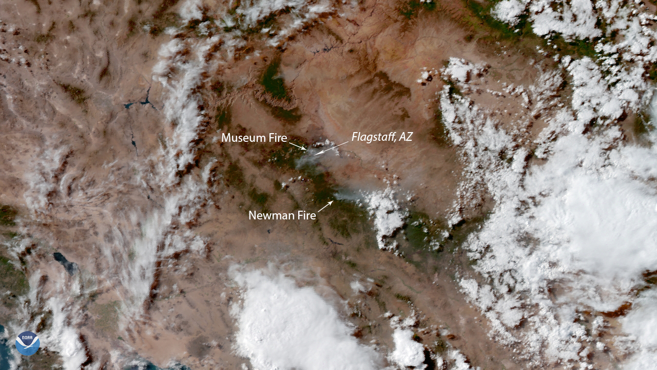
NOAA’s GOES West satellite zoomed in on two wildfires near Flagstaff, Ariz. on July 23, 2019. The Museum Fire, currently searing through the Dry Lake Hills area just outside the city in the Coconino National Forest, is now considered the top priority fire in the country due to its proximity to homes and other structures.
The fire broke out around 11:00 a.m. on July 21, 2019, and has burned more than 1,800 acres so far. More than 600 personnel from local, state, and federal agencies are still fighting to contain it, while roughly 5,000 nearby residents are under “pre-evacuation” orders according to local reports. The cause of the fire is currently unknown.
Further south, the Newman Fire, caused by a lightning strike and discovered on July 11, 2019, is now almost completely contained. Although it has charred roughly 5,000 acres and is still producing smoke, it no longer poses a danger or threat to residents or structures. The public is being urged to use caution when recreating or driving in the nearby Lake Mary corridor.
This GeoColor enhanced imagery was created by NOAA's partners at the Cooperative Institute for Research in the Atmosphere. The GOES West satellite, also known as GOES-17, provides geostationary satellite coverage of the Western Hemisphere, including the United States, the Pacific Ocean, Alaska and Hawaii. First launched in March 2018, the satellite became fully operational in February 2019.