

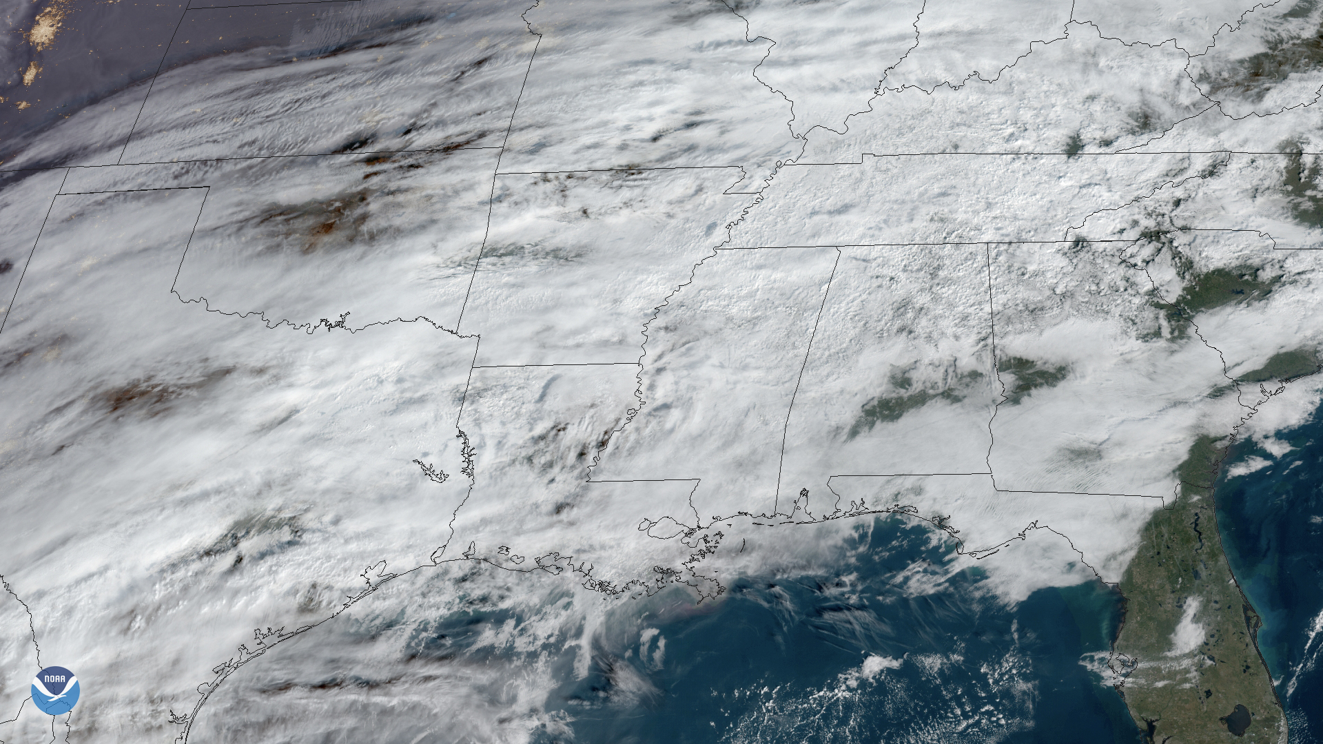
On Jan. 15, 2020, GOES East captured this image of the Mississippi River Delta and Mobile Bay as it experienced flash flooding conditions. Warnings have been issued for the lower Mississippi River, with the National Weather Service (NWS) advising residents driving in and around that area to avoid flooded roads. The New Orleans office cautions drivers to not move cars through any accumulation of water, adding that “two feet... can carry away most vehicles, including pickups.”
Additionally, municipal authorities are preparing for the imminent failure of the Oktibbeha County Lake Dam near the Mississippi River and are taking steps to alleviate pressure on the dam walls. However, the Clairborne and Millers Ferry Dams along the Alabama River are holding steady; forecasts state that levels will rise above the flood stage by Thursday afternoon and rise to 46.5 feet by Sunday near the Clairborne and 69 feet on Friday by the Millers Ferry.
In the New Orleans area, which is one foot below sea level, the flood stage of 14 feet was reached on Jan. 10. As of Wednesday morning, the NWS’ Advanced Hydrologic Prediction Service recorded that levels reached 16.9 feet near the Pearl River, falling short of the record of 21.05 feet that was made in 1983. For the next 24 hours, the NWS will monitor for additional activity and make adjustments to the forecast as needed.
The GOES East geostationary satellite, also known as GOES-16, keeps watch over most of North America, including the continental United States and Mexico, as well as Central and South America, the Caribbean, and the Atlantic Ocean to the west coast of Africa. The satellite's high-resolution imagery provides optimal viewing of severe weather events, including thunderstorms, tropical storms, and hurricanes.