

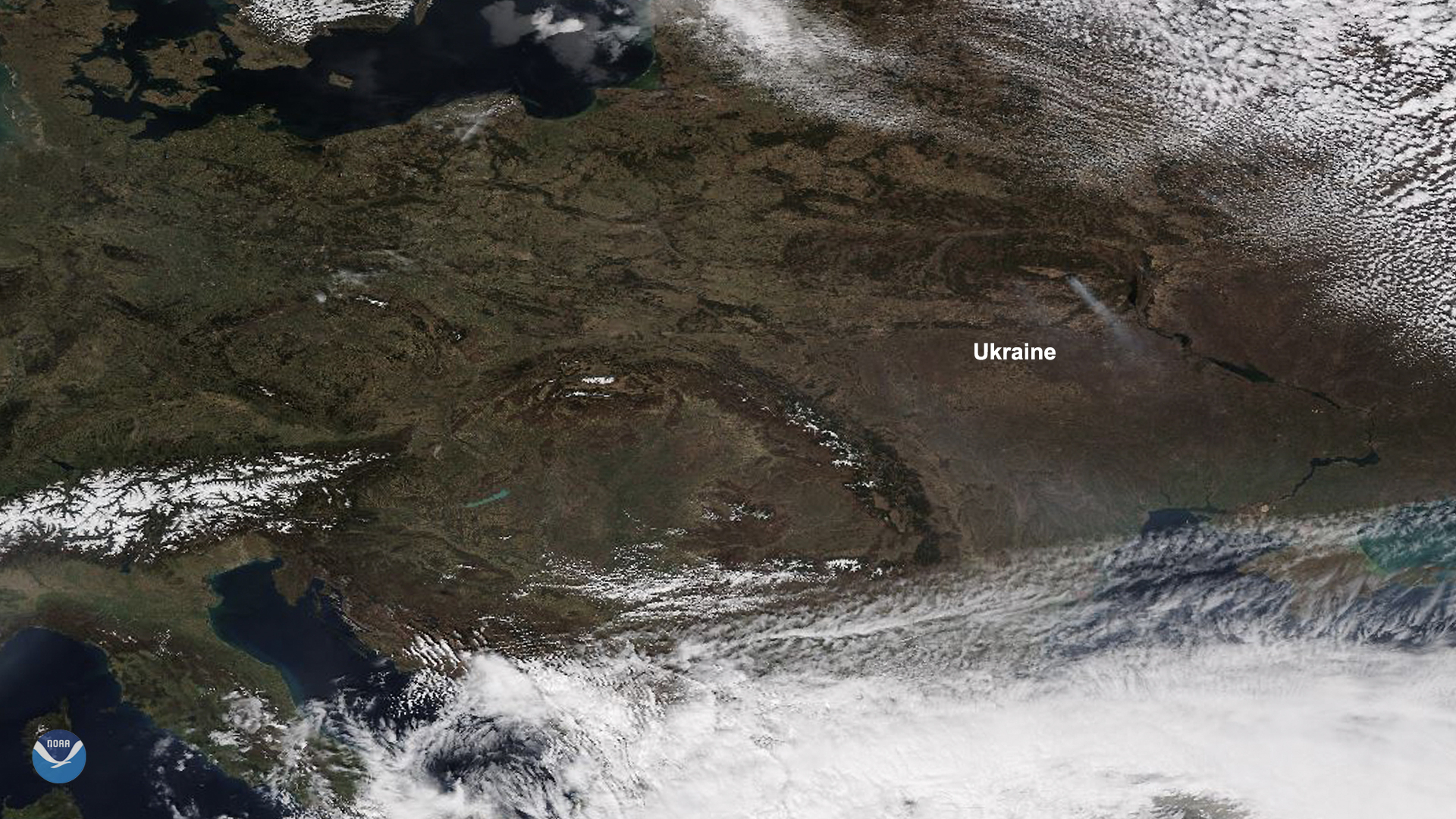
On April 5, 2020, NOAA-20 passed over Ukraine as fires broke out within and around the Chernobyl Exclusion Zone. It is believed that the flare-up was started by a grass fire on April 6 near the Grezlya River, located within the “green fence” that helps contain the radionuclides within the zone.
Within 24 hours, the fire beds expanded to the city of Kyiv, Konotop, and the Zhytomyr region, and as of April 8, a few of the fires are still burning in the Kotovsky Forest. In all, more than 270 people were involved in containing the emergency situation, and the government asserted that despite the elevated radiation levels caused by the fires, the radiation background in the Kyiv region is within normal limits and does not exceed natural background values; currently, they are five times less than the permissible radiation limit.
Thanks to extensive planning by the State Agency of Ukraine On Exclusion Zone Management (SAUEZM), the authorities were able to quickly reach and extinguish most of the fires. “This winter turned out to be very dry,” the head of the SAUEZM stated, and added, “clearing roads will allow [us] to quickly reach the place of ignition, and fire breaks and mineralized strips will become barriers to the spread of fire.”
The Ministry of the Interior of Ukraine, in its April 8 tweet about the fire, noted that “in the last 24 hours alone, there were 541 cases of open fires in the region. The fire passed two square miles, with burns all over the country.” During the course of 2020, there have been more than 15,000 cases of isolated fire incidents, which have destroyed 65 square miles of land. In a Ministry of the Interior bulletin, authorities mention how easily fires can be avoided, highlighting the need for citizens to be aware of one’s surroundings. “And the fact is,” it continues, “that the main cause of fires in open territories is caused by human error.”
This image was captured by the NOAA-20 satellite's VIIRS instrument, which scans the entire Earth twice per day at a 750-meter resolution. Multiple visible and infrared channels allow it to detect atmospheric aerosols, such as dust, smoke and haze associated with industrial pollution and fires. The polar-orbiting satellite circles the globe 14 times daily and captures a complete daytime view of our planet once every 24 hours.