
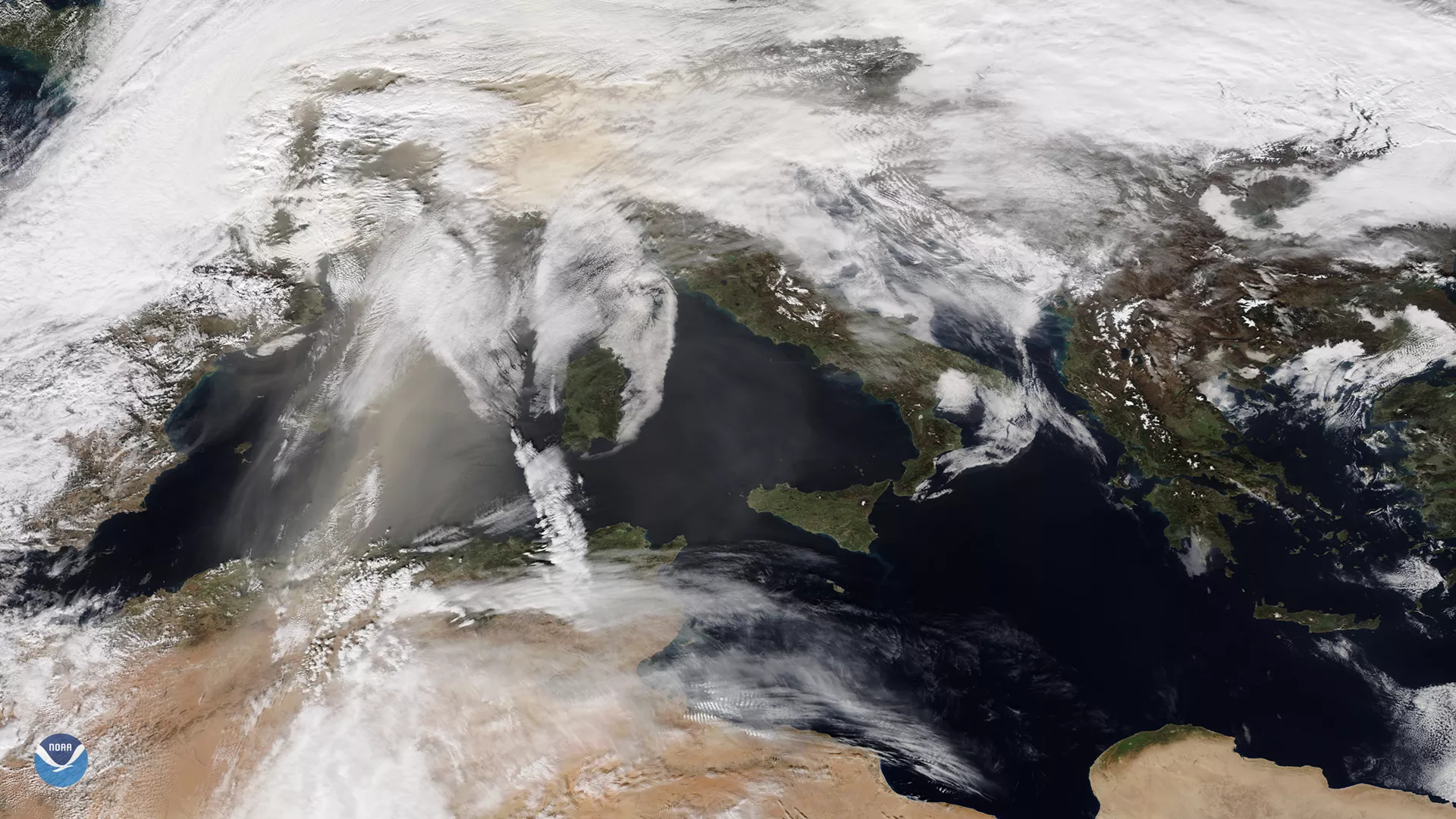
Orange skies and dusty ski slopes plagued Europe during the first weekend of February. In the TrueColor NOAA-20 satellite imagery from Feb. 6, 2021, you can see the brownish dust blowing off the coast of Northern Africa, traveling northward across the Mediterranean Sea, and pushing over central Europe.
The dust in Europe swept in from a jet stream pattern that shifted southward into Africa. The jet stream winds blew sand and dust from the coast of Algeria northward into southern and central Europe, and deposited so much onto the landscape that snow cover in parts of the Alps turned a rusty orange.
According to the United Kingdom’s Met Office , “Saharan dust is relatively common [as far north as the UK], often happening several times a year when big dust storms in the Sahara coincide with southerly wind patterns.” Dust concentrations were at their height on Saturday, and are currently in the process of dissipating.
“We saw air quality values in the affected regions drop significantly," the Copernicus Atmosphere Monitoring Service added. Barcelona and Marseille, especially, were impacted by the change in the winds and air quality. Other areas affected included the northern Balkans, Germany, and Austria.
The NOAA-20 satellite's VIIRS instrument scans the entire Earth twice per day at 350- to 750-meter resolution. Multiple visible and infrared channels allow it to detect atmospheric aerosols, such as dust, smoke and haze associated with industrial pollution and fires. The polar-orbiting satellite circles the globe 14 times daily and captures a complete daytime view of our planet once every 24 hours.