

At 1:15 a.m. CST this morning, the NOAA-20 satellite passed over a line of severe storms that spawned several tornadoes in central Tennessee that wreaked havoc and left at least 25 people dead. “There’s a really good possibility that there may be more,” Gov. Bill Lee said during a press conference on Tuesday morning. He explained that it’s still early and that there are a number of people injured and others who are still missing.

Severe thunderstorms near Tennessee, shortly before the tornadoes touched down, seen by GOES-East on March 3, 2020. The yellow flashes are lightning, seen via the satellite’s Geostationary Lightning Mapper.
One particularly long-lived tornado touched down northwest of Nashville around 11:41 p.m. CST, causing heavy damage as it moved eastward for about 10 miles and ended around the town of Hermitage. East of Nashville, the cities of Mt. Juliet and Lebanon also sustained damage. The Mt. Juliet police department tweeted an approximate map of the path that tornado took through the city limits.

A zoomed-in view of thunderstorms over Nashville, Tennessee, seen by GOES-East on March 3, 2020. In this view, lightning is shown as white flashes.
The Nashville Fire Department said that they are responding to reports of more than 40 structural collapses around Nashville and urged residents to avoid downed power lines and storm debris. A local television news reporter tweeted that hundreds of people in downtown Nashville were left homeless after their apartment complexes were destroyed. Additionally, a public information statement from the National Weather Service stated that so far, surveys in Mt. Juliet and Donelson have "found at least EF-3 damage ," where wind gusts ranged from 136-165 mph.
The city’s power provider, Nashville Electric, stated at 4:14 a.m. CST that more than 44,000 residents had lost power, but they are working as quickly as possible to assess the damage and restore it. Schools, courts, transit lines, an airport, and the state capitol have been closed, and even some damaged polling stations had to be moved just hours before Super Tuesday voting began.
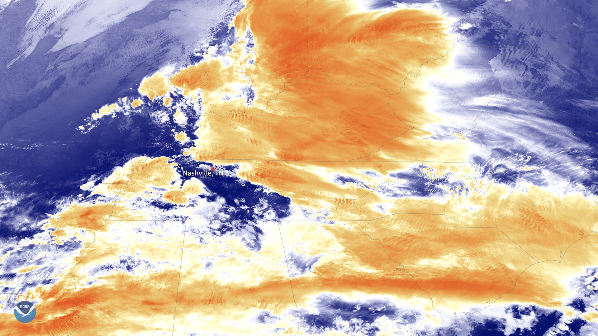
The main image above was captured by the NOAA-20 satellite's VIIRS instrument , which scans the entire Earth twice per day at a 750-meter resolution. Multiple visible and infrared channels allow it to detect atmospheric aerosols, such as dust, smoke and haze associated with industrial pollution and fires. (In this case, it utilized its high resolution infrared band 5.) The polar-orbiting satellite circles the globe 14 times daily and captures a complete daytime view of our planet once every 24 hours.
The GOES East geostationary satellite, also known as GOES-16, keeps watch over most of North America, including the continental United States and Mexico, as well as Central and South America, the Caribbean, and the Atlantic Ocean to the west coast of Africa. The satellite's high-resolution imagery provides optimal viewing of severe weather events, including thunderstorms, tropical storms, and hurricanes.