
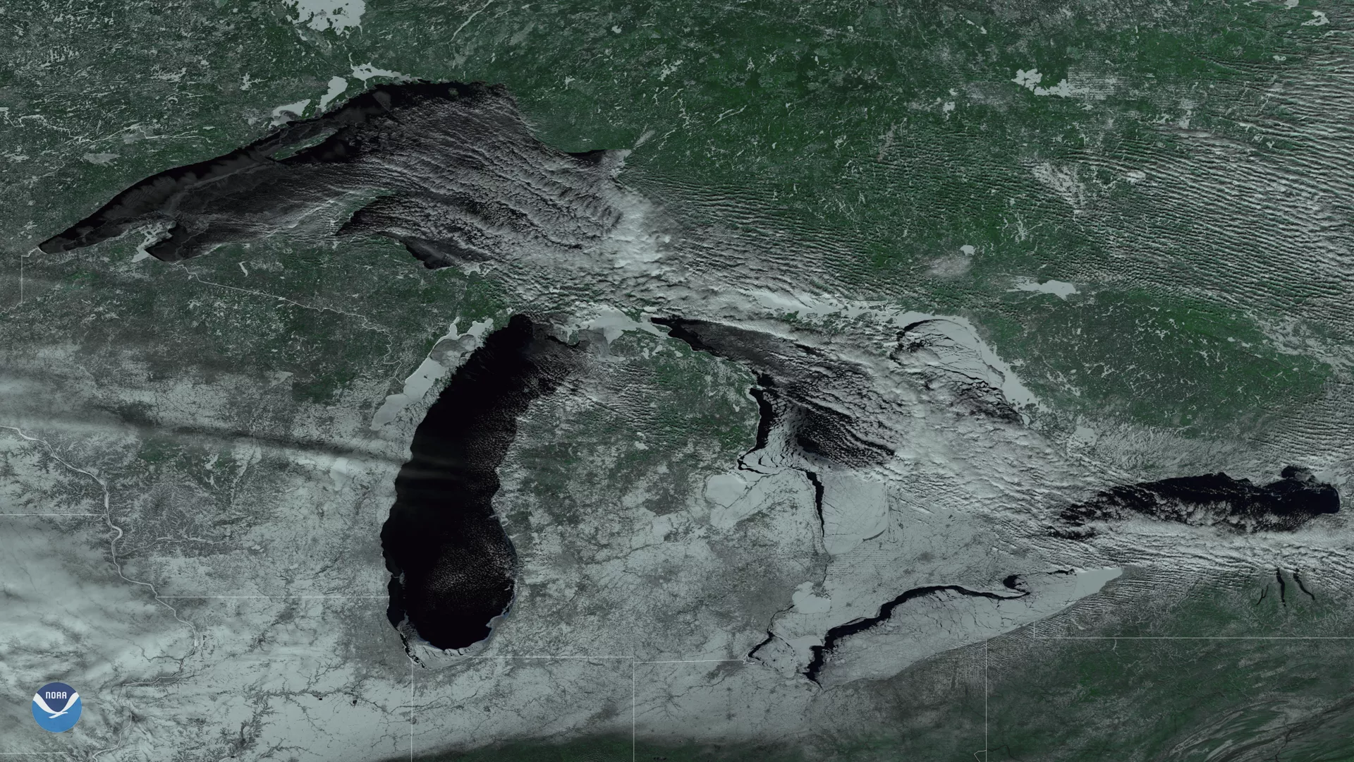
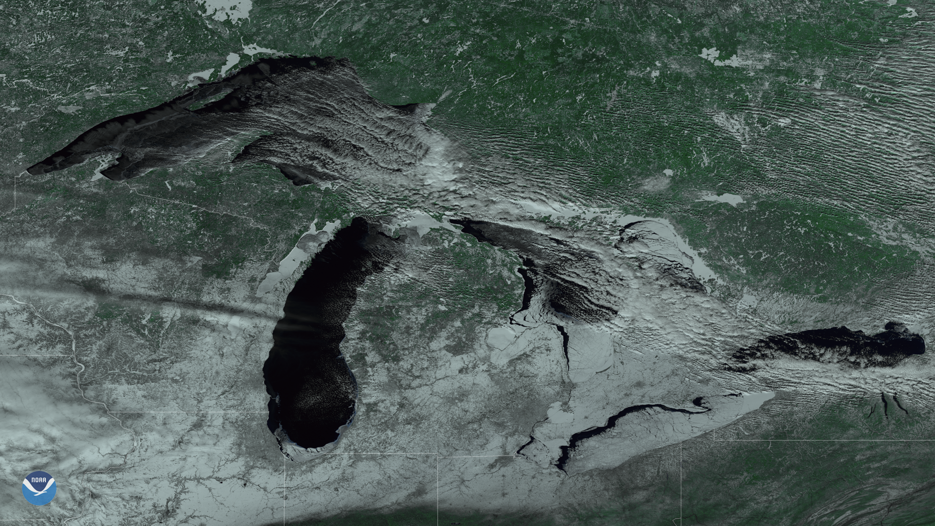
This color-enhanced imagery from the Suomi NPP satellite's VIIRS instrument shows ice cover on the Great Lakes on February 12, 2018. Clear skies, thanks to high pressure over the region, reveal lake ice and snow cover on the ground in remarkable detail. As of February 11, 69.1 percent of the Great Lakes were ice covered, according to data from NOAA's Great Lakes Environmental Research Laboratory. This year's ice cover is the highest since 2015, and is above the long-term average maximum (55 percent) that typically occurs in late February and early March.
As shown in this imagery, Lake Erie has the greatest amount of ice cover (about 92 percent). During cold winters, ice cover on Lake Erie often exceeds 90 percent because it is the shallowest of the five lakes.
This image was created by combining three of the high resolution thermal and visible channels from the Suomi NPP satellite's VIIRS sensor (SVI 4,2,1 RGB). These channels allow us to distinguish different land types and features based on their visual and thermal differences. Lake ice and snow cover on land appear gray-white, while the relatively warm, non-frozen lake water appears nearly black. Color-enhanced images like this one help highlight visual differences in ice thickness, including cracks on the ice surface.