

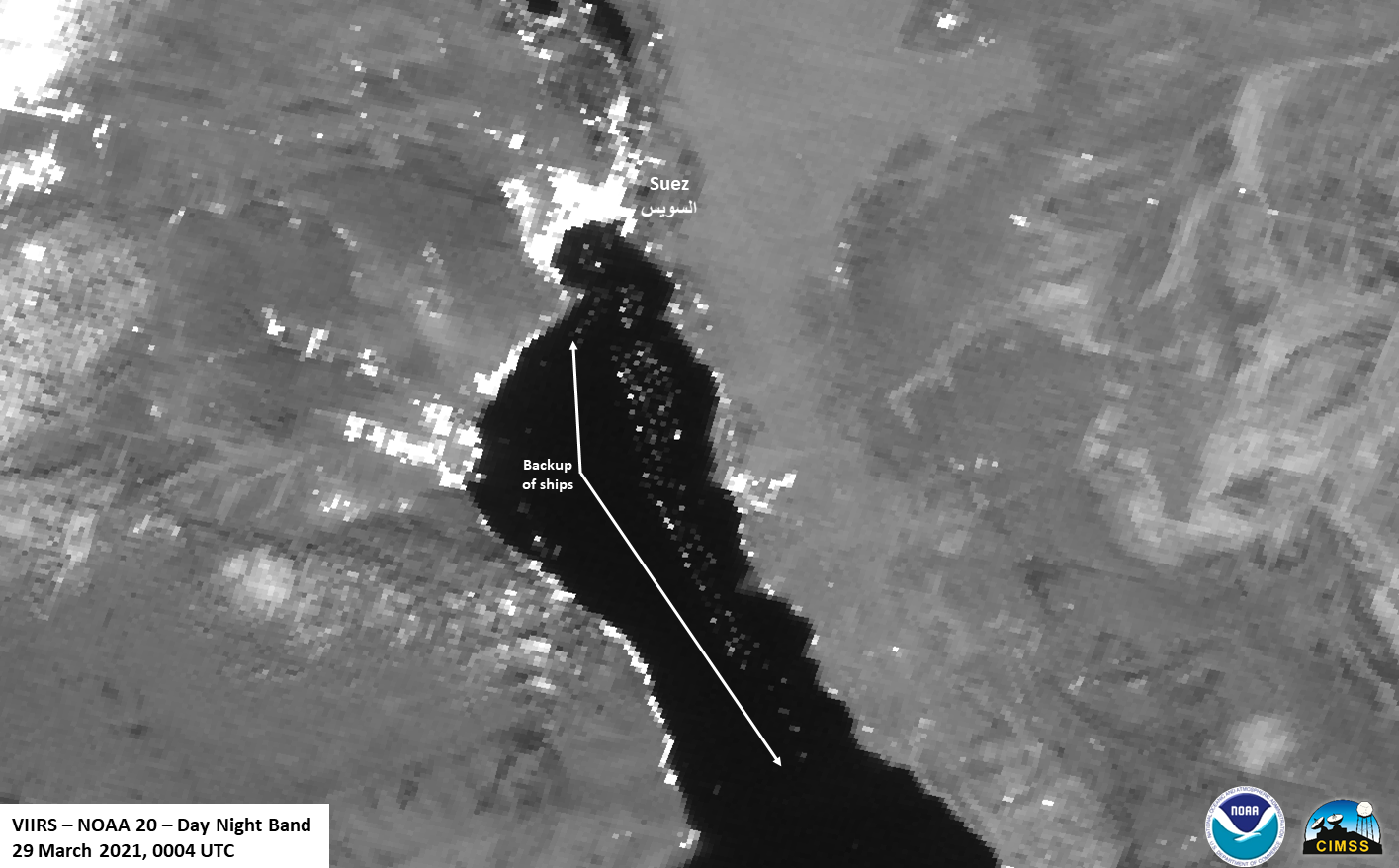
On March 29, the NOAA-20 satellite captured this view of a cargo ship traffic jam in the Red Sea near the entrance of the Suez Canal. The backup of more than 400 ships on either side of this vital waterway was caused by a massive container ship more than 1300 feet long that became wedged sideways and stuck amid high winds and a sandstorm on March 23.
Today, salvage teams were finally able to free the massive vessel during high tide by attaching a fleet of tugboats to the ship’s bow from where it had lodged into the canal’s bank and then turning it free, thus ending a crisis that had halted billions of dollars a day in maritime commerce.
Luckily the ship is intact and has no damage according to the Suez Canal Authority’s chairman Osama Rabie. It also didn’t appear to cause damage to the canal. Although he said shipping will return to normal at 7:00 p.m. local time, it will still take some time to clear the backlog.
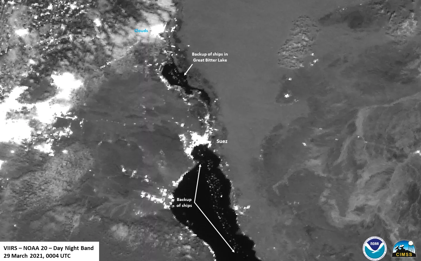
This Day/Night Band imagery was acquired by the NOAA-20 satellite’s Visible Infrared Imaging Radiometer Suite ( VIIRS ) Instrument.
The Joint Polar Satellite System (JPSS) is the Nation’s advanced series of polar-orbiting environmental satellites. JPSS represents significant technological and scientific advancements in observations used for severe weather prediction and environmental monitoring. These data are critical to the timeliness and accuracy of forecasts three to seven days in advance of a severe weather event. JPSS is a collaborative effort between NOAA and NASA.