
This game is similar to the game of Battleship but it uses graphing instead of a grid. The object of the game is to plot a safe flight path, including take off and landing, for your plane. The goal of the game is to introduce young learners to the concept of graphing before they encounter it as part of their curriculum. It is meant to be a new mathematical STEM challenge for them to build on later.
Complete instructions, graphing exercises, and game materials are in the PDF.
Materials
- Pencils
- Folders and something to prop boards on
- Printed game boards (and blank tracking sheets) (in PDF)
- Printed Aviation Trivia Cards (in PDF)
- Coordinate Notes Tracking Sheet (in PDF)
Tips and Tricks
- Use the quick introduction on 'How to Make a Line Graph' (in PDF) to introduce or refresh the idea with your students. This is not a full lesson plan on graphing and is just enough information to get them up to speed for the game.
- Use the 'Check Your Knowledge' (in PDF) section to make sure the students are ready for the game.
- Read the instructions for the game and answer any questions. You can also provide a written reminder of the instructions.
- Play one round with the simplified game boards ('Practice Sheet').
- Play one round with the aviation game boards.
- If time allows, conclude with the space debris game boards.
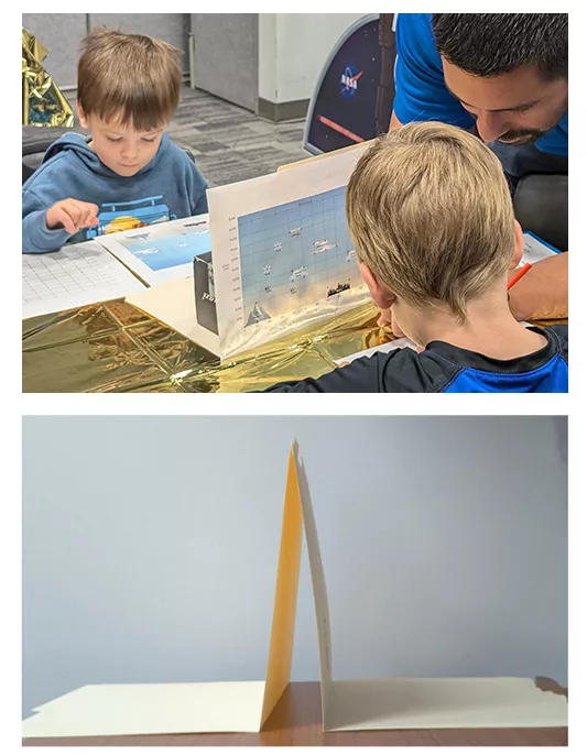
- Tape two folders together to create a barrier so the students won’t be able to see each other’s game boards.
Some Background Information on Aviation and Flight Planning
Pilots are required to create a proposed flight path that shows the route they’d like to take between airports. Pilots will consider many factors when creating their flight plan to make sure that they will have a safe trip. Then they will file their flight plan with Air Traffic Control to make sure that they will be able to avoid other planes and that they will be able to take off and land safely at their chosen airport.
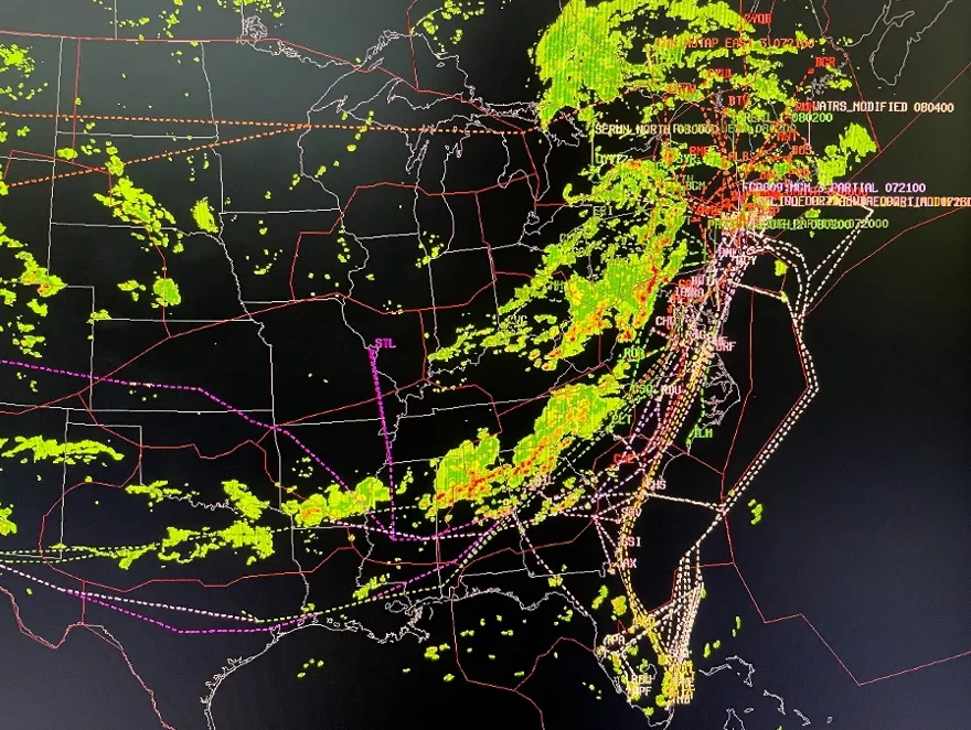
These days pilots use computer software tools to plan their flights. These tools can provide information about the weather forecast and atmospheric conditions while considering the type of aircraft that will be flying.
NOAA’s Joint Polar Satellite System (JPSS) provides data and imagery to scientists, businesses, planners, and government agencies so that they can make maps with helpful information. Instruments on JPSS satellites provide information to help pilots make safe decisions when they are planning their flights. The instruments provide data on weather, clouds, smoke, fog, ice, and turbulence.
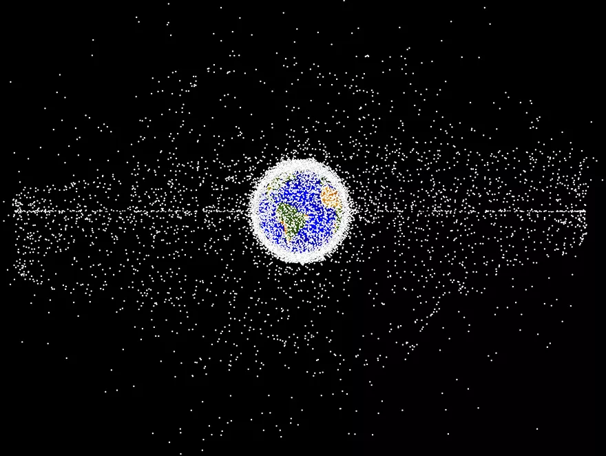
Some Background Information on Space Debris in Low Earth Orbit
Space debris are pieces of launch byproducts, rockets, and decommissioned satellites that continue to orbit around Earth. The amount of space debris has been steadily increasing over the last sixty years of aerospace exploration and some agencies, like NASA, are working to limit the amount of debris by planning ways to reuse satellites or deorbit them. Satellites in Low Earth Orbit, like the JPSS system, have to make small course corrections to avoid debris and other uncrewed spacecraft.
This means that the teams responsible for the operation of the satellite need to maneuver around the obstacles from command stations in the NOAA Satellite Operations Facility located in Maryland.
LeoLabs, a partner of NOAA’s Office of Space Commerce and NASA Goddard Space Flight Center’s Scientific Visualization Studio has a website where you can see debris and spacecraft that are currently in low earth orbit: https://platform.leolabs.space/visualization
Game Rules
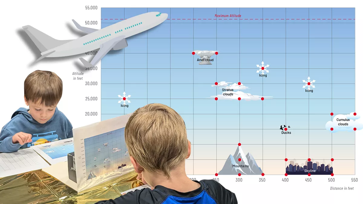
- Start by sitting across from your partner. This game is similar to the game of Battleship but it uses graphing instead of a grid. The object of the game is to plot a safe flight path on your blank graph, including take off and landing, for your plane. Your partner will have a board that shows any hazards that might be in your path.
- Use a folder to prop the game board up so that it is hidden from your partner.
- Your plane can take off from anywhere on the board and land anywhere on the board as long as it does not run into any obstacles.
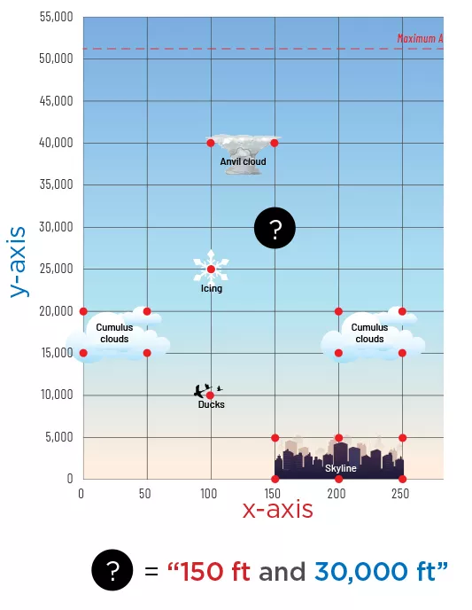
- Use the red guide dots to judge the locations of the hazards, not the shape of the graphic.
- One player will make a guess about a safe point to plot anywhere on the board and say it out loud listing the x-axis first and the y-axis second. (Ex: 150 ft and 30,000 ft) The second player will check their graph to see if any obstacles are present at that location. If they don’t see anything there they will say, “All clear.” If they do see an obstacle, they will tell the other player what is there. (Example: “Please be aware that a mountain is in your flight path.”) They do not have to tell them how large the hazard is.
- Both players will take turns guessing until one of them thinks they have plotted a safe flight path. When this happens they will say, “Tower, are we cleared for takeoff?” They will give their graph to the other player who will check to make sure the path is safe and does not cross any of the red guide dots.
If the path is clear from takeoff to landing they win the game. Say, “You are cleared for takeoff.”
If the flight path is not safe, because the player has routed the flight plan through some hidden obstacles, the graph is returned and they will take a penalty and miss three turns. Say, “You are not cleared for takeoff.”
- On their next turn after attempting to declare a flight path a player can choose to use that turn to answer a trivia question in order to earn the opportunity to ask for the coordinates of one obstacle. In order to get the coordinates they will need to answer a question on one of the Aviation Trivia cards correctly. These questions are meant to be tough, and may not be something you’ve learned before, so take your best guess!
Fold over to hide answer when showing partner.