
Search
Showing 1 - 8 of 24 results
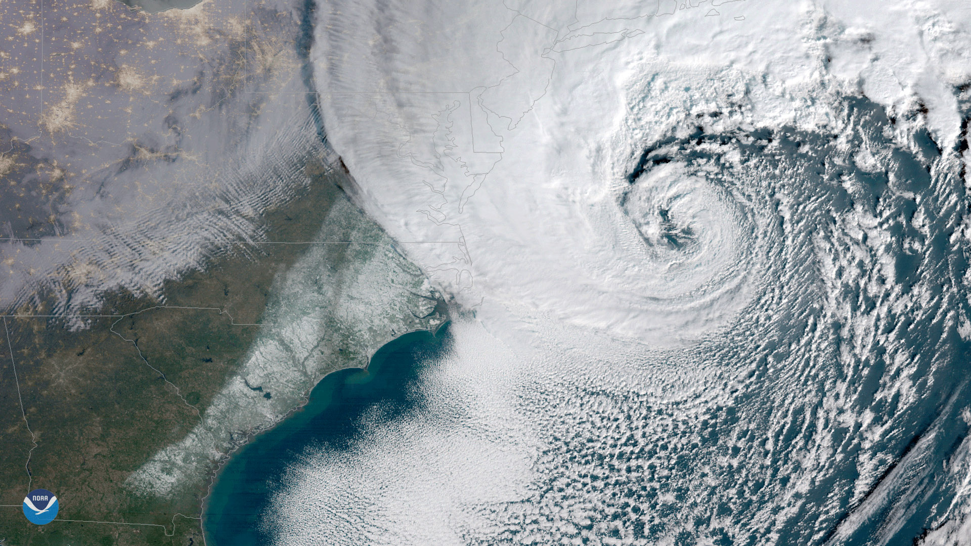
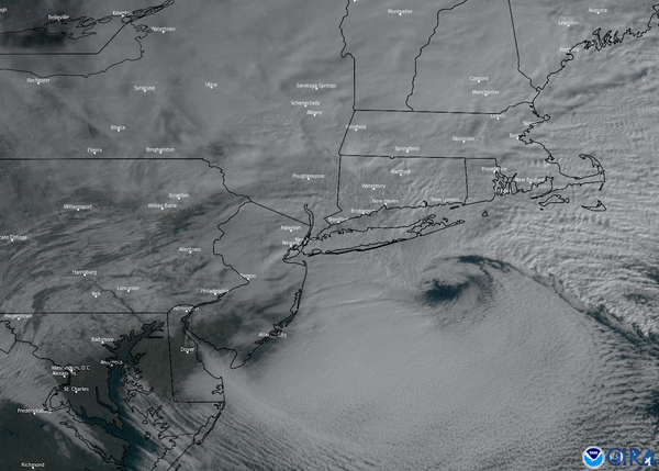
The NOAA-20 satellite captured this imagery of a nor’easter off the mid-Atlantic coast and a low-pressure system off of…
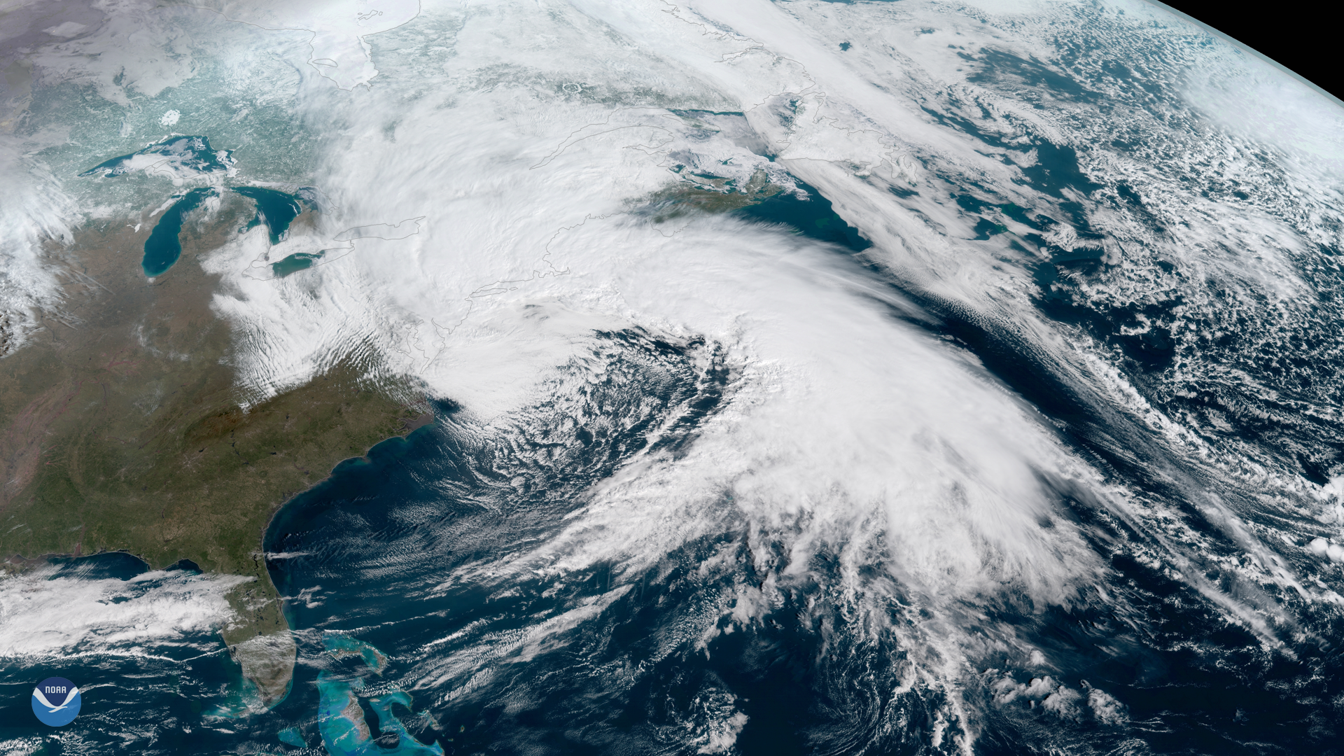
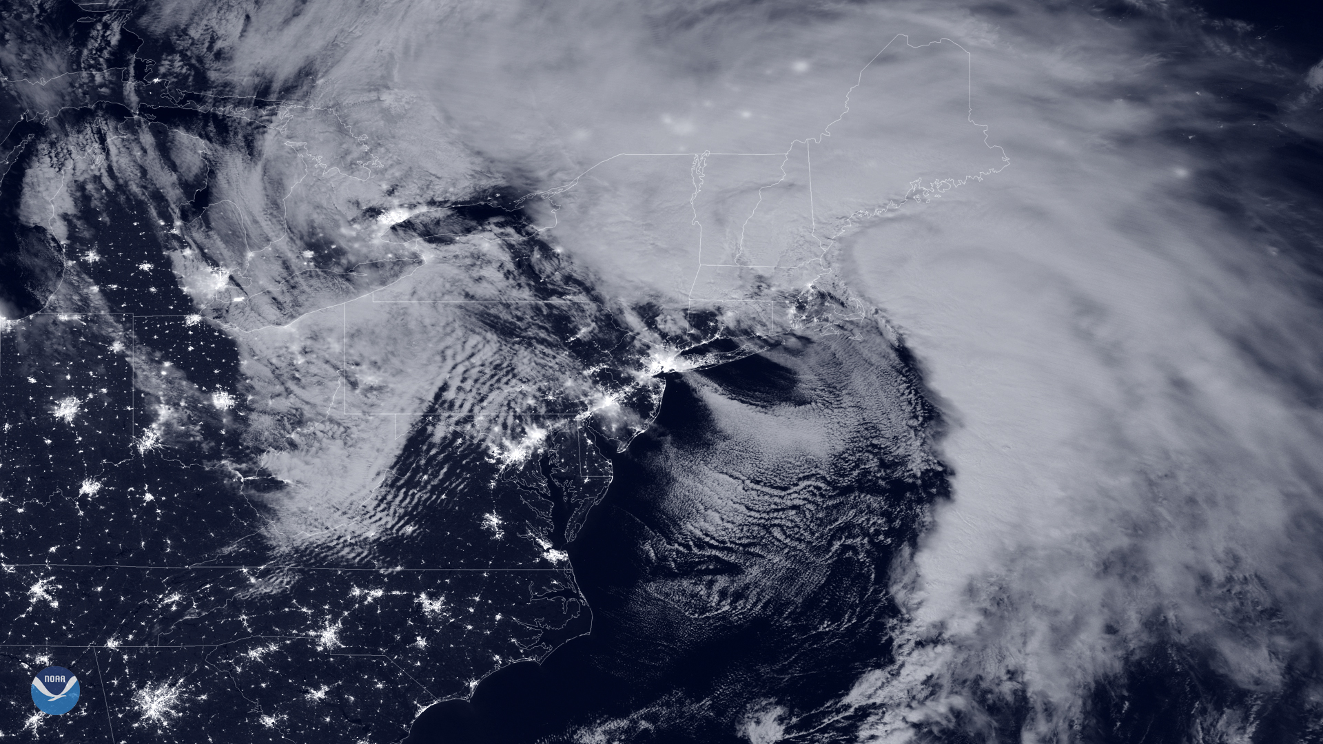
NOAA's GOES East satellite captured this geocolor enhanced image of a powerful nor'easter moving up the U.S.…
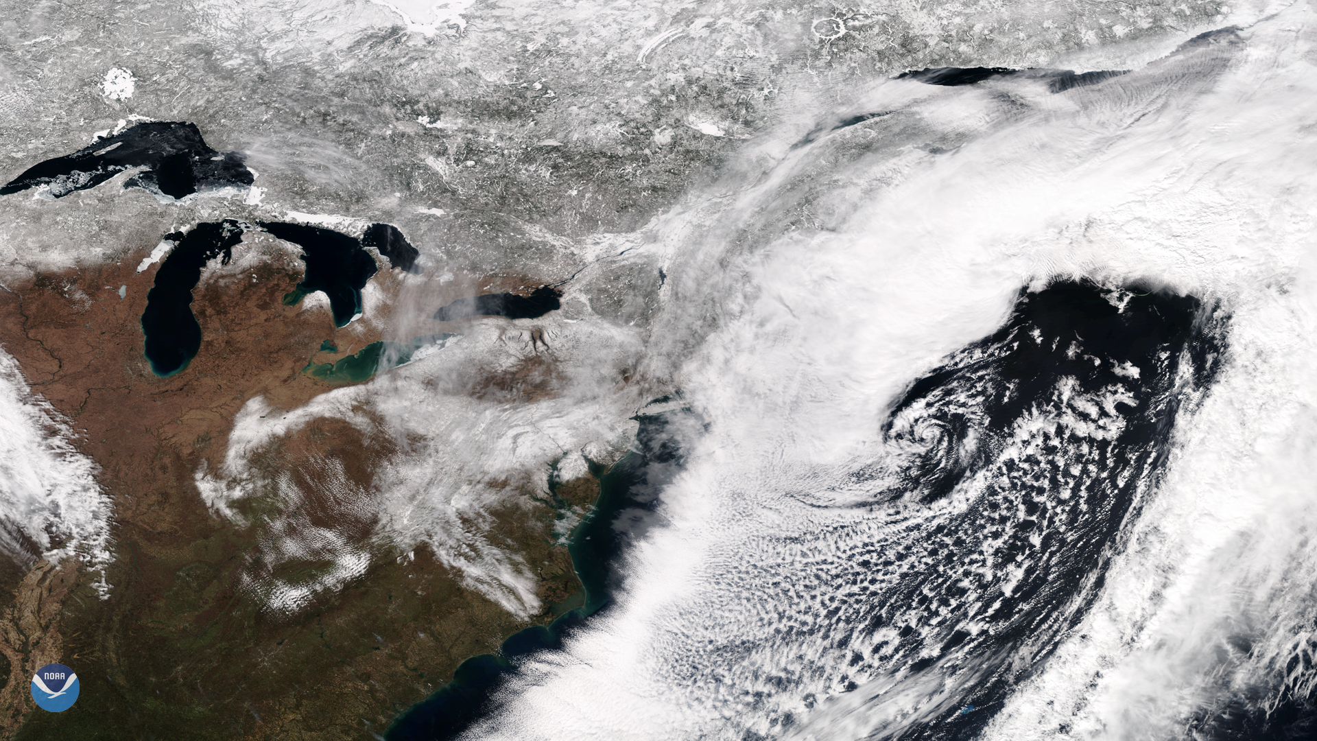
NOAA's GOES East satellite captured this dramatic image of last week's powerful nor'easter that brought gale-…
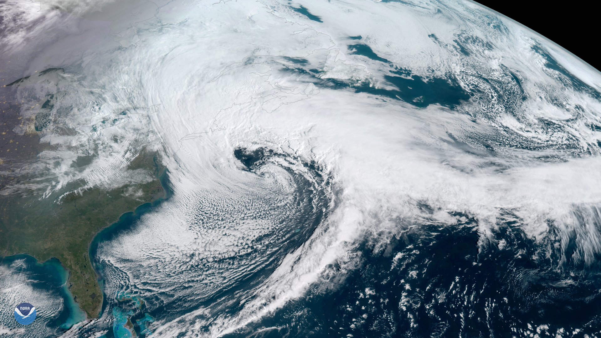
he Suomi NPP satellite's VIIRS instrument captured this week's nor'easter moving away from the U.S. East…
NOAA's GOES East satellite (GOES-16) captured the Nor'easter storm over the East Coast this morning (13:15 UTC).…
This nor-easter started to develop Wednesday morning, Dec. 16, where snow, ice, and rain stretched from the Southeast up…
A dangerous nor’easter parked over New England delivered a powerful punch to the region this week. A nor’easter is…
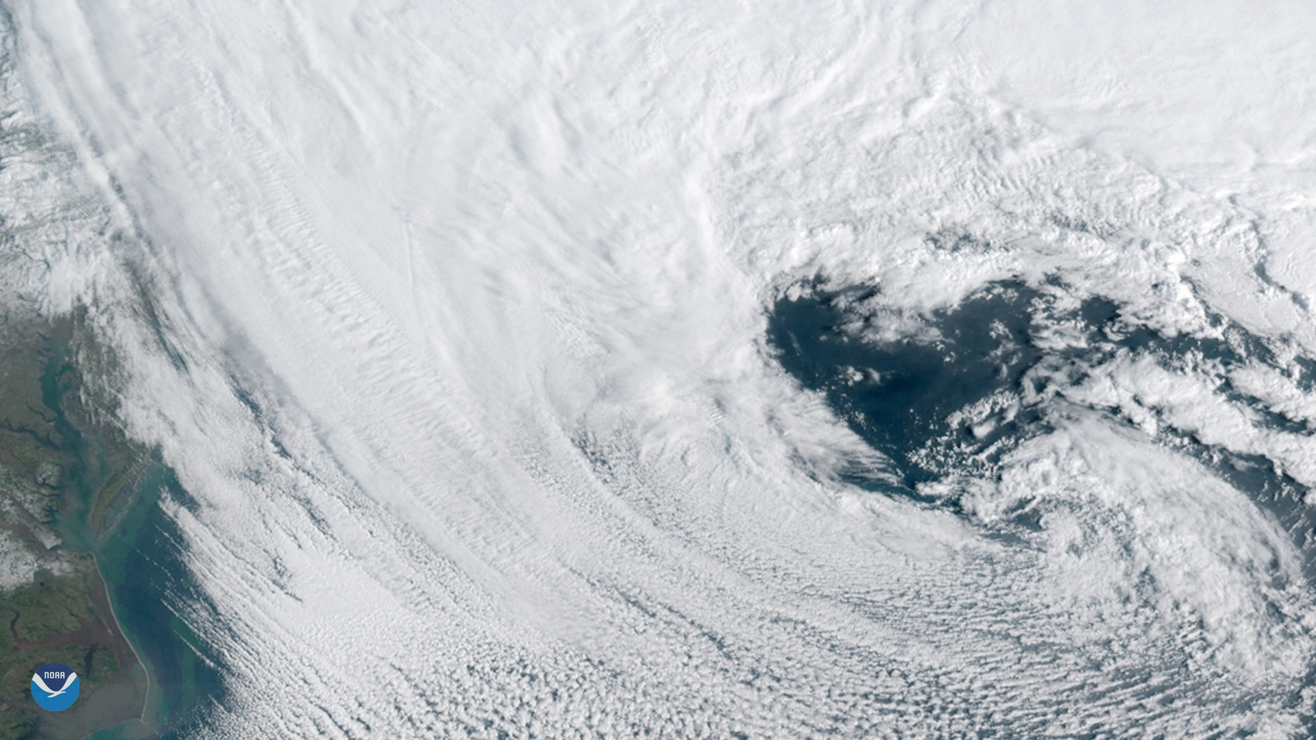
GOES East spied this heart-shaped cloud pattern within a powerful nor'easter that barreled up the U.S. East Coast on…