
Search
Showing 585 - 592 of 628 results
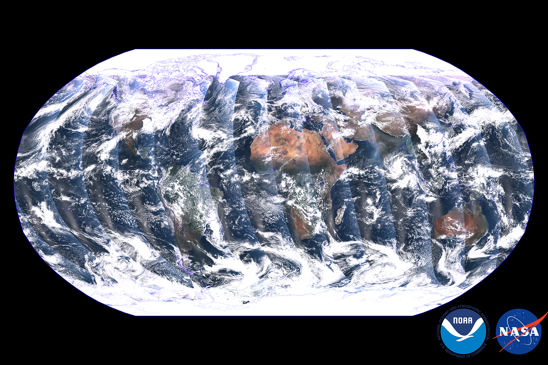
The Visible Infrared Imaging Radiometer Suite (VIIRS) instrument on NOAA-21 began collecting Earth science data on December…
Unusually hot days are becoming much more common. Prolonged periods of these unusually hot days - known as heat waves - are…
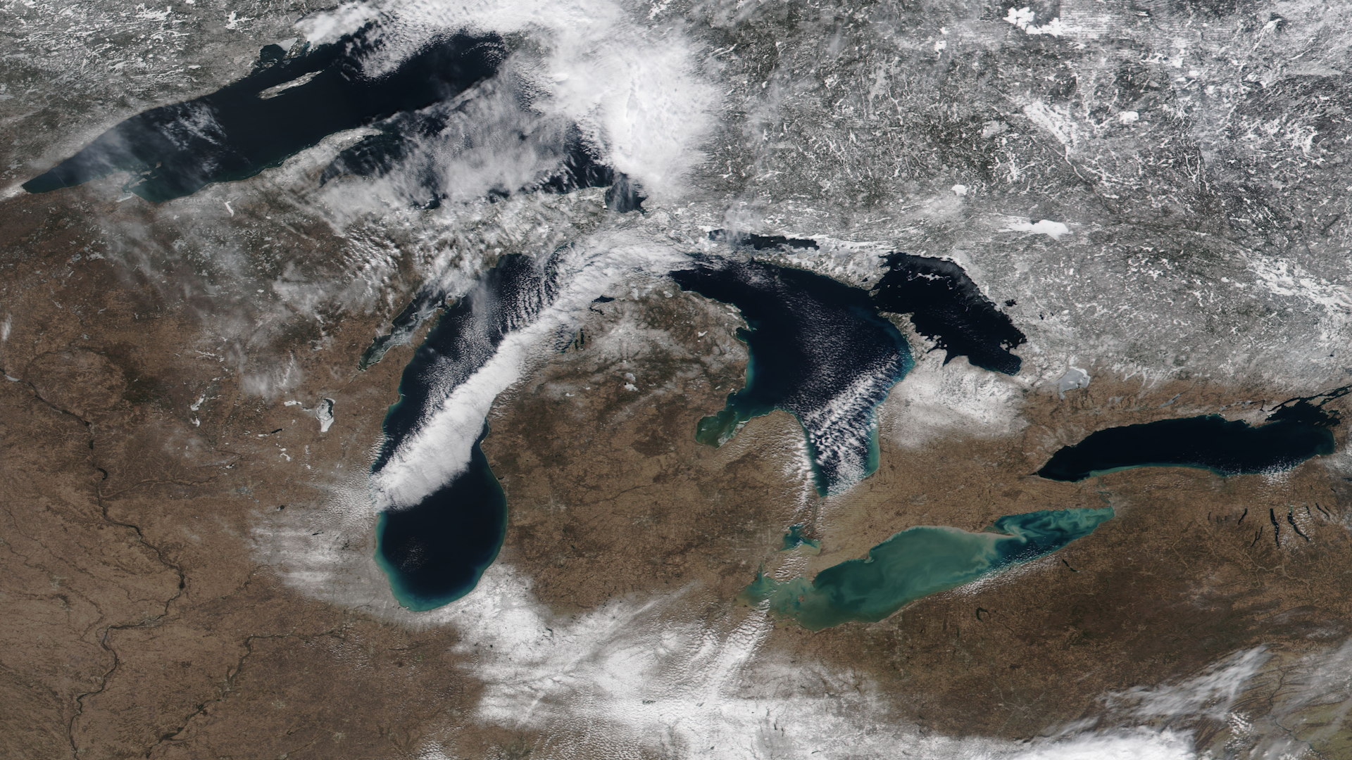
For the second consecutive year, ice cover on the Great Lakes remains significantly below average for this time of year,…
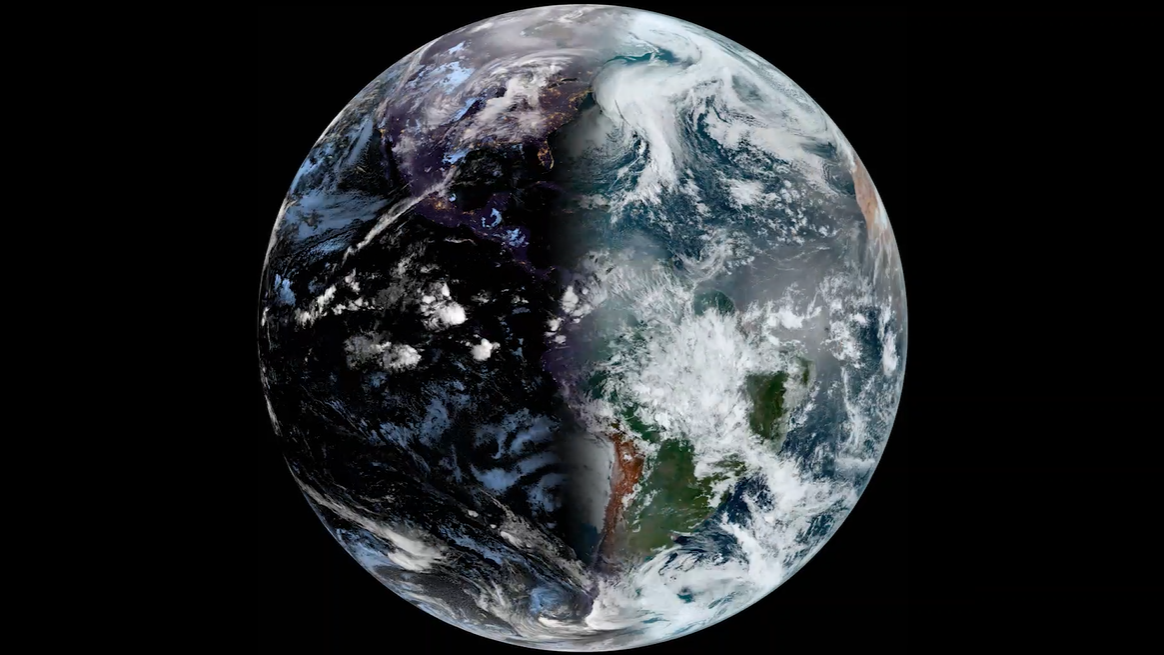
NOAA satellites watched spring arrive in the Northern Hemisphere on March 20, 2025.
General overview of GOES-18's satellite mission as well as instruments, benefits, and more.

NOAA began monitoring sea level more than 20 years ago, with the TOPEX/Poseidon satellite in 1992. NOAA launched its newest…

LEO satellites track storms, winds, and sea ice, helping the National Weather Service Ocean Prediction Center issue warnings…
An effort to improve NOAA services through optimizing the use of satellite data along with other sources of data and…