
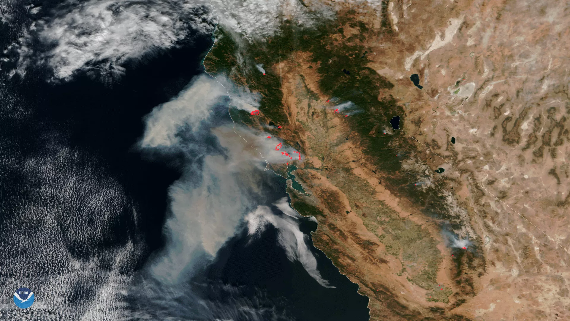
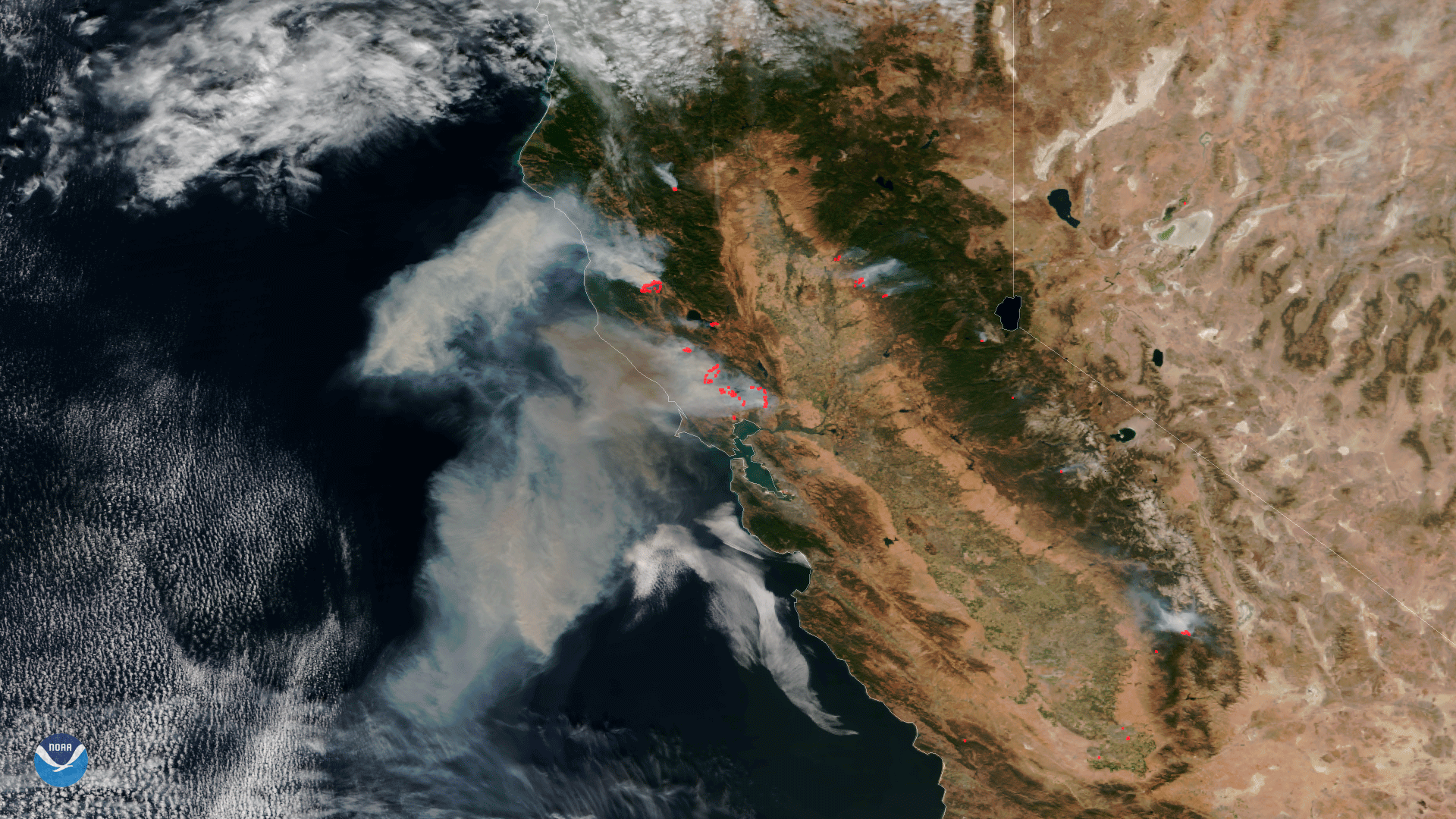
Data from the VIIRS instrument aboard NOAA/NASA Suomi NPP satellite from October 9, 2017 shows the extent of the fires burning in California. This image combines the satellite's true color imagery along with thermal imagery (in red) that indicates the hot spots associated with the active fires. According to information shared at 1:00PM EDT Oct. 10th from the Department of Forestry and Fire Protection, 17 large wildfires that started in the past 36 hours continue to burn across California and have burned over 115,000 acres.