
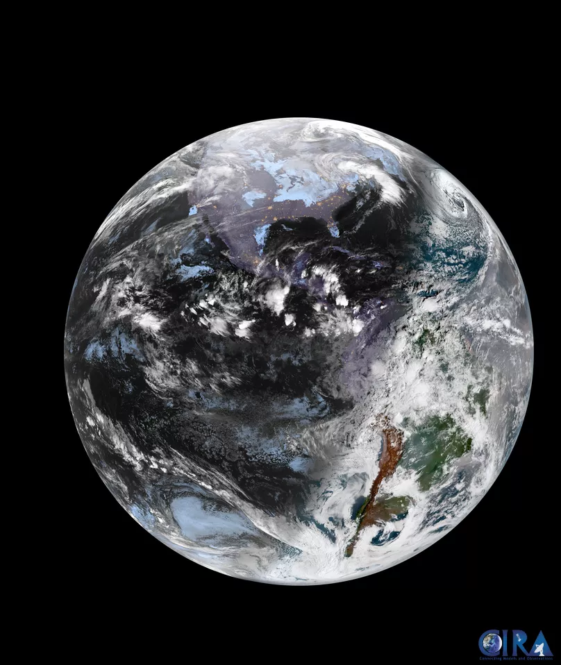
As the entire world transitioned into 2025, NOAA’s GOES-19 satellite captured this awe-inspiring full-disk image of Earth at 11:20 UTC on January 1, 2025. This view captures earth after our planet and all its timezones have entered the new year. Imagery from GOES-19 during the post-launch testing phase should be considered preliminary and non-operational.
From all of us celebrating on Earth—and NOAA's satellites in orbit—here’s to a new year of innovation, collaboration, and discovery! As the clock struck midnight across time zones worldwide, NOAA's National Environmental Satellite, Data, and Information Service (NESDIS) captured breathtaking views of Earth’s dynamic weather patterns, with the glow of city lights below.
These images, taken moments after midnight in each local time zone (and labeled in Coordinated Universal Time, or UTC), provide a unique perspective of our planet’s ever-changing face as we transitioned from 2024 to 2025.
Earth never looks the same twice. From swirling clouds to sparkling coastlines, each moment showcases a snapshot of nature’s artistry and complexity as the Earth orbits the sun and the seasons change—a reminder of NOAA’s critical mission to monitor and understand the world’s everchanging systems.
The following series of images illustrates how NOAA satellites and others operated by international partners serve as our eyes in the sky, monitoring everything from seasonal shifts to extreme weather—helping communities around the world stay safe, informed, and resilient.
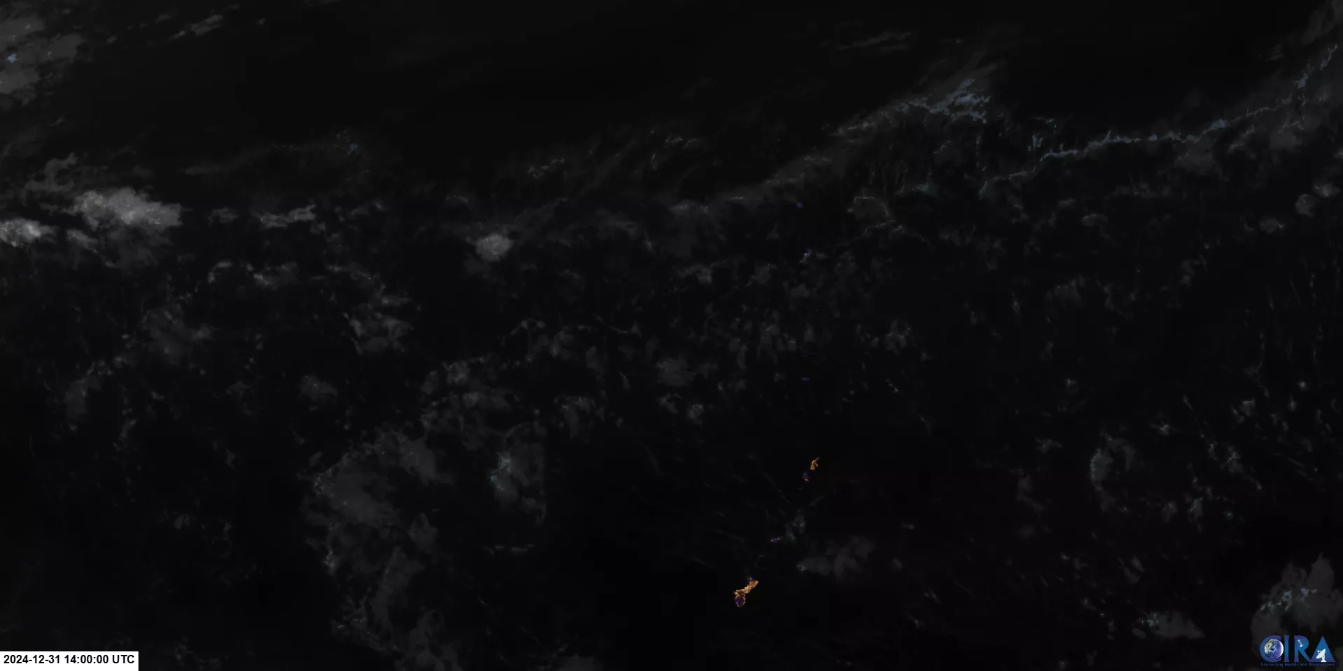
Chamorro Time Zone (Guam and the Northern Mariana Islands)
Satellite: Himawari-9
Product: GeoColor (CIRA)
Date: Dec. 31, 2024 (14:00 UTC)
This image, captured by Japan’s Himawari-9 satellite just after midnight (local time), shows Guam and the Northern Mariana Islands glowing against the vast Pacific Ocean. Operated by the Japan Meteorological Agency, Himawari-9 plays a critical role in weather and environmental monitoring across the Asia-Pacific region and partners with NOAA to ensure continuous global coverage.
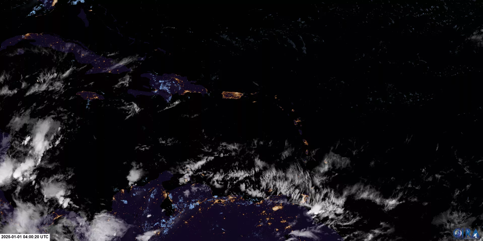
Atlantic Standard Time Zone (Puerto Rico and the U.S. Virgin Islands)
Satellite: GOES-16
Product: GeoColor (CIRA)
Date: Jan. 1, 2025 (04:00:20 UTC)
This view of the Caribbean was captured shortly after midnight, local time, by NOAA’s GOES-16 satellite, also known as GOES East. With its advanced imaging capabilities, GOES East plays a vital role in monitoring weather patterns, supporting disaster response, and improving forecasting throughout the Western Hemisphere.
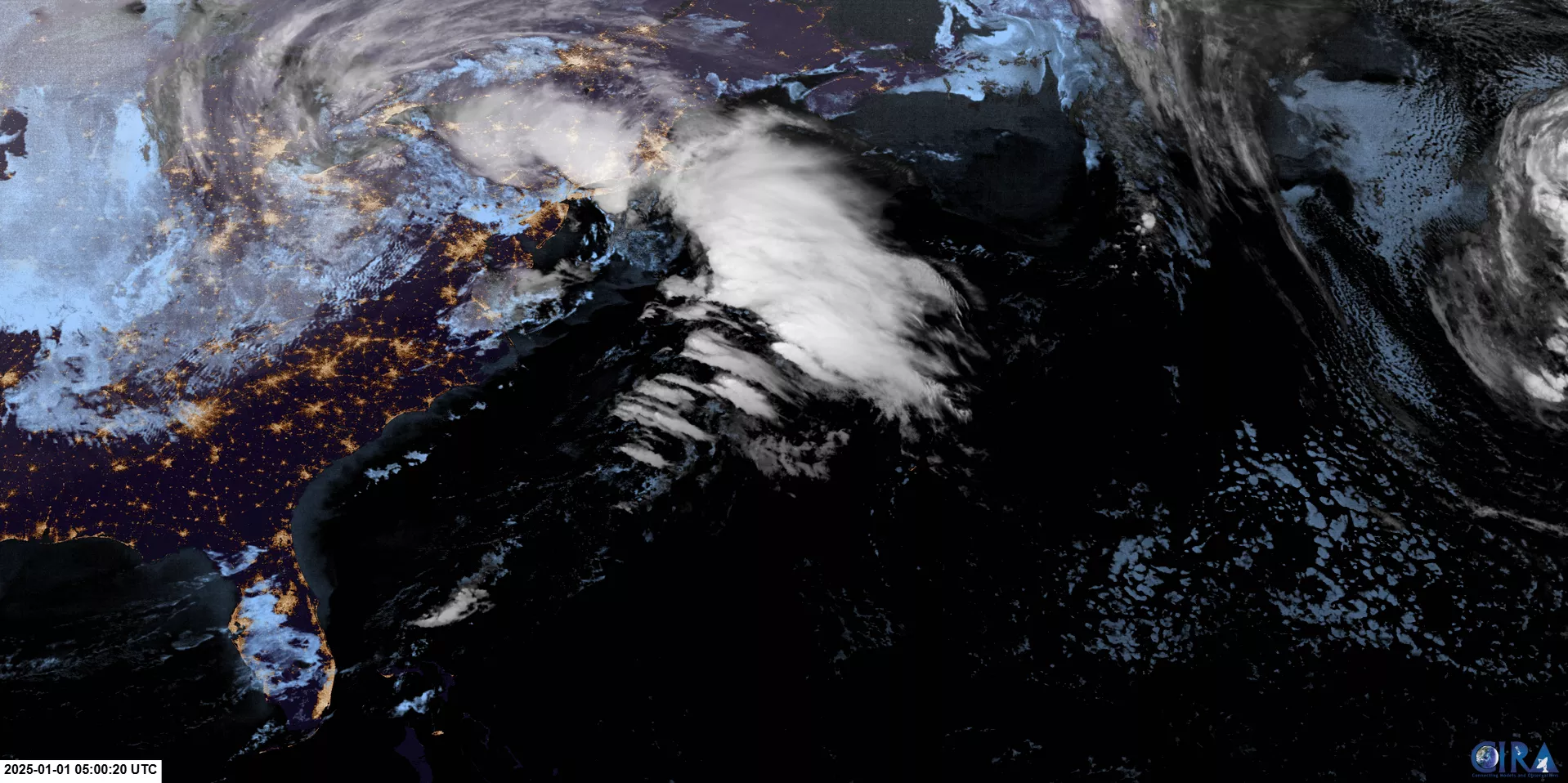
Eastern Time Zone (Eastern U.S.)
Satellite: GOES-16
Product: GeoColor (CIRA)
Date: Jan. 1, 2025 (05:00:20 UTC)
NOAA’s GOES-16 satellite welcomed 2025 with this stunning image of the eastern United States. As GOES East, it provides continuous monitoring of atmospheric conditions, helping track severe storms and seasonal transitions throughout the year.
Central Time Zone (Central U.S.)
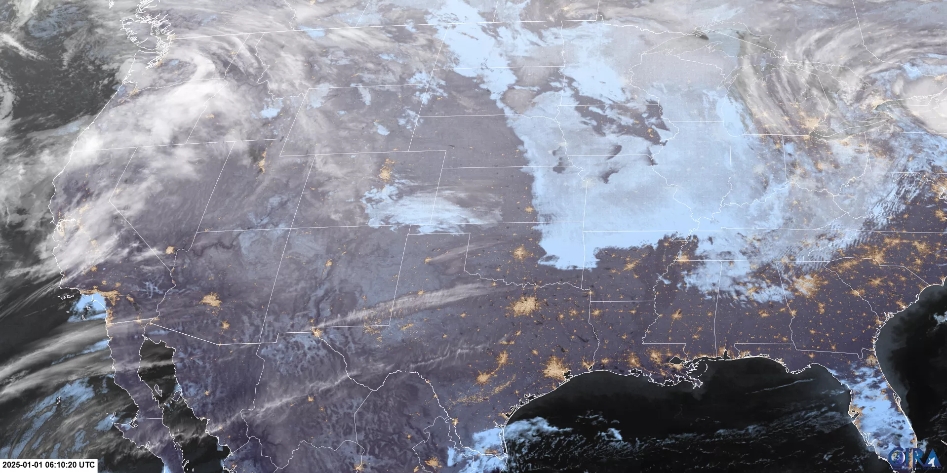
Imagery from GOES-19 during the post-launch testing phase should be considered preliminary and non-operational.
Satellite: GOES-19
Product: GeoColor (CIRA)
Date: Jan. 1, 2025 (06:10 UTC)
This image of the Central United States was captured by NOAA’s newest satellite, GOES-19, which launched on June 25, 2024, and is currently undergoing post-launch testing. In March, GOES-19 will move to its operational location at 75.2° west longitude, where it will officially assume the title and role of GOES East in April, replacing GOES-16. Imagery from GOES-19 during the post-launch testing phase should be considered preliminary and non-operational.
GOES-19 is also equipped with NOAA’s first coronagraph, the Compact Coronagraph-1 (CCOR-1), designed to observe the outer atmosphere of the sun, called the corona. This capability enables GOES-19 to monitor space weather events that could disrupt power grids, communication networks, navigation systems, and more.
Mountain Time Zone (Mountain U.S.)
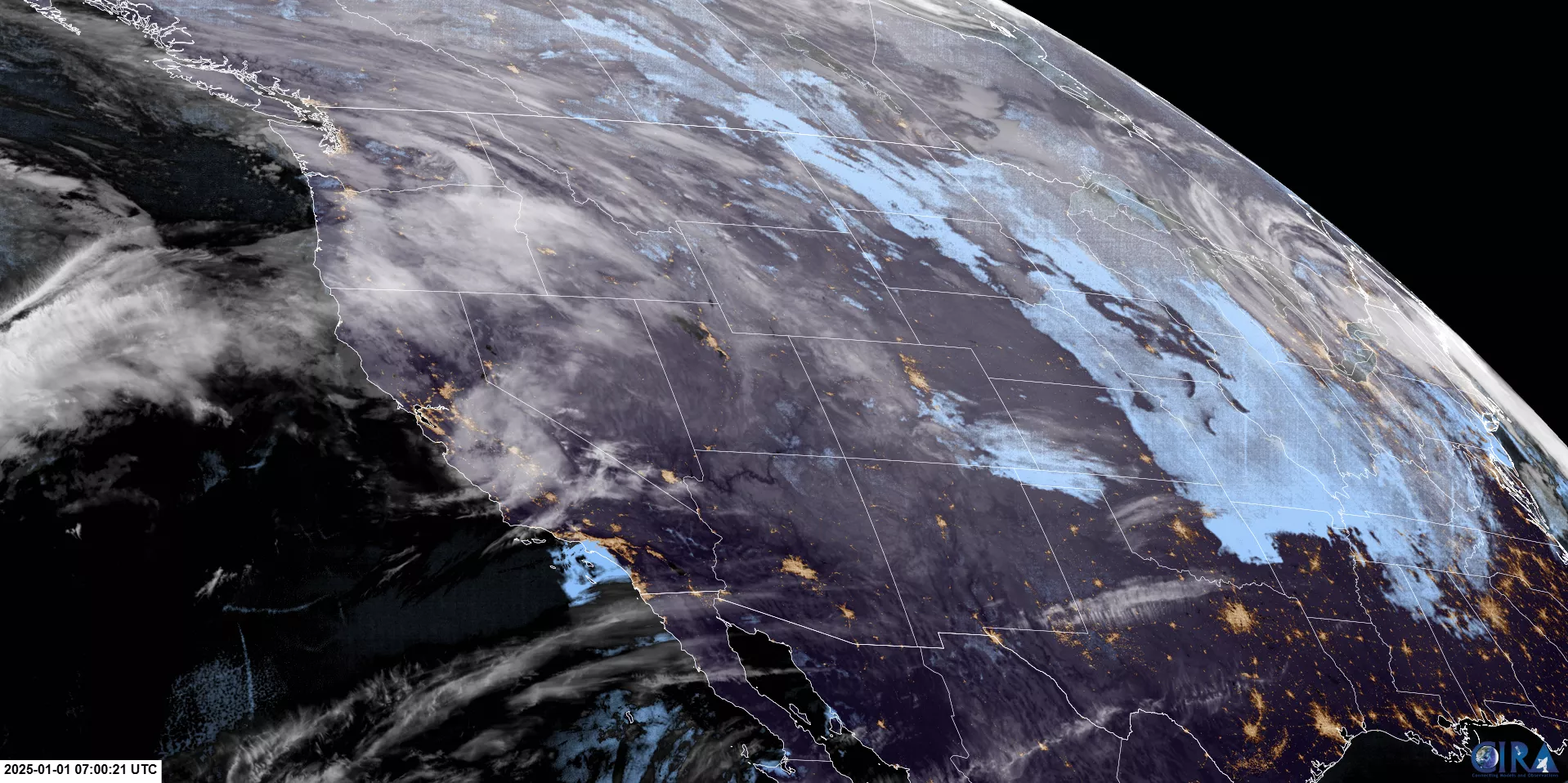
Satellite: GOES-18
Product: GeoColor (CIRA)
Date: Jan. 1, 2025 (07:00:21 UTC)
NOAA’s GOES-18 satellite, also known as GOES West, captured this image centering on the Mountain Time Zone just after midnight. GOES-18 monitors critical weather systems, including storms and wildfires, providing vital data for forecasting and disaster preparedness throughout the United States, the Pacific Ocean, Alaska and Hawaii.
Pacific Time Zone (U.S. West Coast)
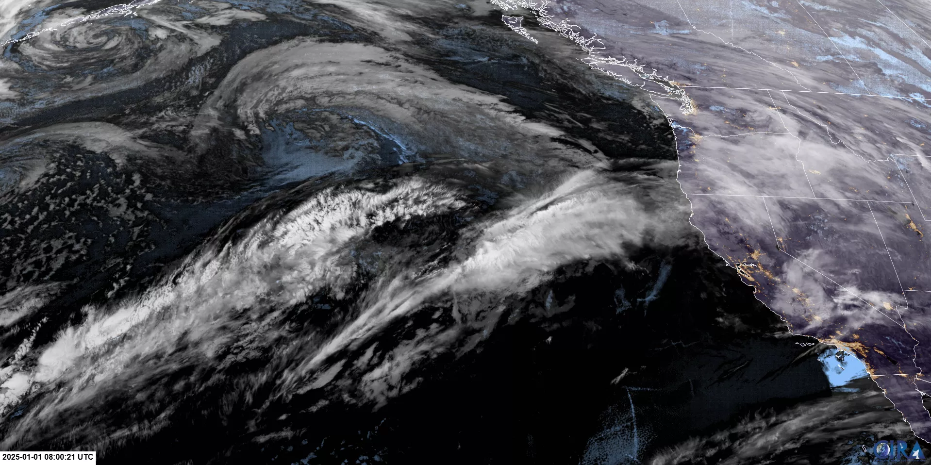
Satellite: GOES-18
Product: GeoColor (CIRA)
Date: Jan. 1, 2025 (08:00:21 UTC)
As the West Coast rang in 2025, NOAA’s GOES-18 satellite captured this view of the Pacific coastline. GOES-18 plays a crucial role in detecting heavy rainfall, monitoring wildfires, and tracking other environmental factors across the Pacific region.
Wishing Alaska a very Happy New Year
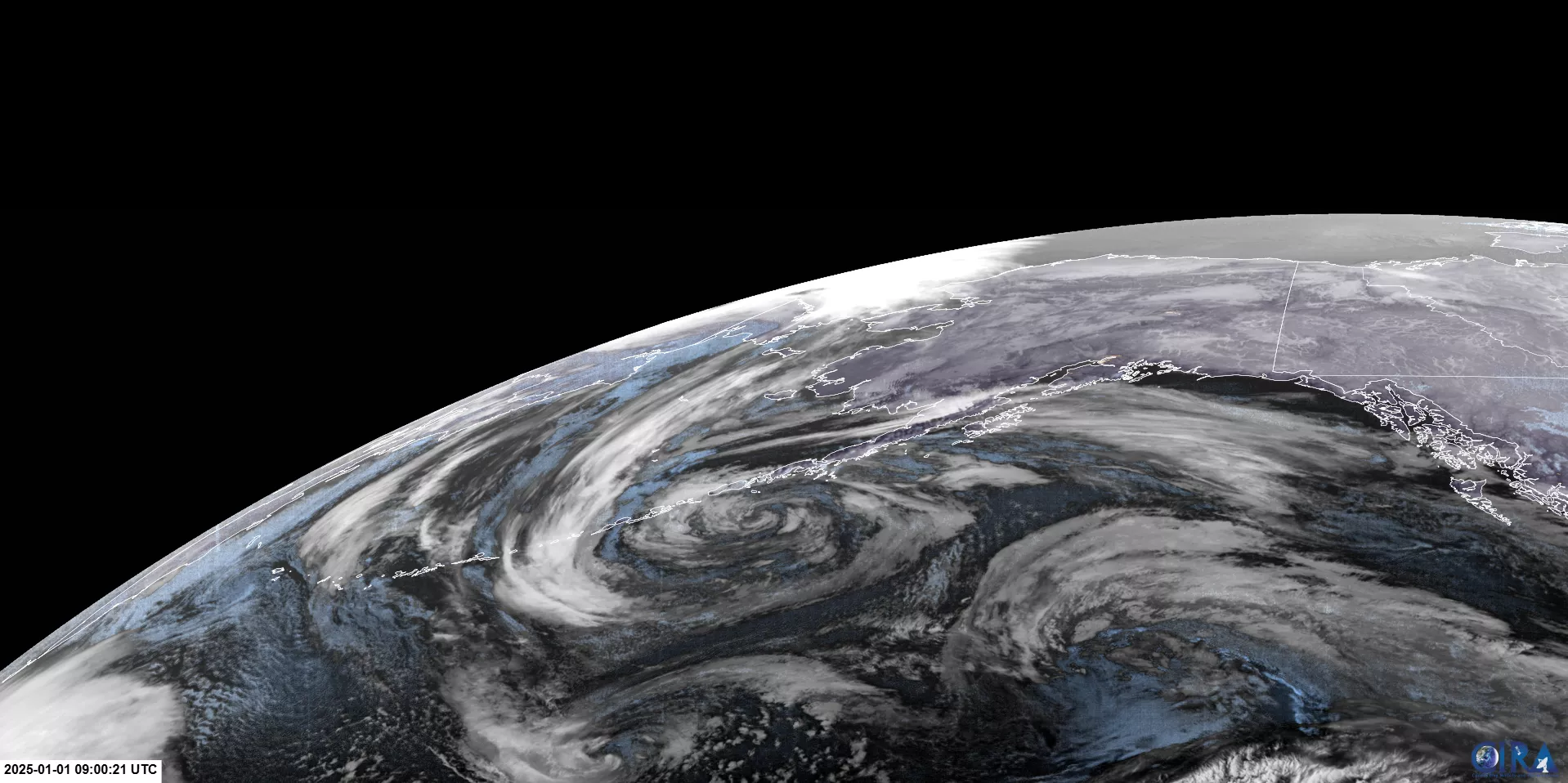
Satellite: GOES-18
Product: GeoColor (CIRA)
Date: Jan. 1, 2025 (09:00 UTC)
This stunning image of Alaska was captured by NOAA’s GOES-18 satellite just after midnight. GOES West provides advanced monitoring of atmospheric conditions and space weather, supporting aviation and environmental safety across the region.
Hawaii Standard Time Zone (Hawaii)
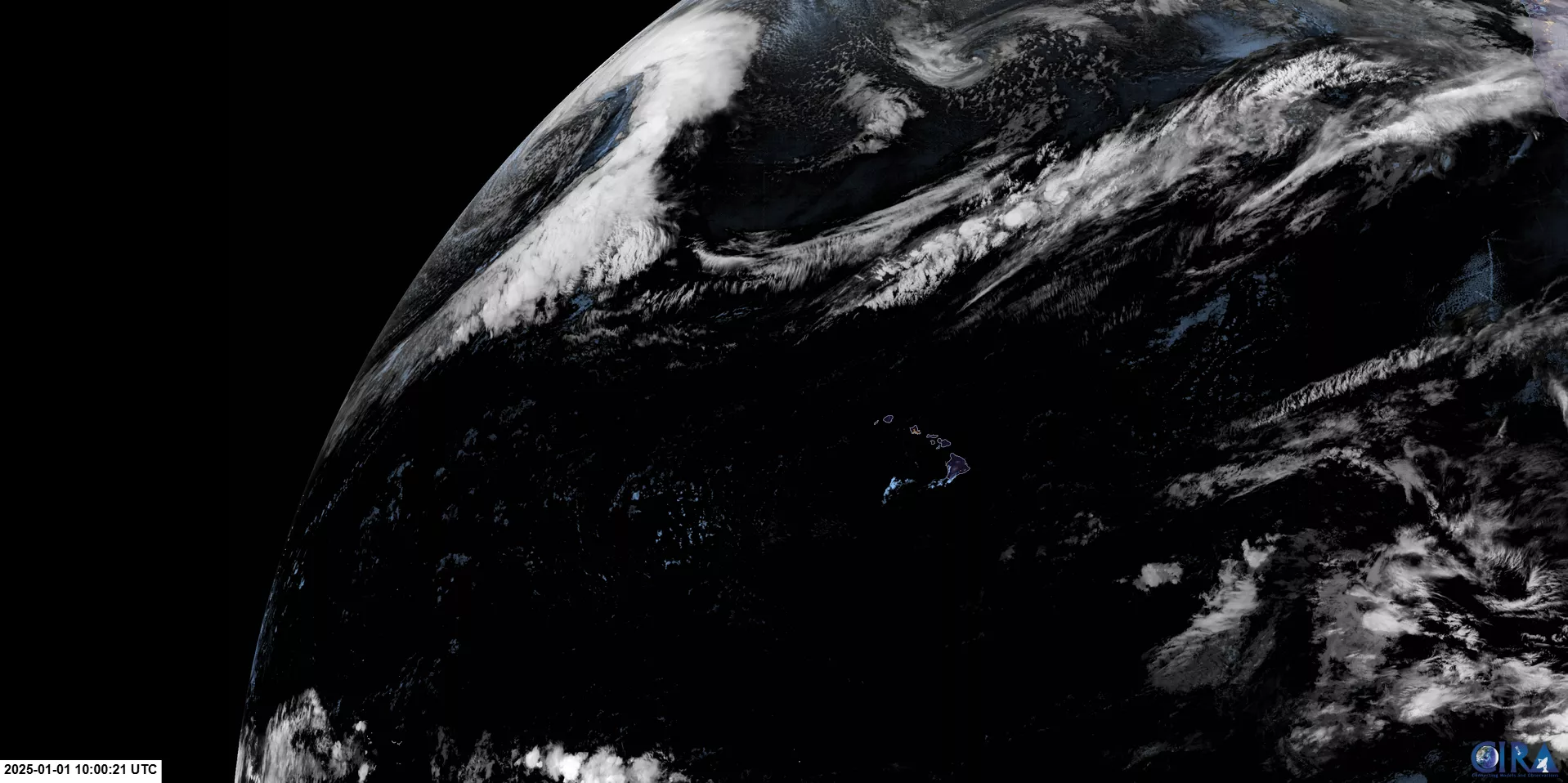
Satellite: GOES-18
Product: GeoColor (CIRA)
Date: Jan. 1, 2025 (10:00 UTC)
NOAA’s GOES-18 satellite offers this beautiful nighttime view of Hawaii and the Pacific Ocean at the stroke of midnight. From tracking tropical storms to monitoring volcanic activity, GOES-18 ensures the safety and preparedness of communities across the Pacific.
Happy New Year to all in American Samoa
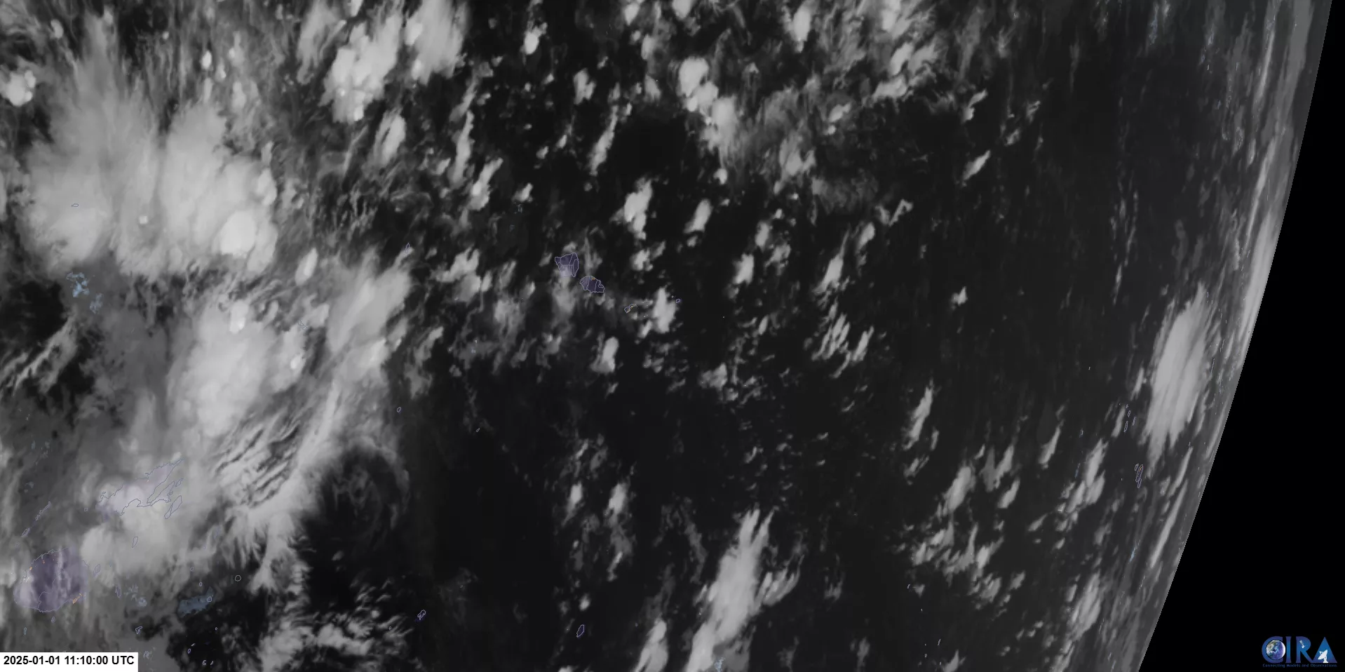
Satellite: Himawari-9
Product: GeoColor (CIRA)
Date: Jan. 1, 2025 (11:10 UTC)
Captured just after midnight, local time, this image of American Samoa was taken by Japan’s Himawari-9 satellite, one of NOAA’s international partners. Himawari-9 provides continuous monitoring of weather and environmental changes, ensuring uninterrupted coverage across the Pacific region.