
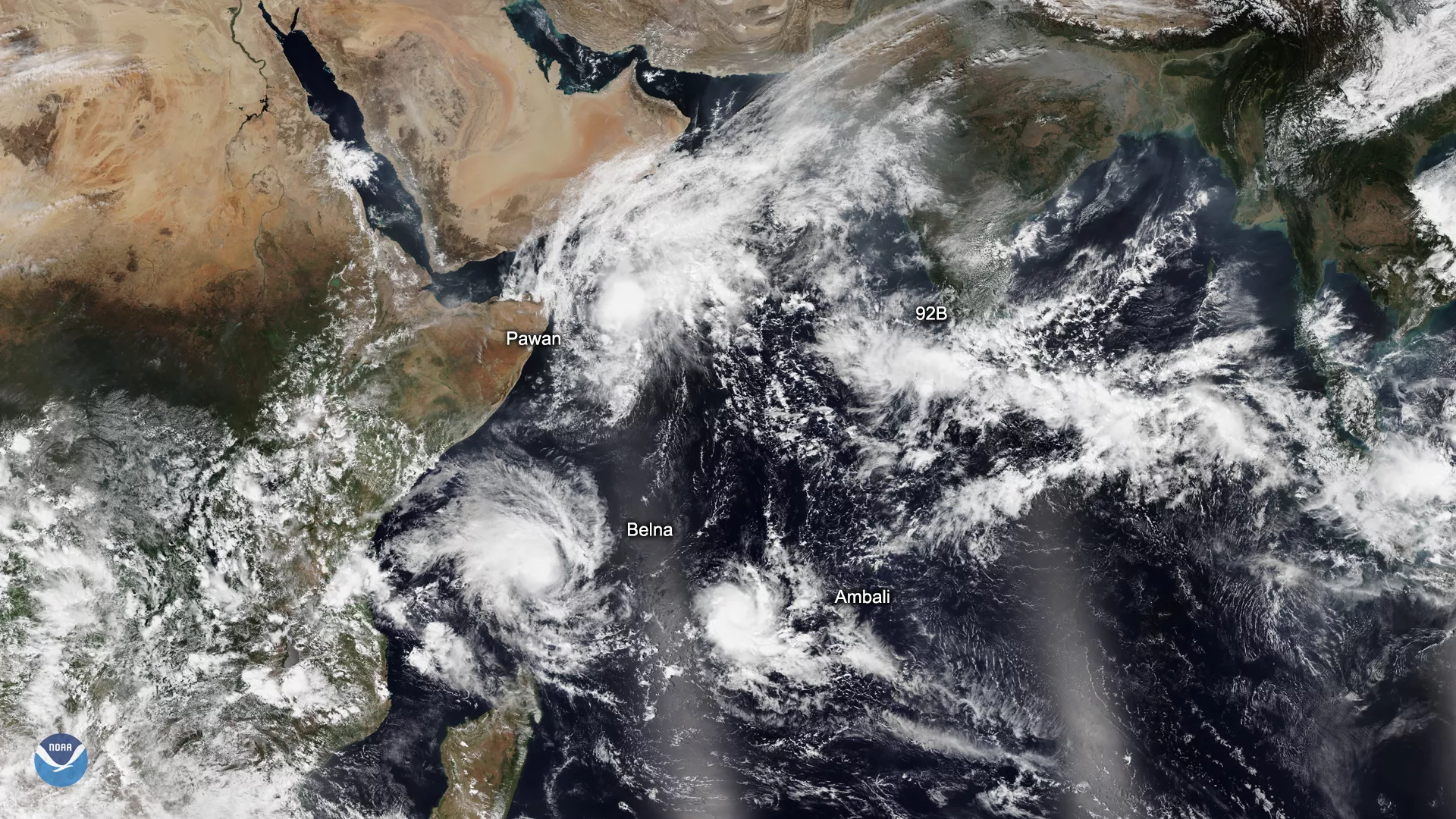
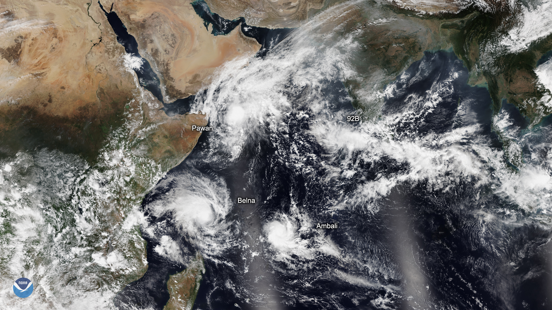
On Dec. 5, 2019, the NOAA-20 satellite captured this image of three tropical cyclones churning over the Indian Ocean, along with remnants of a fourth off the coast of Gujarat in western India and a developing system, 92B, off the southern tip of the country.
According to Colorado State University hurricane expert Philip Klotzbach, the southernmost storm, Tropical Cyclone Ambali, intensified by 115 mph in the past 24 hours from a tropical depression to a major tropical cyclone. This is the most rapid intensification on record by a storm in the Southern Hemisphere since 1980. The old record in the region was set by Severe Tropical Cyclone Ernie in 2017, which intensified by 110 mph in 24 hours, south of Indonesia. Ambali is currently the equivalent of a Category 3 hurricane on the Saffir-Simpson Hurricane Wind Scale , but is not expected to threaten land before dissipating.
Klotzbach also explained that the only named storm in the Northern Hemisphere to intensify more in a 24-hour period since 1966 was Hurricane Patricia in the eastern North Pacific in 2015 (120 mph in 24 hours). In the Atlantic Ocean, the record since 1966 was set by Hurricane Wilma in 2005 (110 mph in 24 hours).
Closer to Africa, Tropical Cyclone Belna is gaining strength, and is currently the equivalent of a Category 1 hurricane. It is forecast to head southward toward Madagascar, the Comoro Islands, and Mayotte during the next few days bringing strong winds, heavy rainfall, and potentially dangerous flash floods to the area.
Tropical Cyclone Pawan (formerly known as Tropical Cyclone 06A) off the Horn of Africa is slowly weakening but is still bringing some heavy rain and potential flooding to parts of Somalia, according to the Joint Typhoon Warning Center. The storm’s current maximum sustained wind speed is roughly 40 mph and it will likely make landfall this weekend.
These types of storms go by different names in various parts of the world. The name “hurricane” is given to systems that develop over the Atlantic and the Eastern Pacific Oceans. In the western North Pacific and the Philippines, they are referred to as “typhoons;” while in the Indian and South Pacific Ocean, they are called “cyclones.”
This image was captured by the NOAA-20 satellite's VIIRS instrument , which scans the entire Earth twice per day at a 750-meter resolution. Multiple visible and infrared channels allow it to detect atmospheric aerosols, such as dust, smoke and haze associated with industrial pollution and fires. The polar-orbiting satellite circles the globe 14 times daily and captures a complete daytime view of our planet once every 24 hours.