

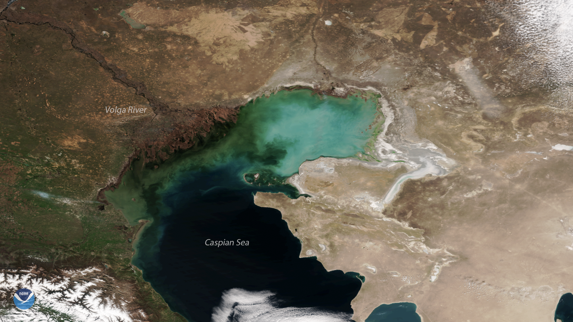
The Suomi NPP satellite captured this clear-sky view of the Volga River Delta and the northern Caspian Sea on April 9, 2018. Straddling the border of southern Russia and western Kazakhstan, the Volga River Delta is the largest inland river delta in Europe. The river flows into more than 500 channels as it drains into the sea, where nutrients from upstream create a thriving wetland ecosystem. The turbulent, dark green water at the southern tip of the Volga River Delta is a result of mud carried downstream from spring rains and melting snow. Brighter green areas seen in the northern part of the Caspian Sea are due to algal and phytoplankton blooms, which thrive in the large quantities of agricultural and industrial runoff that flow down Europe's longest river.
The salty Caspian Sea, where the Volga River drains, is the largest inland body of water on Earth. Plumes of sediment and phytoplankton are often visible on the lake's northern shores, which sit well below sea level. Satellites help monitor the environmental health of the lake by providing data on lake temperatures, salinity, water levels and pollution.
Although true-color images like this may appear to be photographs of Earth, they aren't. They are created by combining data from the three color channels on the satellite's VIIRS instrument sensitive to the red, green and blue (or RGB) wavelengths of light into one composite image. In addition, data from several other channels are often also included to cancel out or correct atmospheric interference that may blur parts of the image.