
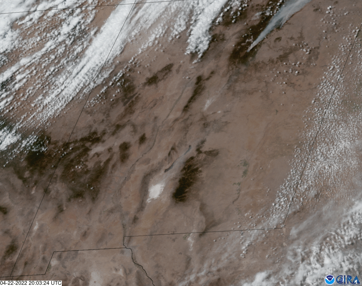
On Earth Day, April 22, NOAA’s GOES East satellite watched strong winds kick up dust and sand in West Texas and New Mexico, notably from the famed White Sands National Park near the center of the frame, as well as spread smoke plumes from wildfires burning farther north.
While we can see brownish-colored sand blowing across New Mexico and Texas in this GeoColor imagery, the glistening white sand is made mostly of gypsum, and covers 275 square miles of desert in the Tularosa Basin—where White Sands National Park is located—making it the largest dunefield of its kind on Earth.
The high winds also fanned fires throughout the region. In this imagery, we can see the grayish smoke plume emanating from the Calf Canyon and Cooks Peak fires in northern New Mexico. At the last report, the Calf Canyon Fire has burned more than 54,000 acres and was just 12% contained. The Cooks Peak Fire has burned nearly 52,000 acres and was 9% contained.
The GOES East geostationary satellite, also known as GOES-16, keeps watch over most of North America, including the continental United States and Mexico, as well as Central and South America, the Caribbean, and the Atlantic Ocean to the west coast of Africa. The satellite's high-resolution imagery provides optimal viewing of severe weather events, including thunderstorms, tropical storms, and hurricanes.