

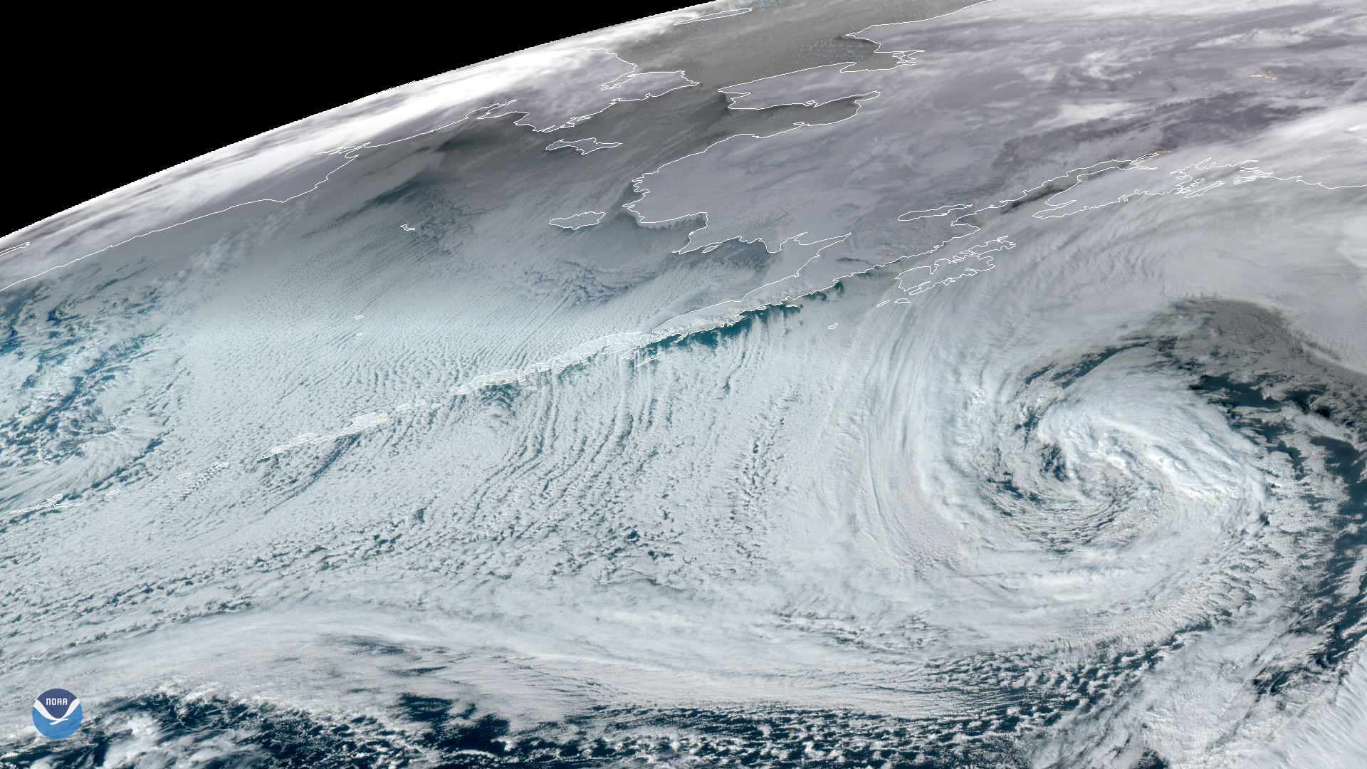
A potent extratropical cyclone, seen by GOES-West on Jan. 28, 2020, is slowly making its way eastward across the Gulf of Alaska, bringing violent winter storm and blizzard conditions in coastal areas of the Alaska Peninsula and throughout the southern regions of the state.
Additionally, cloud streets are clearly visible stemming from the ice shield in the Bering Sea as well as the Aleutian Islands and the Alaska Peninsula. Stretching into the open ocean, these rolling cloud formations occur when frigid air picks up warmer vapor from the water as it passes overhead, giving rise to heated air columns called thermals. As this warmer air encounters the colder air above, it condenses into cumulus clouds that cool and sink into long parallel rows of counter rotating air that align in the direction of prevailing winds. This phenomena is a common occurrence in various parts of the world, and is famously seen over the Great Lakes during winter, for example.
According to National Weather Service meteorologist Brian Jackson, it is also pretty common to see off the ice pack in the arctic as well. “The ice acts just like land and caps the warmer water and vapor so as the air flows off the ice and over the ocean, the streets regularly form,†he says.
This GeoColor enhanced imagery was created by NOAA's partners at the Cooperative Institute for Research in the Atmosphere. The GOES-West satellite, also known as GOES-17, provides geostationary satellite coverage of the Western Hemisphere, including the United States, the Pacific Ocean, Alaska and Hawaii. First launched in March 2018, the satellite became fully operational in February 2019.