
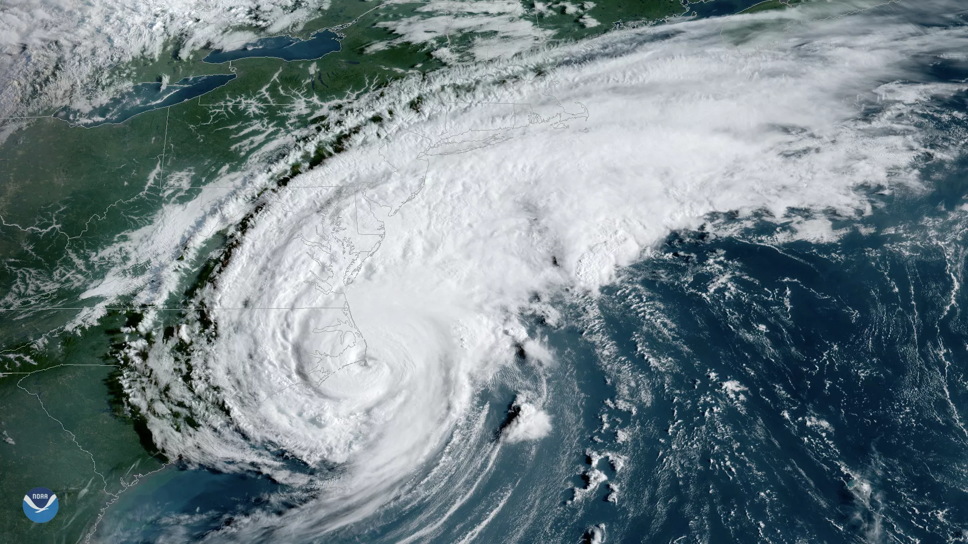
Hurricane Dorian made landfall over Cape Hatteras, N.C., at 8:35 a.m. EDT Friday, Sept. 6, 2019, with maximum sustained winds near 90 mph. NOAA's GOES East captured this view of the strong Category 1 storm at 8:20 a.m. EDT, just 15 minutes before the center of the storm moved across the barrier islands.
Life-threatening storm surge, inland flooding and strong gusty winds remain the primary hazards as the storm continues moving toward the northeast, according to the National Hurricane Center (NHC). Video footage from Frying Pan Tower which sits approximately 32 miles from Bald Head Island, N.C. shows the storms violent winds ripping apart an American flag that sits atop the decommissioned lighthouse. Around this time last year, Hurricane Florence battered the tower and a previously retired flag.
As of 9:30 a.m. EDT Friday, more than 350,000 homes and businesses along the North and South Carolina coasts were in the dark. At 6 a.m. EDT the North Carolina Department of Transportation tweeted , saying at least 73 roads, 17 of which are considered primary routes, were closed due to Dorian.
Dorian is expected to continue lashing the North Carolina coast for several hours before heading northward where the storm’s center is forecast to pass southeast of southeastern New England tonight and Saturday morning. By the time Dorian reaches Newfoundland, Canada, it is forecast to become a post-tropical cyclone with tropical-storm-force winds, according to the NHC.
Check out our Live Hurricane Tracker for up to date information or visit our Hurricane Imagery Archive for older satellite imagery.
Find the latest updates on Hurricane Dorian at hurricanes.gov.