
According to the National Weather Service's Eastern Region, "a strong coastal winter storm will bring significant impacts to portions of the northern Middle Atlantic through northern New England Thursday (February 9, 2017) into Thursday night. The potential exists for heavy snow and strong winds leading to dangerous travel conditions affecting the major Interstate 95 corridor including Philadelphia, New York City and Boston."
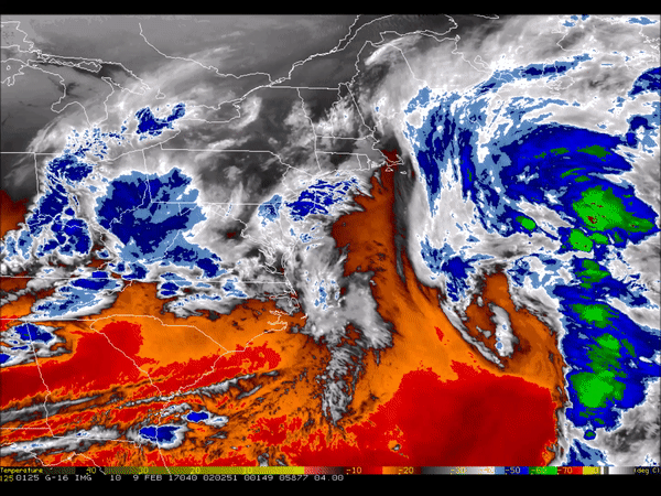
The development and path of this intense storm can be seen in this five-minute water vapor imagery from GOES-16 captured at approximately 9:30 am today. Of particular interest in this animation is the improved spatial resolution compared to current GOES. The satellite's Advanced Baseline Imager offers 16 spectral bands, three of which are water vapor bands -- this imagery was created with band 10. These additional water vapor bands enables meteorologists to see further down into the mid-troposphere in clear sky regions compared to the current GOES water vapor band. It also allows them to better characterize the total amount of moisture in the atmosphere that can turn into rain and snow.
Note: GOES-16 data are currently experimental and under-going testing and hence should not be used operationally.
To see more animations from GOES-16, visit the NOAA Satellites YouTube page. A gallery of GOES-16 images is availaboe on the NESDIS website.