Working in concert, the four space-weather instruments aboard GOES-16’s will enable NOAA’s Space Weather Prediction Center to significantly improve space weather forecasts, provide early warning of possible impacts to Earth’s space environment, and potentially disruptive events on the ground.
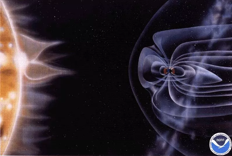
Of the six instruments on board GOES-16, NOAA’s next-generation geostationary satellite, four—the Solar Ultraviolet Imager (SUVI), the Space Environment In-Situ Suite (SEISS), the Magnetometer (MAG) and the Extreme Ultraviolet and X-ray Irradiance Sensors (EXIS)—are concerned with space weather, a term referring to changes in the solar-terrestrial environment (i.e., a region in space that includes the upper part of the terrestrial atmosphere, the outer portions of the Earth’s geomagnetic field, and the solar emissions that can affect them) that can have a debilitating effect on the technological systems on which society depends.
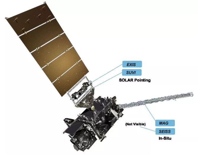
The location of the four space-weather instruments on GOES-16.
Space weather may sound like the stuff of science fiction, but it’s quite real and taken very seriously. Earth-bound radioactive waves and particles from a solar storm can disrupt communications, navigation, and power grids; cause damage to spacecraft; and even put astronauts and airline passengers at risk of exposure to space radiation. Technologists have been aware of the threats posed by space weather for years and previous GOES satellites have carried space-weather instruments to monitor and predict potentially harmful space weather. However, none of these earlier instrument were as advanced or capable of providing as much information about the conditions of the sun and near-space environment as the space weather sensors aboard GOES-16. The following is a breakdown of each of these advanced sensors and the information they provide to space weather forecasters within NOAA’s Space Weather Prediction Center and to space weather operations around the world.
Solar Ultraviolet Imager (SUVI)
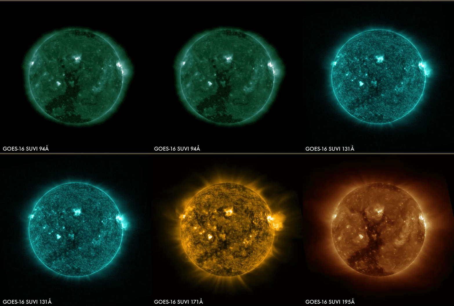
This animation shows the six wavelengths SUVI can use to see the sun.
The Solar Ultraviolet Imager (SUVI) is a telescope that monitors the sun within the extreme ultraviolet (EUV) wavelength range. SUVI is used to characterize complex features on the sun and detect the occurrence of solar flares and coronal mass ejections (CMEs), thereby providing early warnings of potential Earth impacts from severe to extreme space weather. SUVI provides space weather operators with images of the sun in six carefully selected EUV wavelengths that characterize the structure of solar active regions, solar prominences and filaments and the boundaries of coronal holes from which the background solar wind emanates. SUVI high-cadence imagery can monitor solar flare dynamics and help determine if and when a CME might cause a geomagnetic disturbance.
Magnetometer
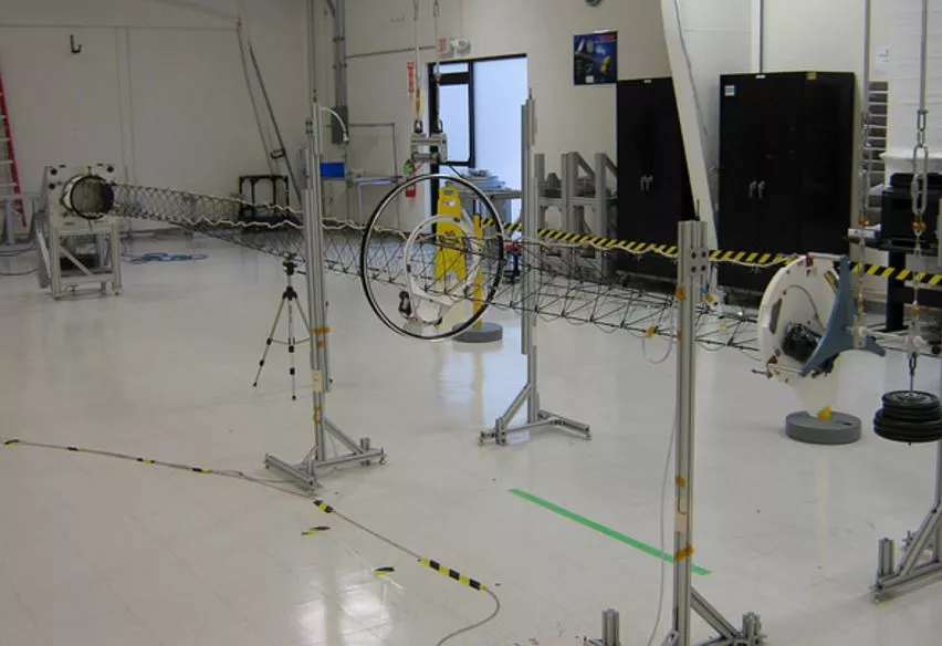
GOES-16's magnetometer prior to installation.
GOES-16's Magnetometer (MAG) measures the strength and polarity of Earth’s magnetic field. MAG data are used to identify abrupt changes in the magnetosphere signaling the occurrence of a geomagnetic storm. At geostationary distances, the background magnetic field is weak and knowledge of the local field as measured by MAG is vital for interpreting energetic particle measurements and for modeling this weak field under various conditions. There are times, however, when perturbations in the solar wind from CMEs can effectively “push” the magnetosphere inside geostationary orbit such that geostationary satellites on the sun-lit side of the planet are subject to the harsh conditions of interplanetary space. MAG measurements contribute to improved situational awareness for space weather operations.
Space Environment In-Situ Suite
The Space Environment In-Situ Suite (SEISS) is comprised of four sensor types -- an Energetic Heavy Ion Sensor (EHIS), two Magnetospheric Particle Sensors (High and Low - MPS-HI and MPS-LO), and a Solar and Galactic Proton Sensor (SGPS) – that work together to monitor proton, electron, and heavy ion fluxes in the magnetosphere. Data from SEISS are used to drive the NOAA Solar Radiation Storm scale for highly energetic proton and for issuing alerts from highly energetic electrons. Monitoring elevated radiation levels within the near-earth space environment is important for the health and safety of astronauts and commercial air travelers. Knowledge of the geostationary energetic charged particle environment is also needed to protect satellite systems and for diagnosing spacecraft anomalies when they occur.
Extreme Ultraviolet and X-ray Irradiance Sensors
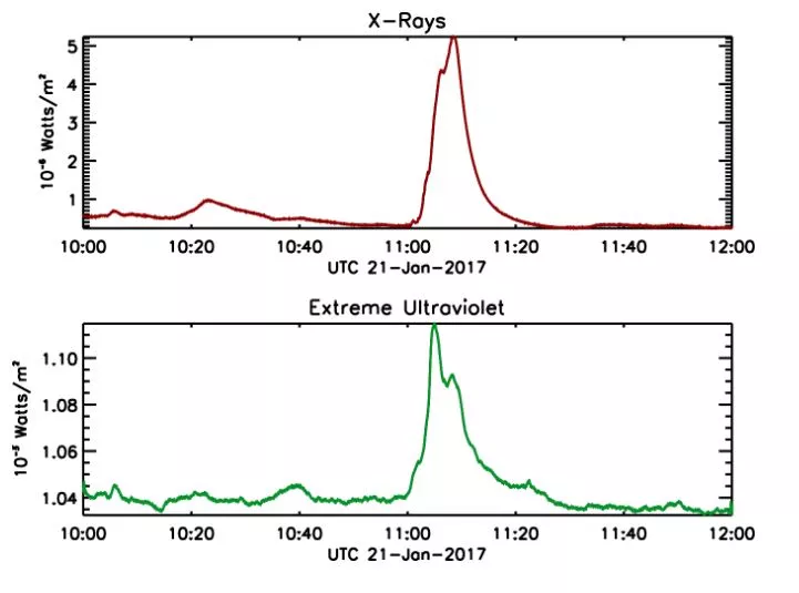
The figure shows an example of EXIS observations at two different wavelengths of a flare that peaked at 11:05 UTC [6:05 a.m. EST] on January 21, 2017. This is a relatively small flare, yet the brightness of the sun in soft (lower energy) X-rays increased by a factor of 16. EXIS will give NOAA and space weather forecasters the first indication that a flare is occurring on the sun, as well as the strength of the flare, how long it lasts, the location of the flare on the sun, and the potential for impacts here at Earth.
The Extreme Ultraviolet (EUV) and X-ray Irradiance Sensors (EXIS) instrument on GOES-16 monitor solar irradiance in the higher energy (i.e., shorter wavelength) portion of the electromagnetic spectrum. Solar photons within the X-ray and EUV bands are absorbed by the Earth’s upper atmosphere and have profound effects on the coupled ionosphere (the layer of the earth's atmosphere that lies about 50 to 600 miles above the earth's surface) and thermosphere (the region of the atmosphere above the mesosphere). EXIS consists of two main sensors, the X-Ray Sensor (XRS) and the Extreme Ultraviolet Sensor (EUVS). The primary function of the XRS is to detect the occurrence of solar flares, which can have an immediate effect on terrestrial radio communications and signal the occurrence of enhanced space radiation and the possible onset of a geomagnetic storm. XRS data are also used to drive the NOAA Radio Blackout scale. Measurements of the solar EUV irradiance, as measured by the EUVS, are used to determine the density, temperature and composition of the upper atmosphere which, in turn, are used for satellite orbital predictions and in sophisticated climate models.
Working Together to Improve Space Weather Forecasts
Working in concert, GOES-16’s SUVI and EXIS instruments provide improved imaging of the sun and detection of solar eruptions, while SEISS and MAG more accurately monitor energetic particles and the magnetic field variations associated with space weather. Together, observations from these instruments will enable NOAA’s Space Weather Prediction Center to significantly improve space weather forecasts, provide early warning of possible impacts to Earth’s space environment, and potentially disruptive events on the ground.
To learn more about space weather and the instruments aboard GOES-16 please visit NOAA’s Space Weather Prediction Center and the GOES-16 web pages.
