
February 03, 2021
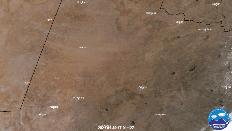
On Jan. 30, 2021, NOAA’s GOES East viewed a dust storm that blew across North Texas. With sustained winds of 30-40 mph, the dust was fast and thick enough to disrupt visibility for drivers as well as create poor air quality for pedestrians.
This GeoColor imagery above, which combines multiple channels from the satellite’s Advanced Baseline Imager (ABI), shows the dust pushing southwestward across the landscape. Around Lubbock, Texas, which was the epicenter of the dust up, there were reports of wind gusts reaching 60 miles per hour. Travel advisories stated that driving on northern and southern roads would prove difficult in the windy onslaught, and that it would last for the entire day.
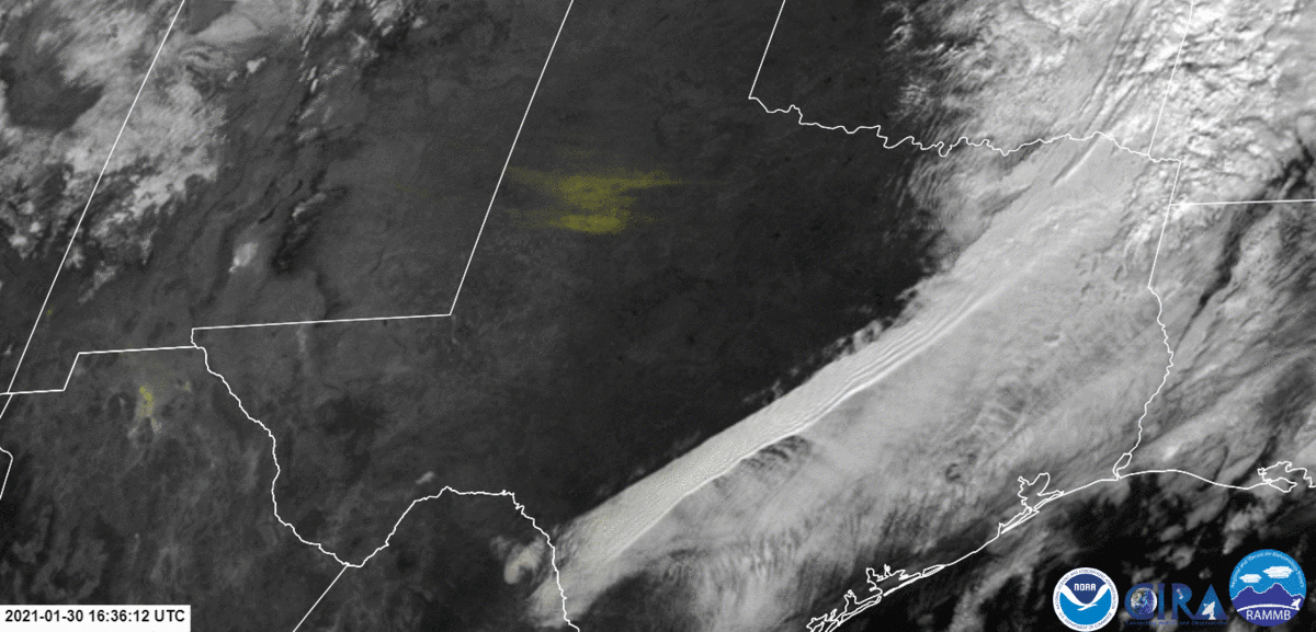
In this second image, created from the newly developed DEBRA (Dynamic Enhanced Background Reduction Algorithm) dust product, the dust storm appears bright yellow. This false coloring helps to overcome the usual challenges with visualizing airborne dust particles over flat and dry surfaces, such as those found in the heart of Texas.
The GOES East geostationary satellite, also known as GOES-16, keeps watch over most of North America, including the continental United States and Mexico, as well as Central and South America, the Caribbean, and the Atlantic Ocean to the west coast of Africa. The satellite's high-resolution imagery provides optimal viewing of severe weather events, including thunderstorms, tropical storms, and hurricanes.