
NOAA Team Members

Harry D. (Doug) Whiteley
Deputy Director, Office of Systems Development
Doug Whiteley is the Deputy Director of the Office of Projects, Planning, and Analysis (OPPA) at the National Environmental Satellite, Data, and Information Service (NESDIS), National Oceanic and Atmospheric Administration (NOAA) since September 2012. In this role, Whiteley oversees the development, acquisition, integration, installation and acceptance of major system elements (spacecraft, instruments, launch services and ground systems) for NOAA operational environmental satellite systems. In support of these activities, he also oversees requirements definition studies, conceptual and detailed engineering design, and overall systems planning.
Prior to his promotion to Deputy Director of OPPA, Whiteley served in numerous capacities in multiple offices within NESDIS since joining NOAA in 1998. From 1998 to 2006, Whiteley worked in the Office of Satellite Operations (now Office of Satellite and Product Operations) first as a satellite subsystem engineer for the Defense Meteorological Satellite Program (DMSP) and later as the engineering Team Lead overseeing all aspects of DMSP flight and ground operations. In 2006, Whiteley transferred to the National Polar-orbiting Operational Environmental Satellite System (NPOESS) Program Office to be the government Command, Control and Communications (C3S) Segment Integrated Product Team (IPT) Lead. As IPT lead he oversaw the development and delivery of command and control, terrestrial and space data networking, receptor placement and installation, and international collaboration. Whiteley eventually transferred to the NESDIS Office of Systems Development (now Office of Projects, Planning, and Analysis) as a Senior Systems Engineer to work various flight and ground projects with interagency and international partners prior to becoming Deputy Director.
Prior to Joining NOAA, Whiteley worked as a contractor on various NASA flight projects: On-line Engineer for LANDSAT 4&5 responsible for monitoring spacecraft and payload command activity and health and safety, Instrument Engineer for the High Speed Photometer on the Hubble Space Telescope supporting post-launch activation and on-orbit calibration of the instrument, and Spacecraft Subsystems Engineer for NOAA’s Geostationary Operational Environmental Satellite (GOES) I-M program providing launch and anomaly support for multiple subsystems.
Whiteley is a graduate of NOAA’s Leadership Competencies Program (LCDP), a competitive 18 month course that builds leadership acumen, as well as OPM’s Leadership for a Democratic Society. Whiteley holds a Bachelor of Science in Aerospace Engineering from the University of Maryland, College Park.

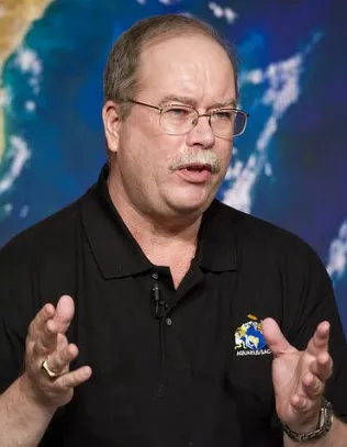
Jim Silva
Chief, Systems Engineering & Integration Division
NOAA/NESDIS, Office of Systems Development
Jim Silva is Chief of the Project Management and Execution Division (PMED) within the NESDIS Office of Projects, Planning and Analysis. PMED is responsible for oversight of the implementation phase of NESDIS satellite programs that are outside of JPSS and GOES-R.
As Chief, Silva has the overall lead for executing the following flight projects: Jason-3, DSCOVR, NOAA sensors on MetOp-C and GOES-N sustainment. Throughout the 33 years Silva has proudly served NOAA, he has primarily led various flight and ground projects within NESDIS. Mr. Silva was the NOAA instrument manager for the POES sensors (AMSU-A, AVHRR, HIRS, SBUV, SEM) slated for the KLM series in the 1980's. He later went on to two ground system project management roles: one to assess NOAA's requirements for processing and disseminating Jason-1 data, the other to exploit the S-NPP data for the NOAA and other civilian users such as EUMETSAT, DOT/FAA and USDA/FS.
Silva holds a Bachelor of Science in Meteorology from Penn State University and a Master of Science in Engineering Management from the University of Maryland.

Walid Bannoura
Project Manager, Project Management & Execution Division
NOAA/NESDIS, Office of Projects, Planning and Analysis
Walid Bannoura is the Jason-3 project manager for NOAA, responsible for the overall development and integration of the U.S. contribution to the Jason-3 program. His contribution prepares NOAA to operate the Jason-3 satellite in this international, four-partner mission.
Previously to working on Jason-3, Bannoura served as the development project manager for the Ocean Surface Topography Mission (OSTM)/Jason-2 Satellite Ground System development at NESDIS. Prior to joining NESDIS, Mr. Bannoura served NOAA in the National Weather Service (NWS). At the NWS, he worked as the modernized NWS wide area computer systems operations Program Engineer and Software Installation Manager. This wide area computer system is distributed at over 140 weather forecast offices nationwide.
In 2009, Bannoura completed the Leadership Competency Development Program (LCDP)–a competitive 18-month training to build his leadership acumen. He holds a Bachelor of Science in Electronics Engineering from Howard University and a Master of Science in Computer Systems Management from the University of Maryland.

Angelo G. Wade
Electronics Engineer, Office of Satellite Ground Services
NOAA/NESDIS/Office of Satellite Ground Services
Angelo Wade is the Ground Systems Manager at the National Environmental Satellite, Data, and Information Service (NESDIS), National Oceanic and Atmospheric Administration (NOAA). In this role, Wade oversees the development, acquisition, integration, installation and acceptance of major ground system elements for NOAA operational satellite systems. In support of these activities, he also oversees requirements definition studies, engineering design and overall systems planning. Wade currently serves as the Ground Systems Project Manager for the Jason-3 program, and is responsible for the Jason-3 ground systems development.
Prior to his Ground Systems Manager Position at NOAA, Wade served as the Polar Operational Environmental Satellite (POES) Systems Engineer from December 1997 to 2003. Within this position, Wade served as the POES Technical Representative to the U.S. and French joint program “Argos,” and the POES Program Technical Representative coordinating the joint U.S., Canadian, and French, Search and Rescue Program.
Before his appointment at NOAA in 2003, Wade worked with National Aeronautics and Space Administration (NASA) as the Electromagnetic Compatibility Test Engineer and was responsible for testing and certifying NASA’s satellites such as the Hubble Space Telescope, Casini, TOPEX/Poseidon, etc.
Wade holds Bachelor of Science in Electrical Engineering, from the University of the District of Columbia, 1986, and Master of Science in Electrical Engineering, George Washington University, 1995.

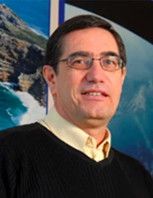
John Lillibridge
Jason Project Scientist
NOAA/NESDIS/STAR/SOCD/Ocean Physics Branch
Jason Lillibridge serves as NOAA’s Jason Project Scientist. He joined the agency in 1990 as a geodesist and later oceanographer at the Laboratory for Satellite Altimetry, now in College Park, Maryland. Prior to joining NOAA, he was a research associate at the University of Rhode Island's Graduate School of Oceanography.
Lillibridge is a member of the Ocean Surface Topography Science Team and a member of the science and calibration/validation teams for other current and future altimetry missions: Cryosat-2, SARAL/Altika and Sentinel-3.
He received a Bachelor of Science in Physical Oceanography from the University of Washington in 1976, and a Master of Science in Physical Oceanography from the Massachusetts Institute of Technology (Joint Program with Woods Hole Oceanographic Institute) in 1979.

Eric Leuliette
Deputy Project Scientist
NOAA/NESDIS/STAR/SOCD/Ocean Physics Branch
Eric Leuliette, Ph.D., serves as a NOAA’s Jason Deputy Project Scientist. He joined the agency in 2007 as a research oceanographer in the Laboratory for Satellite Altimetry in College Park, Maryland. Prior to NOAA, he was an assistant research professor at the Colorado Center for Astrodynamics Research at the University of Colorado.
Leuliette is a member of the Ocean Surface Topography Science Team and the GRACE Science Team. As a member of Working Group 1 of the IPCC, he was a contributing author and reviewer for the chapter "Observations: Oceanic Climate Change and Sea Level" of the IPCC's Fourth Assessment Report Climate Change 2007: the Physical Science Basis.
Leuliette received a Bachelor of Science in Physics from Carnegie Mellon University and an Master of Science and Ph.D. in Physics from the University of Colorado in Boulder. He held a postdoctoral fellow position at the University of Texas's Center for Space Research in Austin.
NASA Team Members

Steven W. Clarke
Joint Agency Satellite Division Director
NASA Headquarters
Steven W. Clarke is Director of the Joint Agency Satellite Division (JASD) in the Science Mission Directorate at NASA Headquarters, Washington. He is responsible for managing reimbursable satellite and instrument development activities performed by NASA for partner agencies, including Jason-3, DSCOVR and other NOAA missions.
After several years as a systems and project engineer in the aerospace industry, Clarke joined NASA in 2000 as an integration engineer responsible for NASA's scientific robotic missions. In 2003, he was selected as the Mechanical Branch Chief in the Launch Services Program, Kennedy Space Center, Florida.
Clarke joined the Constellation Ground Operations Project Office when it was established in 2005, assigned as the Chief of the Launch Vehicle Division. Steve was responsible for developing launch vehicle ground processing interface requirements and instilling operability into the launch vehicle design. In 2009, he was selected as the Deputy Director of the Ground Operations Project Office.
Clarke has a Bachelor of Science in Engineering and a Master of Science in Engineering Management from the University of Central Florida.

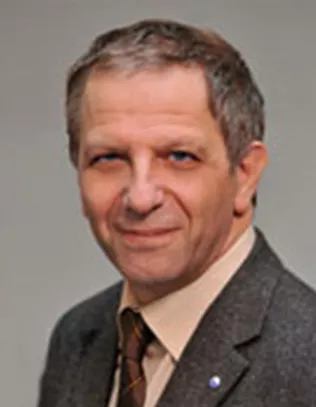
J. C. Duh, Ph.D.
Joint Agency Satellite Division Deputy Director
NASA Headquarters
DJ. C. Duh, Ph.D., was appointed the Deputy Director of the Joint Agency Satellite Division (JASD) in July 2013. He works with the Director of JASD in overseeing the formulation and implementation of reimbursable programs for NASA's partner agencies, and to ensure these programs are executed following NASA's best practices to achieve mission success in the most effective way.
Prior to joining JASD, Duh served as the Associate Chief Information Officer at NASA Headquarters between 2010 and 2013, where he was responsible for delivering Corporate IT Infrastructural Services to all NASA Centers and Facilities in an economical, secure and integrated way.
Duh also served as the Director of the Programs and Plans Division at the NOAA National Weather Service (NWS) Headquarters where he managed all the major NWS technology infusion and systems development programs including re-architecting the NWS main weather forecast and warning systems, and the Dual Polarization upgrade of the national Doppler weather radar systems.
Duh earned his doctorate and Master of Science in Mechanical Engineering and Applied Mechanics from the University of Michigan.

Josh Willis
Jason-3 Project Scientist
NASA Jet Propulsion Laboratory, Pasadena, California
Josh Willis has served as NASA's Jason-3 Project Scientist since 2011. Willis oversees development of NASA's science requirements for Jason-3. He also co-chairs the Ocean Surface Topography Science Team— the NASA- and CNES-funded science team for all of the Jason missions— with colleagues from CNES, NOAA and EUMETSAT.
Willis has worked at NASA's Jet Propulsion Laboratory since 2004 and began his work with the Jason missions as Deputy Project Scientist for the Jason-1 and Ocean Surface Topography Mission/Jason-2 missions in 2009. His research has focused on ocean warming, sea level rise and changes in the large-scale circulation and overturning circulation of the ocean. Satellite altimeter observations from the Jason missions, and their predecessor Topex/Poseidon, have revolutionized oceanography, making studies like these possible.

Parag Vaze
Jason-3 Project Manager
NASA Jet Propulsion Laboratory
Parag Vaze is NASA’s Jason-3 project manager at NASA’s Jet Propulsion Laboratory, Pasadena, California, responsible for overall management and implementation of NASA’s elements of the Jason-3 project. He is also JPL’s project manager for the Surface Water and Ocean Topography mission being jointly developed by NASA and CNES.
Prior to Jason-3, Vaze worked on NASA’s Topex/Poseidon, Jason-1 and Ocean Surface Topography Mission/Jason-2 ocean altimetry missions in management positions ranging from instrument and spacecraft to complete project management for the OSTM/Jason-2 mission. He has held increasingly responsible engineering and management positions with growing levels of responsibility in areas ranging from telemetry system development, command and control, flight software, mission operations, avionics, electrical ground support equipment and project systems engineering.
Vaze holds a bachelor’s in Electrical Engineering and a master’s in Software Engineering from Azusa Pacific University, Azusa, California. He is the recipient of numerous awards, including NASA’s Public Service, Outstanding Leadership and Exceptional Achievement Medals and JPL’s Top Management Award.
Eric Lindstrom
Physical Oceanography Program Scientist
Science Mission Directorate
Dr. Eric Lindstrom is the Physical Oceanography Program Scientist in the Science Mission Directorate at NASA Headquarters in Washington D.C. He is NASA’s Program Scientist for the Jason-3 missions and leader of the climate focus area in NASA’s Earth Science Division. He has degrees in Earth and Planetary Sciences from Massachusetts Institute of Technology and Physical Oceanography from University of Washington. His scientific interests include the circulation of the ocean and air-sea exchange processes and include extensive experience in both sea-going oceanography and remote sensing.
EUMETSAT Team Members
Marc Cohen
Associate Director for Low Earth Orbits (LEO) Programmes at EUMETSAT and Head of LEO Division
Since 1999, Marc Cohen has been responsible for the management of EUMETSAT Low Earth Orbit programmes during their development phase. His role now includes EUMETSAT POLAR SYSTEM (EPS), EPS-Second Generation, Jason-3, Jason-CS and Sentinel-3.
Cohen is responsible for all technical, financial, planning and management activities, commissioning and hand-over of systems to EUMETSAT's Operations Department. He also handles all relevant interactions with international partners and EUMETSAT Delegate Bodies.
Cohen has been engaged in space projects since 1981. Prior to joining EUMETSAT, he worked in Industry and at the European Space Agency; he started at EUMETSAT in 1994, as Ground Segment Manager for Geostationary Earth Orbit Programs.uropean Space Agency and started at EUMETSAT in 1994, as Ground Segment Manager for Geostationary Earth Orbit Programmes.

Francois Parisot
Altimetry Manager
Francois Parisot is a member of EUMETSAT's LEO division and is responsible for managing the altimetry activities at EUMETSAT including the contribution of the organization to the Jason-3 Program as well as future satellite altimetry programs.
In particular, he was involved in the preparation for the Jason-3 program approval at EUMETSAT and is now coordinating all project activities in preparation for launch and commissioning of the satellite.
Francois joined EUMETSAT in 2003 from CNES, where he had supported the launch of the Jason-1 satellite in December 2001.
CNES Team Members
Gerard Zaouche
Jason-3 Project Manager, Altimetry and Precise Positioning Department CNES Toulouse Space Center
Gerard Zaouche is the Jason-3 Project Manager in the Altimetry and Precise Positioning Department (AL) in the Orbital Project directorate (PO). The PO/AL Department is executing the development of ARGOS projects and altimetry and precise positioning projects such as the Jason series, SARAL, SWOT, etc. and is responsible for the DORIS system evolutions.
While at CNES, Zaouche served in “remote sensing” satellites ground operations and “image processing” development (Spot1, Spot4). Starting in 1998, he first served as the Jason-1 Ground System manager and then, from 2002, the Jason-2 System Manager. As Jason-3 project manager (since 2009) he is responsible for the four partner coordination (EUMETSAT, NOAA, NASA, CNES) at the system mission level.
He has a Masters of Science in engineering from École Centrale in Lyon (France).

Sophie Coutin-Faye
Head of Altimetry and precise positioning Department Orbital project directorate, CNES Toulouse Space Center
Sophie Coutin-Faye, Ph.D., has been the head of the Altimetry and Precise Positioning Department at the CNES Toulouse Space Center since 2005. In this role, she oversees the development of the Jason project series in cooperation with NASA, NOAA and EUMETSAT, the SARAL/AltiKa mission in cooperation with India, and the SWOT mission in cooperation with NASA. She also oversees DORIS and ARGOS product lines development and system management.
Before 2005, Coutin-Faye was the Project Manager of the Altimetry and Precise Positioning Service (SALP/SSALTO/AVISO) and the Head of Mission and System, Altimetry and Precise Positioning Department at Earth Observation and Science Directorate of the Toulouse Space Center.
She joined the CNES Headquarters in 1985 as the Geophysics and Geodesy program manager.
She graduated as an engineer from France’s École Nationale Supérieure des Arts et Métiers and has a PhD in Physics from The Institut de Physique du Globe, Paris, University Paris VII. She has been Chevalier de la Légion d’Honneur since 2014.