
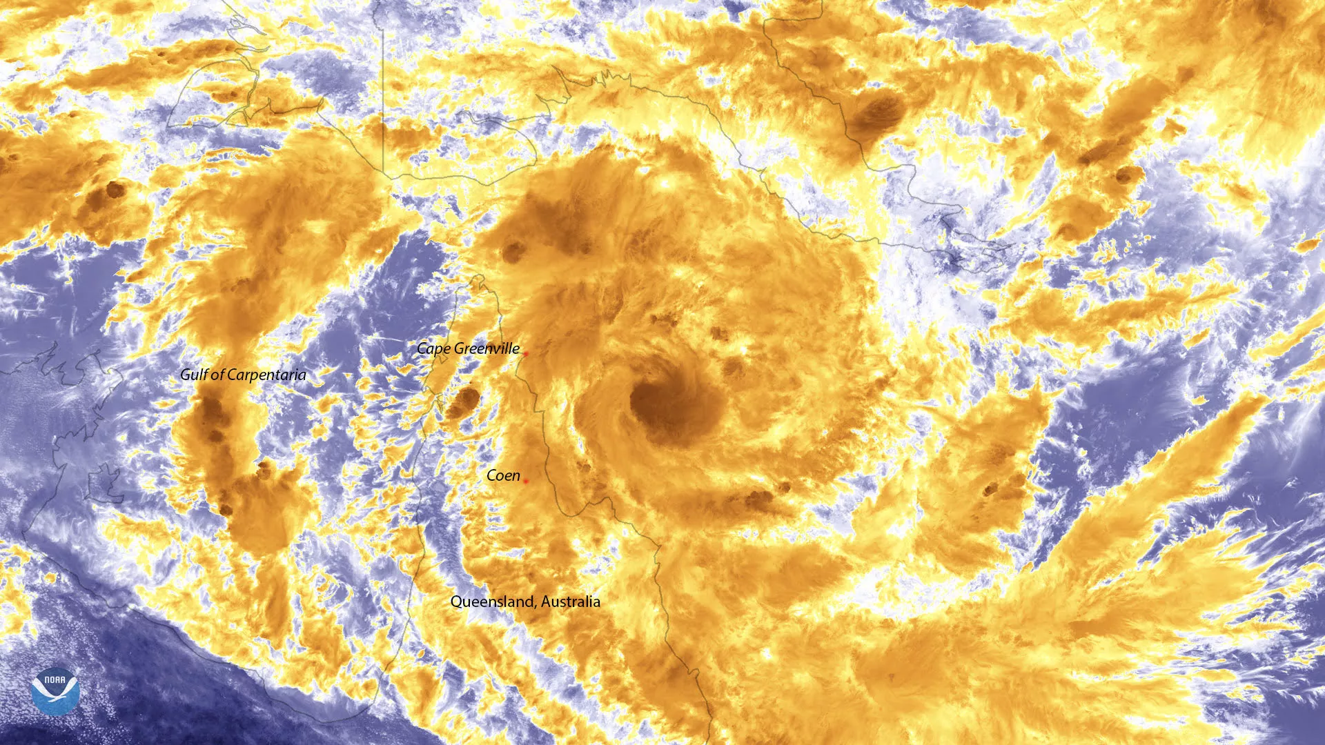
Tropical Cyclone Trevor, seen here by the Suomi-NPP polar orbiting satellite on March 18, 2019, continues to intensify in the Coral Sea. The Category 2 Tropical Cyclone, which is equivalent to a strong tropical storm using the U.S. wind scale terminology, could reach Category 3 strength (equivalent to a Category 1 hurricane) before making landfall over the Cape York Peninsula, located in northern Queensland, Australia.
Areas between Cape Greenville and Coen will begin to feel the effects of the approaching cyclone as early as Tuesday afternoon, according to Australia’s Bureau of Meteorology (BoM). Those in the path of the storm could experience wind gusts of 127 mph as well as flooding.
While Tropical Cyclone Trevor is expected to lose strength as it crosses the Cape York Peninsula, BoM says it will likely intensify once it reaches the Gulf of Carpentaria. The storm could then take aim at Australia’s Northern Territory.
This image was captured by the Suomi-NPP satellite's VIIRS instrument, which scans the entire globe twice daily at a 750-meter resolution. The VIIRS sensor provides high-resolution visible and infrared imagery of Earth's atmosphere, land, and oceans, and helps atmospheric scientists monitor severe weather events such as hurricanes and tropical storms.