
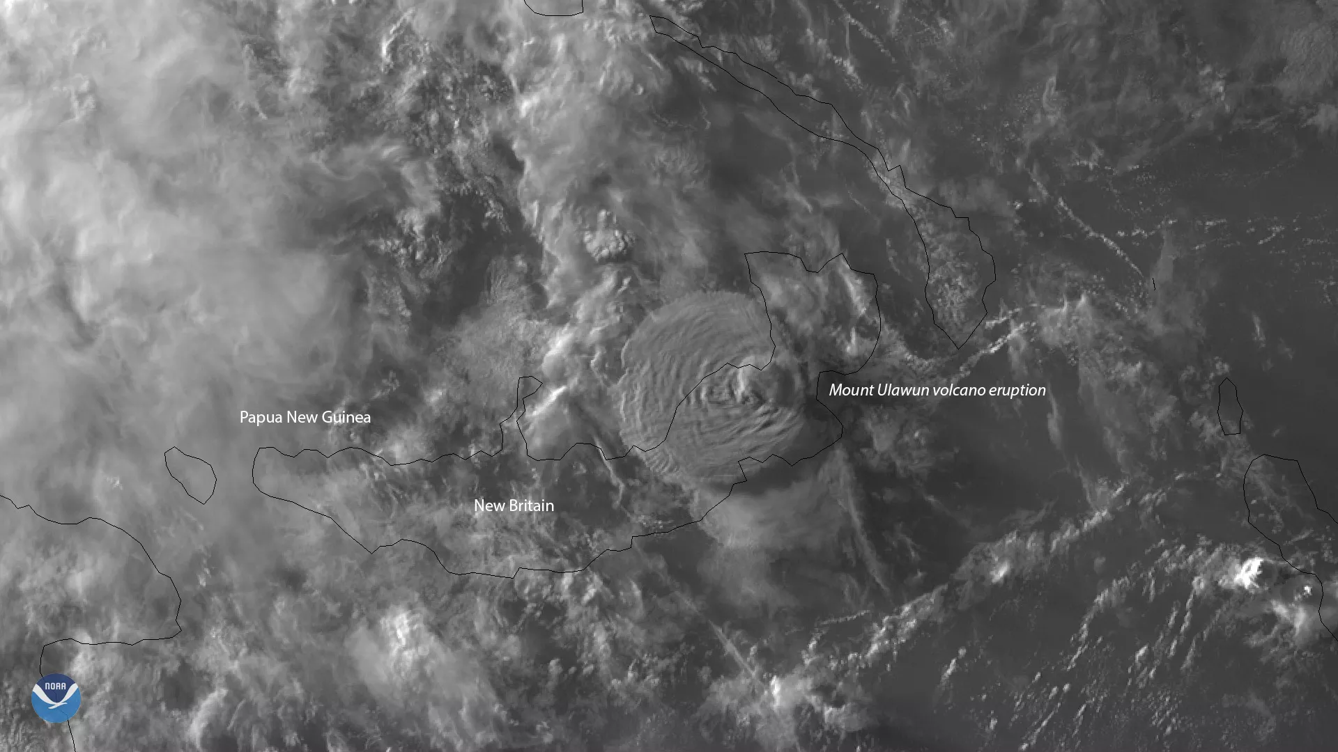
About 5,000 people were forced to flee their homes Wednesday, June 26, 2019, when Mount Ulawun on the island of New Britain in Papua New Guinea erupted. Himawari-8 saw this volcanic cloud, which reached a maximum height of 22 kilometers or more than 13 miles, according to the CIMSS Satellite Blog.
Lava spewed from the volcano, cutting off access to parts of New Britain Highway. As a result, flights into Hoskins Airport were canceled until further notice.
Mount Ulawun, also known as the Father, has an elevation of 7,657 feet, making it the highest volcano in the Bismarck Archipelago. It is one of Papua New Guinea’s most active volcanoes and its first eruption was recorded in 1700.
Himawari-8, the first unit of the Japan Meteorological Agency's (JMA) third-generation of geostationary satellites, provides visible light and infrared images of the Asia-Pacific region. In this case, imagery of the Mount Ulawun eruption was captured by the satellite’s visible band 2. Himawari's data are vital for global geostationary coverage, which is why NOAA and JMA have agreed to mutual back-up arrangements for their geostationary systems.