
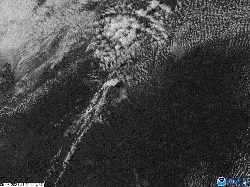
GOES East captured some amazing visible imagery of large thunderstorms as they erupted over Texas on May 3, 2021. The satellite’s Geostationary Lightning Mapper (GLM) also tracked the numerous lightning flashes produced by the storms.
One particularly notable feature of these storms is that they formed along what is called a dry line, or a boundary that separates two air masses of different moisture content—one contains humid air while the other contains dry, dense air. Dry lines are often a key driver for severe thunderstorm formation, where they tend to form on the moisture-rich side of the line.
States like Texas, New Mexico, Oklahoma, Kansas, and Nebraska frequently experience dry lines in the spring and summer, where moist air from the Gulf of Mexico meets dry air from the Southwest. While similar to a cold front, a dry line doesn’t have a strong contrast in temperature, but rather a large contrast in moisture and air density.
The GOES East geostationary satellite, also known as GOES-16, keeps watch over most of North America, including the continental United States and Mexico, as well as Central and South America, the Caribbean, and the Atlantic Ocean to the west coast of Africa. The satellite's high-resolution imagery provides optimal viewing of severe weather events, including thunderstorms, tropical storms, and hurricanes.