

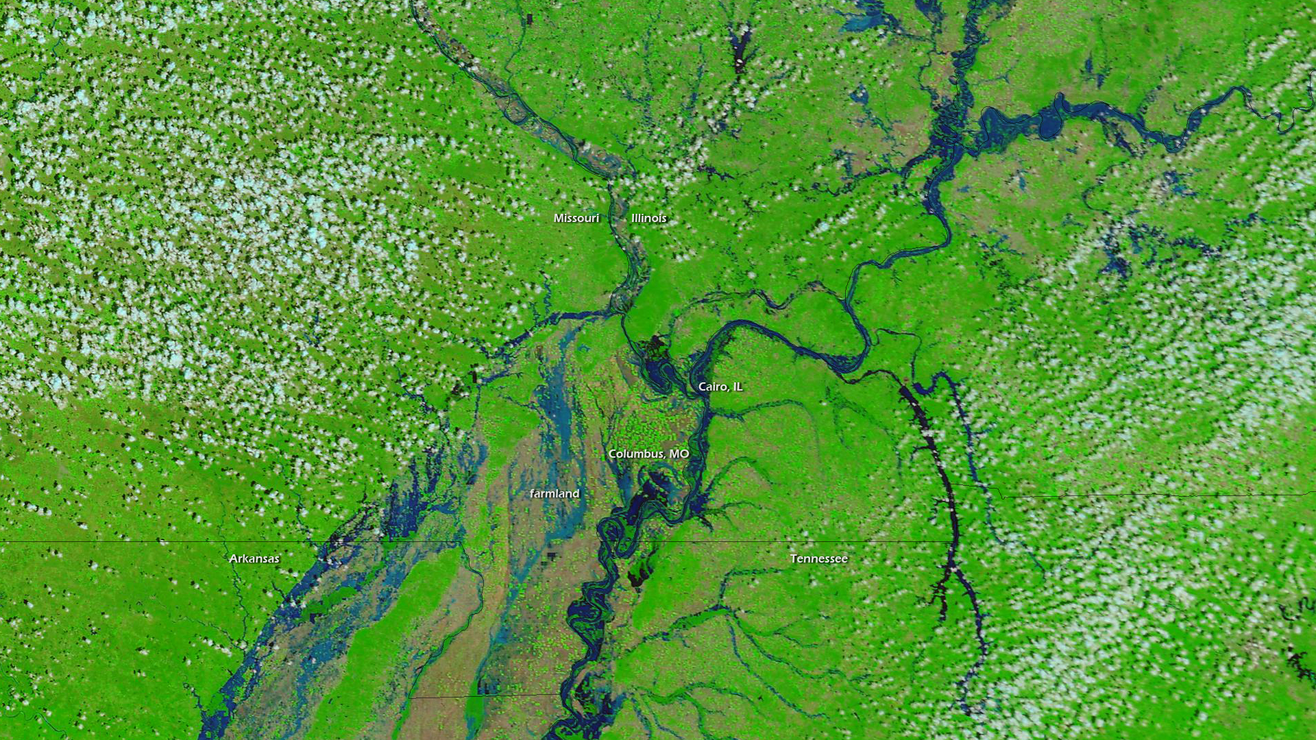
As of April 29, 2011, the National Weather Service lists 369 locations around in the country as flooded, based on river gauge measurements. As spring has progressed, flooding has moved south from the Dakotas and Minnesota along the Missouri, Ohio, and Mississippi Rivers. At the nexus of the Ohio and Mississippi Rivers lies Cairo, IL. This city is no stranger to flooding, as levee breaks in 1927 and 1937 greatly impacted the region. The Ohio River, on the town's eastern bank, is currently only 6 inches below the record stage of 59.5 feet, and is expected to crest at around 60.5 feet next week.
These two false-colored images from the NASA Terra satellite show the Cairo, IL region on April 28, 2011 and April 29, 2010. The differences are stark. Blue colors indicate water, green and brown is dry land. MODIS, the visible and infrared sensor on Terra, is the precursor to the visible and infrared sensors to be flown on NOAA’s future geostationary and polar-orbiting satellites, GOES-R and JPSS.