

As wildfires in Australia continue to burn throughout the continent, sooty rain and cooler temperatures have finally brought some welcome relief to affected communities and fire crews from Sydney to Melbourne, with “torrential” rain reported in some parts of New South Wales (NSW).
However, authorities warn that temperatures are expected to rise again later this week, and dangerous bushfire conditions will likely continue across eastern Victoria and NSW by Saturday. Forecasters also predict very hot and windy conditions in South Australia by Friday, with temperatures averaging around 113 degrees Fahrenheit. They also warn that huge fires in Victoria and NSW have the potential to come together to create a larger “mega blaze.”
As of today, Jan. 6, 2019, there were about 136 fires burning across NSW, 69 of which are still not contained, according to the NSW Rural Fire Service. In total, more than 14.7 million acres (roughly 23,000 square miles, about the size of West Virginia) have been burned across the country’s six states thus far. The fires have destroyed roughly 2,000 homes, and casualties include 24 people, including three firefighters, and an estimated half a billion animals, though the number is likely more. Scientists fear that some wildlife species and plants may have been wiped out completely.
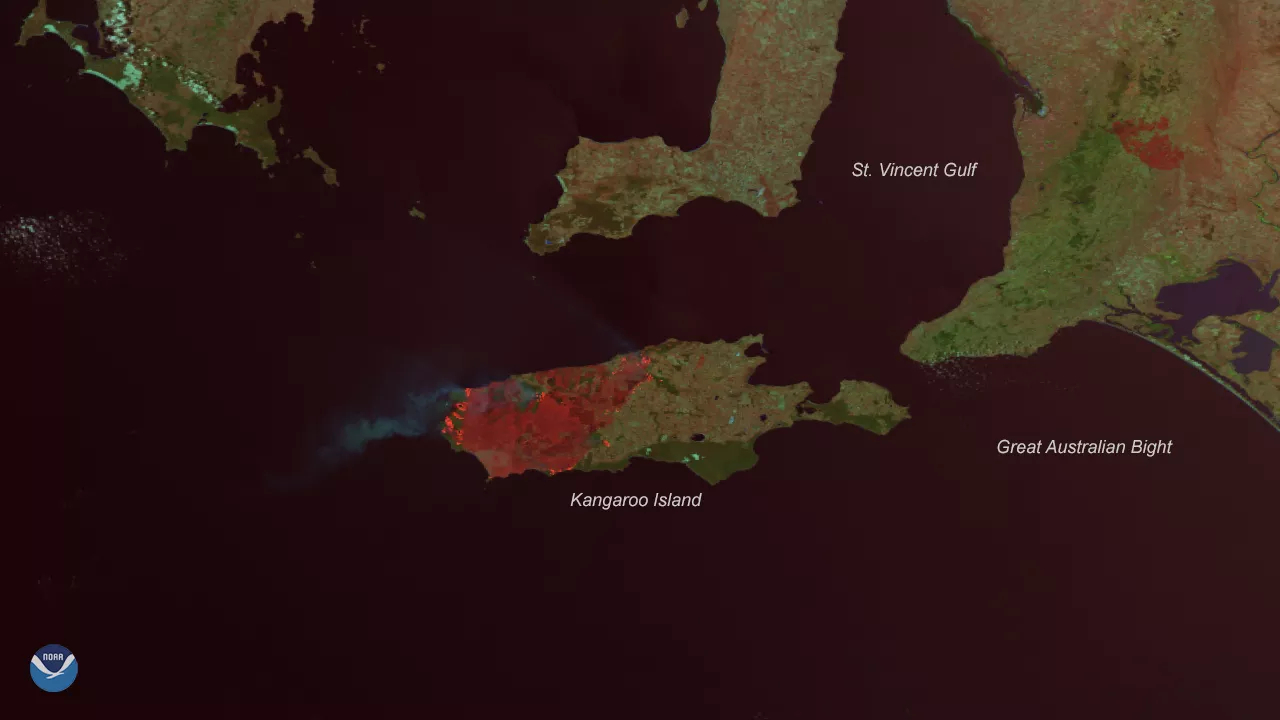
Roughly half of Kangaroo Island, off the southern coast near Adelaide, has been destroyed by fire. Imagery captured Jan. 6, 2020 via NOAA-20, high resolution bands 4, 2, 1.
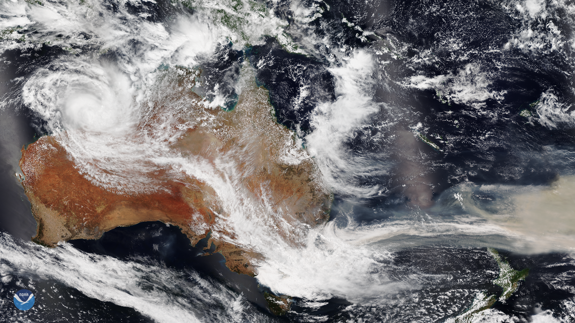
Aside from the fires, Tropical Cyclone Blake formed off the northwestern coast this morning, roughly 150 miles north of Broome, and was named the first cyclone of the 2019–2020 Australian cyclone season. The storm is slowly moving to the east, though it is expected to swing southward close to the Dampier Peninsula. Residents along the coast are being warned of possible destructive winds, and a flood watch has been issued for coastal areas of the western Kimberley and eastern Pilbara regions. The storm is expected to strengthen over the water, but weaken once it moves over land, though it may still bring heavy rainfall and flooding.
This imagery was captured on Jan. 6, 2020 by the NOAA-20 satellite's VIIRS instrument , which scans the entire Earth twice per day at a 750-meter resolution. Multiple visible and infrared channels allow it to detect atmospheric aerosols, such as dust, smoke and haze associated with industrial pollution and fires. The polar-orbiting satellite circles the globe 14 times daily and captures a complete daytime view of our planet once every 24 hours.