
Spacecraft
The satellite's main instrument, the Poseidon-3B Altimeter, measures the round-trip travel time of microwave pulses bounced off the sea surface, from which the precise distance between the satellite and sea surface can be determined. The difference between this distance and the geo-centric height of the satellite determined from a combination of precise orbit tracking systems (DORIS, GPSP, LRA) provides a measurement of sea surface height and the topography of the ocean surface. The shape of the returned radar pulses also gives information on wind speed and significant wave height. See more detail below.
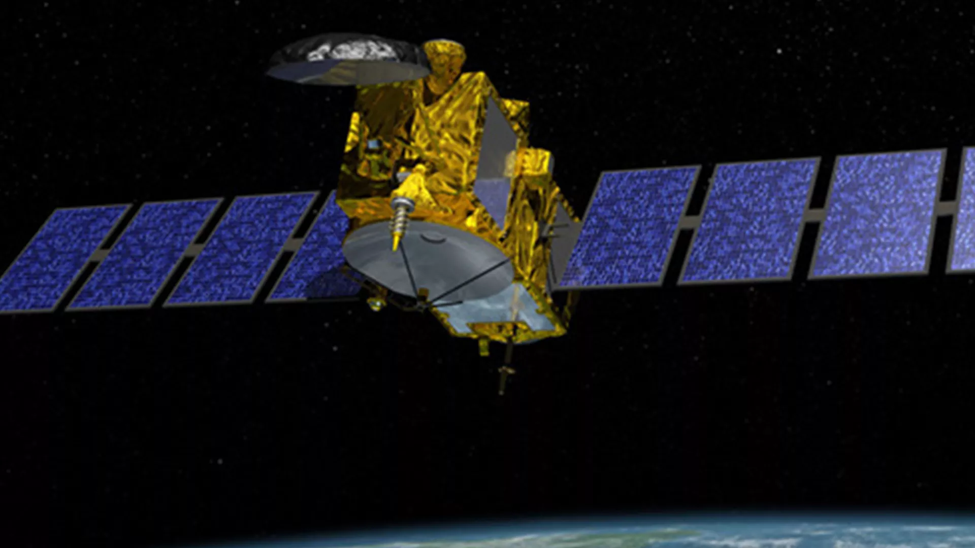
The Jason-3 spacecraft uses the Proteus bus provided by CNES/Thales Alenia Space. The Jason-3 spacecraft is three-axis stabilized and nadir-pointing. Jason-3’s power is provided by two solar panels, and a hydrazine propellant system will be used for orbital maintenance.
Jason-3 will be approximately 510 kg at launch and has dimensions of 3.8m x 10m x 2m with the solar panels deployed, and it will carry the following instruments:
Instruments
Poseidon-3B Altimeter
The Poseidon-3B Altimeter is a radar altimeter that maps sea surface topography used to calculate ocean surface current velocity, wave height, and wind speed. The Poseidon-3B is the primary instrument of the Jason-3 mission. The objective is to map the topography of the sea surface in order to calculate ocean surface elevation drift and velocity of currents, and to measure ocean wave height and wind speed.
The Poseidon-3B emits a radar beam that is reflected back to the antenna from Earth's surface. By measuring the round-trip travel time of the emitted beam, and by using the precise location of the satellite, surface altitude can then be derived within a few centimeters. The two frequencies of the Poseidon's emitted pulses are also used to determine the atmospheric electron content, which can delay the signal's return. These two frequencies also serve to detect the rain events. The strength and shape of the returning signal also provides information on wind speed and the height of ocean waves.
Doppler Orbitography and Radiopositioning Integrated by Satellite (DORIS)
The DORIS instrument provides precise orbit determination and locates the satellite on orbit in real time. The precise location and orbit information of the satellite is essential for providing altimetry data in real time.
DORIS is a dual-frequency system able to determine atmospheric electron content and compensate for ionospheric effects. The receiver onboard the satellite analyzes the received signal frequencies to calculate its velocity relative to Earth. This is used to derive the satellite's position to within two centimeters on the radial component.
Advanced Microwave Radiometer-2 (AMR-2)
The AMR-2 measures radar travel time delay caused by water vapor content in the atmosphere. AMR-2 works by measuring radiation from Earth's surface at three frequencies in order to provide corrections for sea surface and cloud contributions that affect water vapor measurements. These three measurements are combined to determine atmospheric water vapor and liquid water content. Once water vapor content is known, corrections can be applied to Jason-3's altimeter for radar signal path delays. AMR-2's measurements can also be used directly for studying other atmospheric phenomena, particularly rain.
Global Positioning System Payload (GPSP)
The GPSP is a Global Positioning System receiver that will determine the satellite's position. The GPSP supports and enhances the precise orbit determination (POD) by the DORIS system. The GPSP uses triangulation in the same way that GPS fixes are obtained on Earth. At least three GPS satellites are needed to establish the satellite's exact position at a given instant, and the GPSP will receive dual-frequency signals continuously and simultaneously from 16 GPS satellites. Positional data are then integrated into an orbit determination model to continuously track the satellite's trajectory.
It also helps improve gravity field models and provides data for satellite positioning accurate to about 50 meters and 50 nanoseconds.
Laser Retroreflector Array (LRA)
The Laser Retroreflector Array is an array of mirrors that provide a target for laser tracking measurements from the ground. It is a completely passive unit that reflects laser pulses originating from 40 ground-based laser ranging stations on Earth. By analyzing the round-trip time of the laser beam, we can locate where the satellite is on its orbit with centimeter accuracy. It is used to calibrate the other location systems on the spacecraft (Doris, GPSP) with a very high degree of precision.
Passenger Instruments
Joint Radiation Experiment (JRE)
The Joint Radiation Experiment includes CARMEN-3 and Light Particle Telescope (LPT), which are used to measure the satellite's space environment, particularly the effects of radiation and charged particles on advanced components.
CARMEN-3 (Characterization and Modeling of Environment) measures charged particles fluxes and the effects of these fluxes on instruments in Jason-3's orbit environment. It includes a sensor that measures low-level ions and electrons.