
Image Credit: CSU/CIRA & NOAA
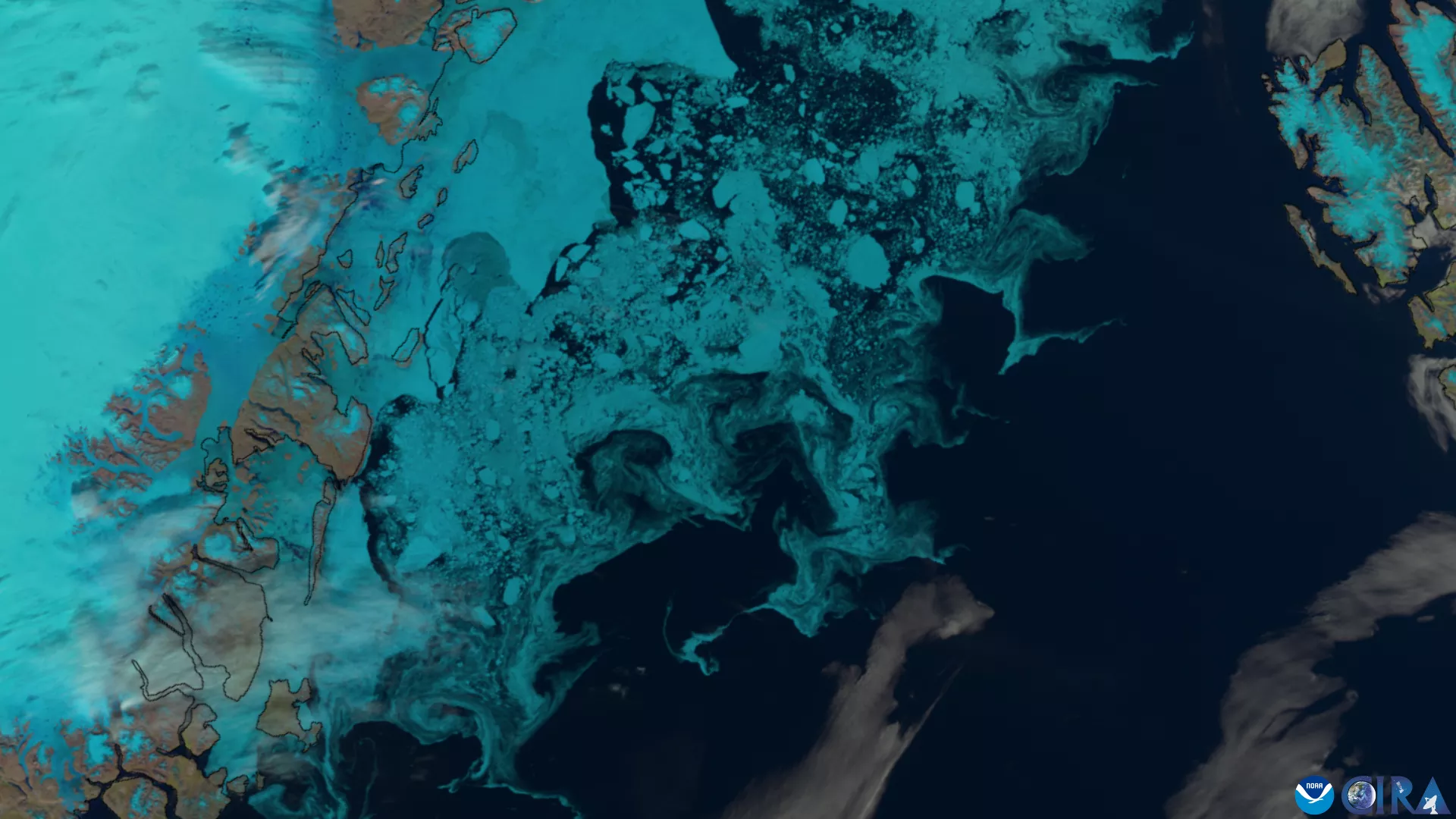
Satellite Image of Sea Ice in the East Greenland Current
The NOAA-20, NOAA-21, and Suomi-NPP satellites captured this image of sea ice off the coast of Greenland on July 12, 2024 using the Visible Infrared Imaging Radiometer Suite (VIIRS). This instrument collects global observations of the land, atmosphere, cryosphere, biosphere, and ocean as visible and infrared images.
Aiwu Li, Physical Scientist, Cryosphere Product Area Lead, NOAA/NESDIS/Office of Satellite and Product Operations (OSPO)

"Snow and sea ice are two important indicators of climate change. The global distribution and seasonal changes in snow cover and sea ice cover are of considerable interest to scientists involved in various aspects of environmental science, weather forecasting, and climate and hydrological modeling. At NESDIS/OSPO, we offer several operational satellite-based cryosphere products. Most of the snow and ice products are archived at NCEI/CLASS (The Comprehensive Large Array-data Stewardship System), which provides long-term datasets that are applicable to climate variability and change impact studies."