
Fire & Smoke Initiative
Where There's Smoke...
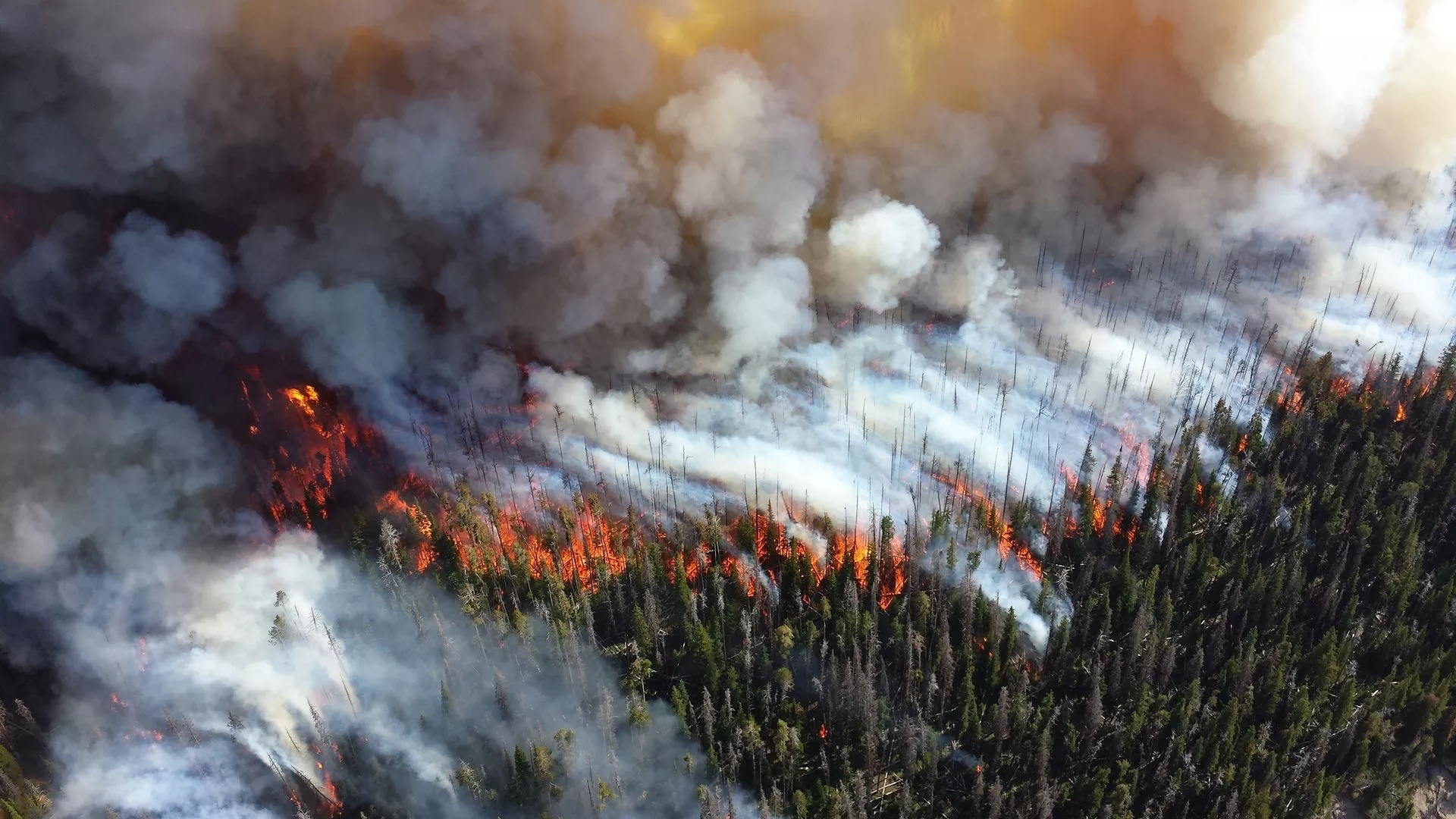
In 2018, wildfires in California caused more death and destruction than any previously recorded year. By the end of the calendar year, the fires in British Columbia had burned more area than in any prior recorded year; and California experienced the single largest (by area) fire on record.
Predicting Disaster
The Fire & Smoke Initiative provides scientists and wildlife management experts with access to data products that can help better predict, plan for, and respond to wildfires.
Insights gleaned from satellite data and products are crucial to mitigating the increasing dangers of wildfires, helping to save lives and property. The Fire and Smoke Initiative has helped improve the use of satellite fire and aerosol products to see and predict fire spread, air quality, visibility challenges due to smoke, and fire forecasts. The VIIRS instrument on NOAA-20 and Suomi-NPP provides high-precision locations of hot spots that help to detect fires earlier and determine their location and spread more precisely.
Smoke in the Forecast
As a result of the Fire and Smoke Initiative, information from the VIIRS instrument about fire radiative power was incorporated into the HRRR Smoke Model, resulting in a much-improved forecast of near-surface smoke, which is even used by school sports coaches to determine if air quality is too bad for student athletes to practice.
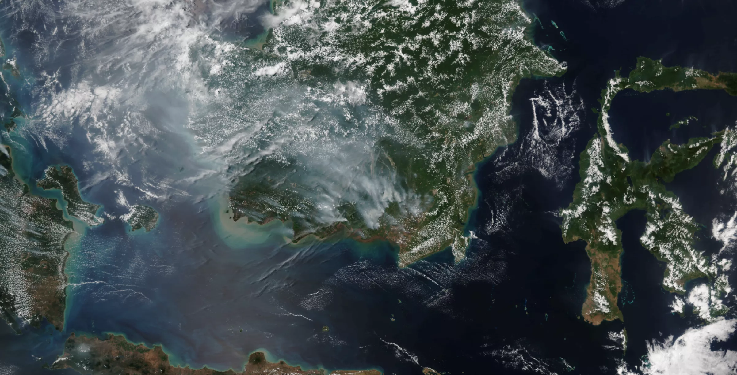
The NOAA-20 satellite collected this true-color image of fires and resulting smoke in Indonesia on Sept. 11, 2019.
At its inception, the Fire & Smoke Initiative relied primarily on Visible Infrared Imaging Radiometer Suite (VIIRS) instruments on the Suomi-NPP satellite and later the NOAA-20 satellite. VIIRS provided day and night imagery to identify fires, and the VIIRS Fire Radiative Power (FRP) product provided vital information on the strength of the fire. These observations and products have been incorporated into models that are staples of smoke and air quality forecasters.
Access Fire & Smoke Initiative Data Products
JPSS Imagery is available through the NOAA View website, an interactive software portal to visualize NOAA’s weather and environmental satellite data. Access to smoke forecasts is available, as well as more information about how to download this data.