
When you watch the news and see pictures of weather from around the U.S. or the world, you are seeing data from the National Oceanic and Atmospheric Administration's environmental satellites recovered and delivered to either the Wallops or Fairbanks Command and Data Acquisition Station. NESDIS’ Office of Satellite and Product Operations operates the CDASs. They are located in remote locations in Wallops Island, Virginia, and Fairbanks, Alaska, to minimize radio frequency interference that is prevalent in more urban areas. The Consolidated Backup Facility located in Fairmont, West Virginia, serves as a backup during system/equipment testing or maintenance.
NOAA's environmental satellites provide data from space to monitor Earth to analyze the coastal waters, relay lifesaving emergency beacon information, and track tropical storms. The CDASs acquire, maintain, and distribute a continuous flow of this environmental satellite data, and execute spacecraft commands, nonstop, 24/7.
But, the two stations are not exactly alike—The Fairbanks CDAS primarily focuses on low Earth orbit satellites with a large contracted staff, while the Wallops CDAS focuses primarily on geostationary satellites and is staffed mostly by federal employees. The station also operates NOAA's Polar Orbiting Environmental Satellites, Deep Space Climate Observatory, Advanced Composition Explorer, and remote ground station operations for the U.S. Space Force, and supports the GOES Data Collection System. Additionally, the station provides backup continuity of operations for Search and Rescue Satellite Aided Tracking (SARSAT) and operates the Radio Frequency Interference Monitoring System. In the future, the station will support the Space Weather Follow-On mission, the U.S. Space Force missions, and an Indian space weather mission.
The original Wallops permit was signed in 1965. After construction, the station has continuously provided weather service to the nation. The station also plans, designs, and implements system modifications, tests and evaluates new systems and techniques for satellite tracking and communications, and helps develop emergency procedures to safeguard the spacecraft. If NESDIS’s Satellite Operations Control Center in Suitland, Maryland, is unable to operate, the Wallops CDAS independently executes emergency plans.
The staff at the Wallops CDAS maintains every aspect of the facility. Their efforts allow the station to process over 41.7 megabits/second daily. The Wallops CDAS helps produce over 7 terabytes of data per day for the safety and security of the nation.
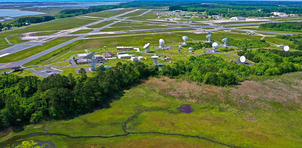
Wallops Island
| Antenna | Receive Bands | Gain (dBi) | Transmit Bands | Latitude (N) | Longitude (E) | Elevation (m) |
|---|---|---|---|---|---|---|
| 26 METER | VHF/L/S | 27.0/43.7/48.8 | 37° 56' 48.080" | 284° 32' 28.691" | 23.4 | |
| 14.2 METER | VHF/L/S/X | 22.4/43.5/44.1/46.6/55.0 | S | 37° 56' 48.390" | 284° 32' 23.773" | 12.6 |
| 13 METER A | L/S/X | 43.1/44.0/55.0 | L/S | 37° 56' 50.041" | 284° 32' 9.938" | 18.0 |
| 13 METER B | L/S/X | 43.1/44.0/55.0 | L/S | 37° 56' 50.809" | 284° 32' 17.040" | 16.3 |
| 18 METER A | S | 49.0 | S | 37° 56' 45.158" | 284° 32' 22.404" | 20.4 |
| 16.4 METER HR1 | L/S | 48.4/50.0 | L | 37° 56' 43.797" | 284° 32' 19.912" | 19.9 |
| 16.4 METER HR2 | L/S | 48.4/50.0 | L | 37° 56' 43.533" | 284° 32' 16.476" | 20.0 |
| 16.4 METER HR4 | L/S/X | 47.7/50.2/59.6 | S/X | 37° 56' 46.100" | 284° 32' 13.40" | |
| 16.4 METER HR5 | L/S/X | 47.7/50.2/59.6 | S/X | 37° 56' 44.100" | 284° 32' 13.50" | |
| 16.4 METER HR6 | L/S/X | 47.7/50.2/59.6 | S/X | 37° 56' 47.440" | 284° 32' 16.57" | |
| 8 METER | L | 40.3 | S | 37° 56' 44.800" | 284° 32' 18.350" | 9.2 |
| 7.2 METER | L | 39.1 | 37° 56' 43.000" | 284° 32' 26.000" | 7.3 | |
| 3.8 METER 1 | UHF | 22.5 | UHF | 37° 56' 43.200" | 284° 32' 19.200" | |
| 3.8 METER 2 | UHF | 22.5 | UHF | 37° 56' 43.220" | 284° 32' 18.640" | |
| 3.8 METER 3 | UHF | 22.5 | UHF | 37° 56' 43.240" | 284° 32' 18.070" | |
| 1.2 METER | L | 24.0 | 37° 56' 44.000" | 284° 32' 24.000" |
WCDAS Aerial Tour
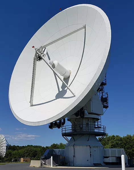
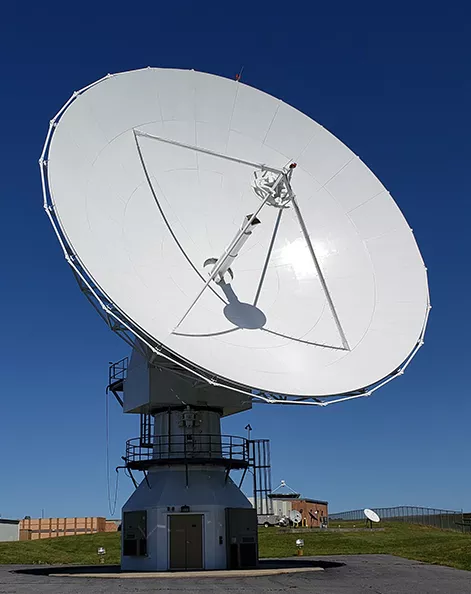
Antennas
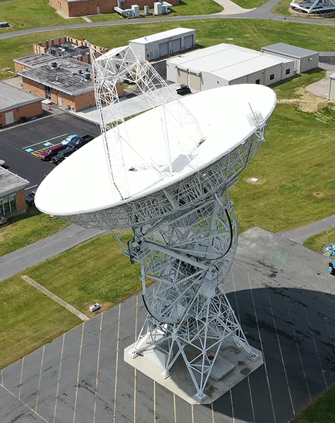
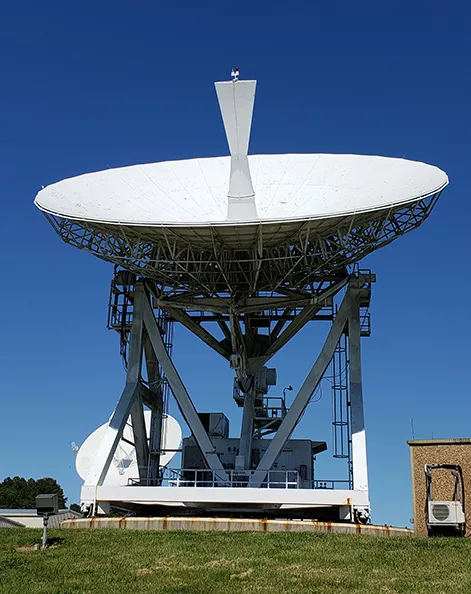
WCDAS 26 meter antenna
WCDAS 16.4 meter HR6 antenna
WCDAS 16.4 meter HR1 antenna
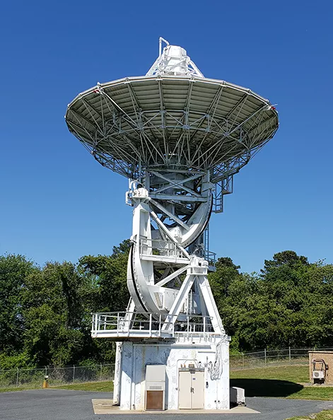
WCDAS 18 meter A antenna
WCDAS 13 meter A antenna
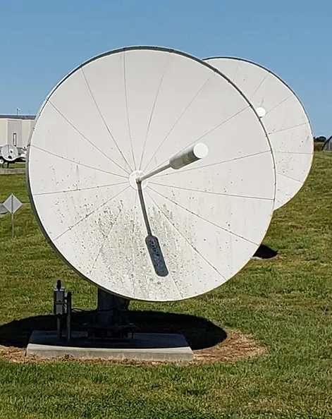
WCDAS DCS Pilot antennas
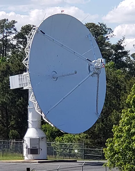
WCDAS 14.2 meter antenna
Contact
35663 Chincoteague Road
Wallops Island, Virginia 23337
+1-757-824-3446